|
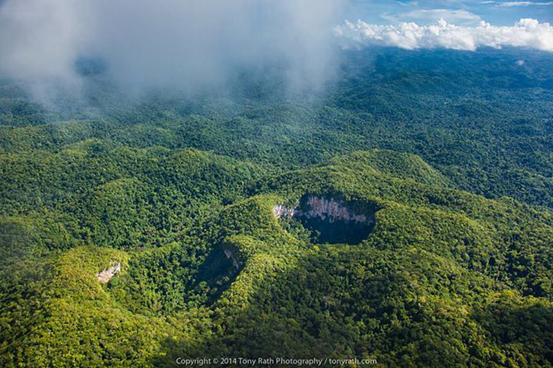
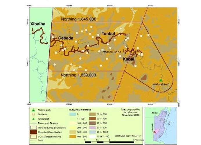
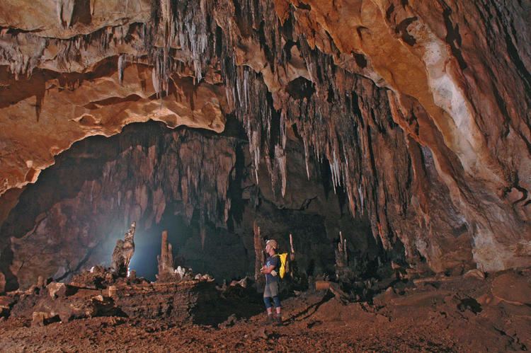
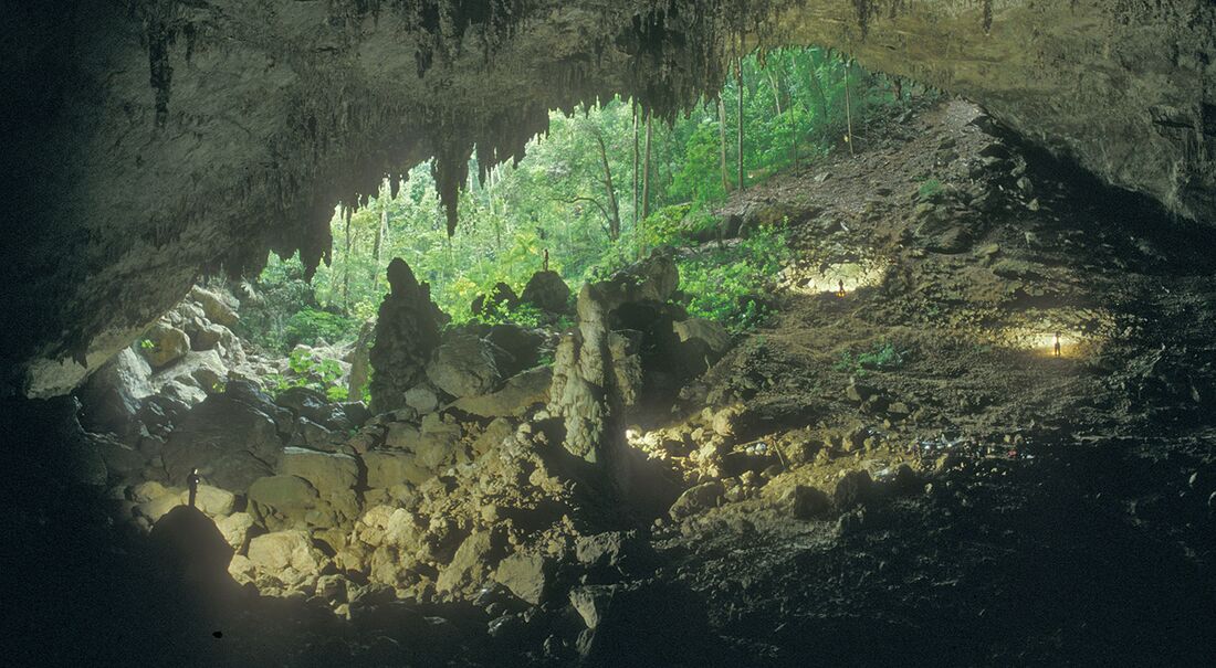
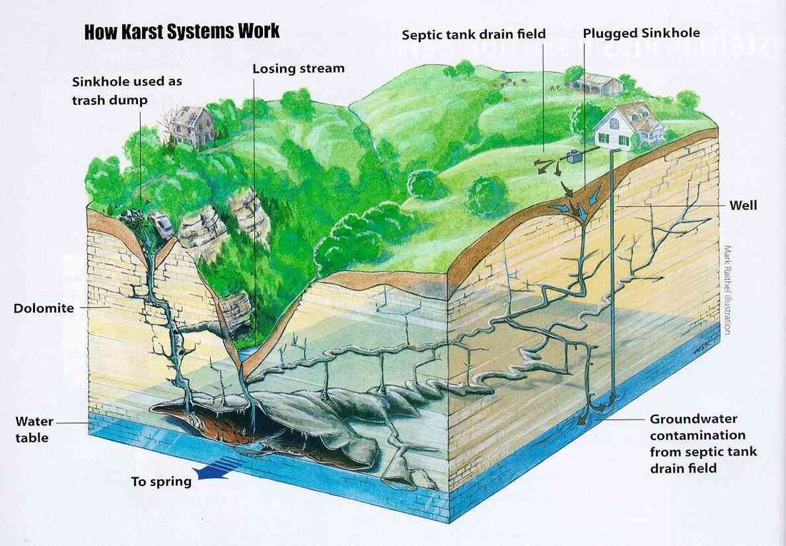
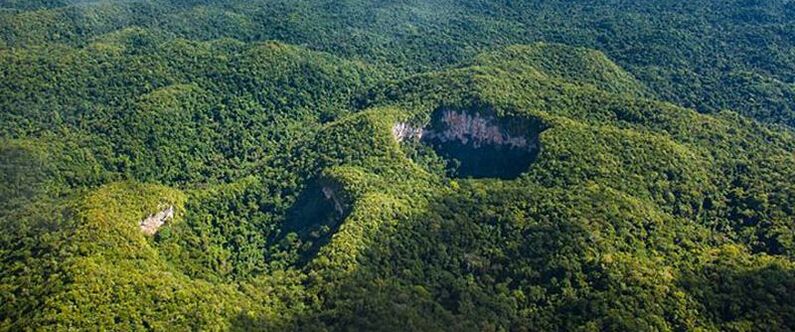
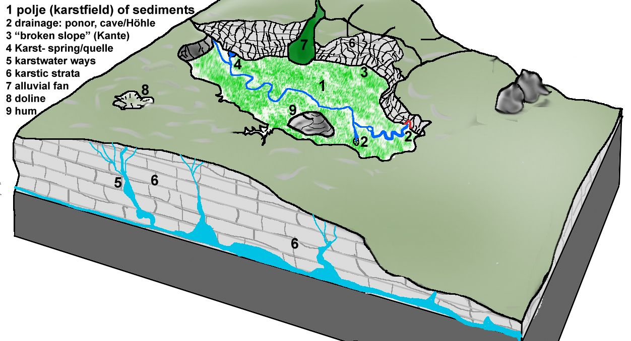
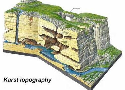
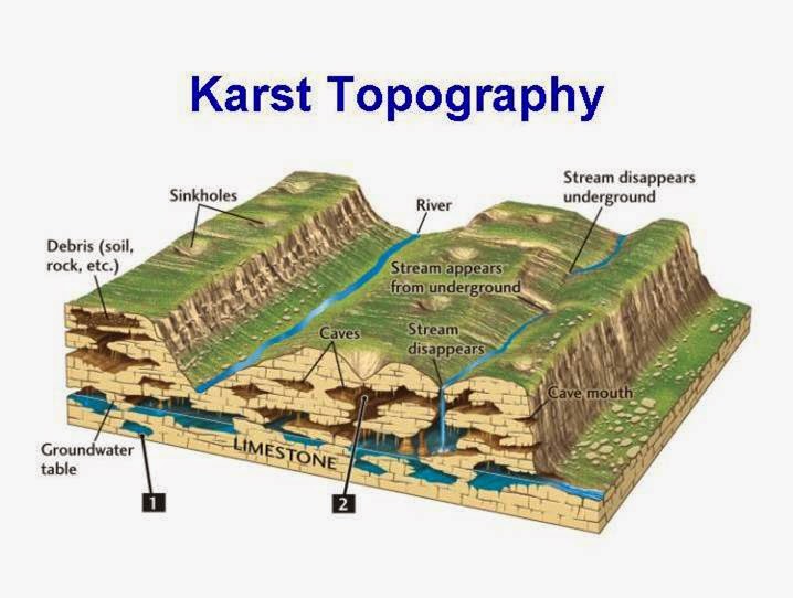
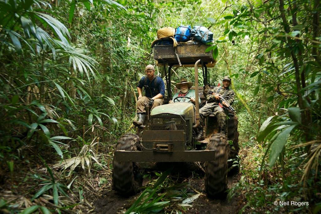
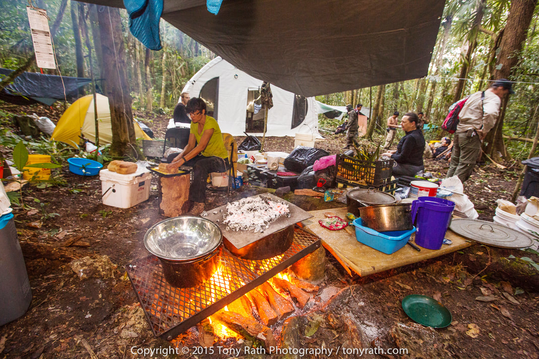
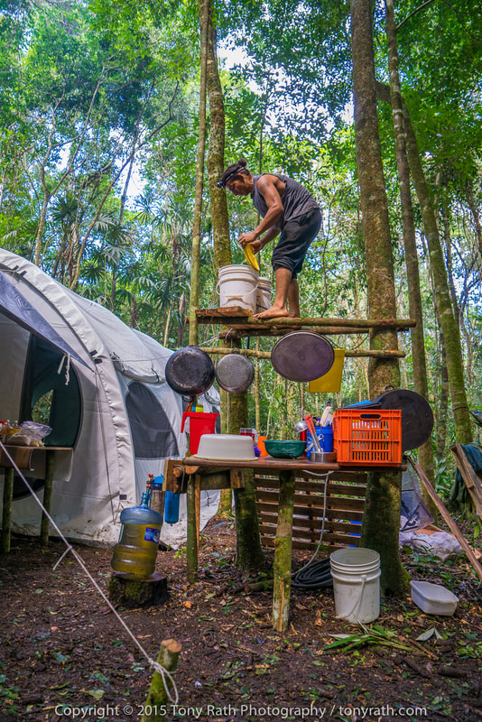
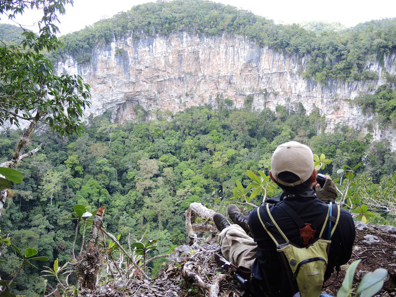
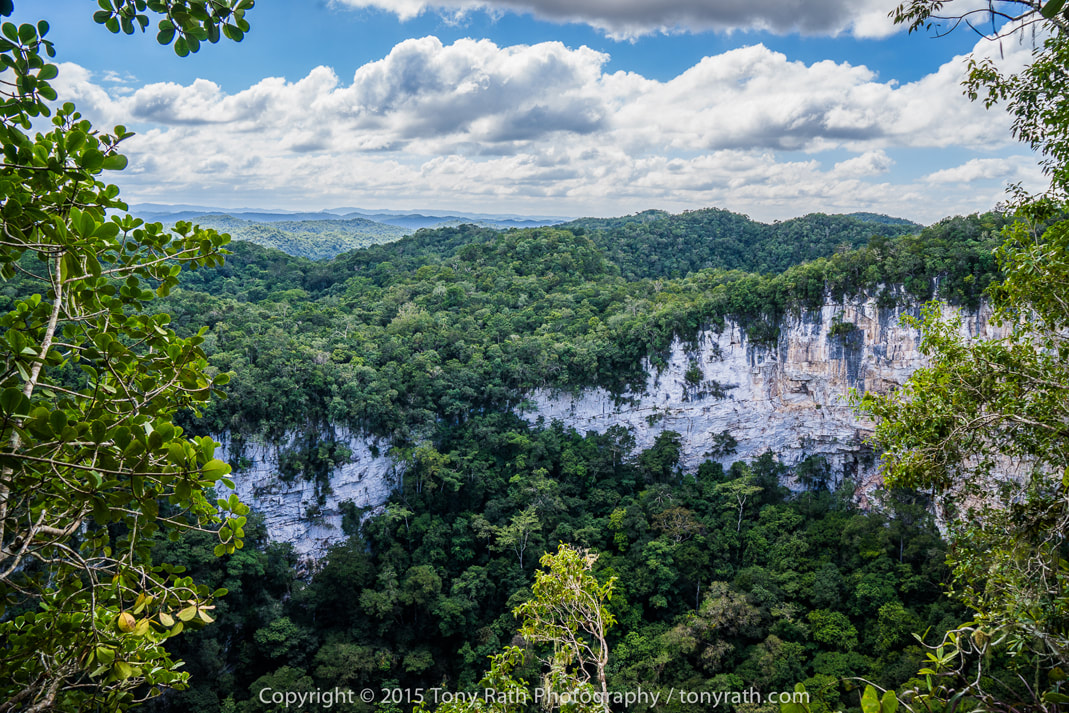
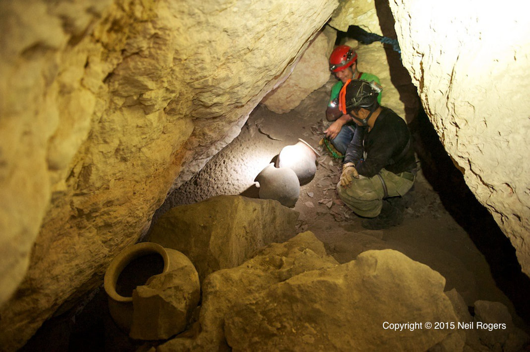
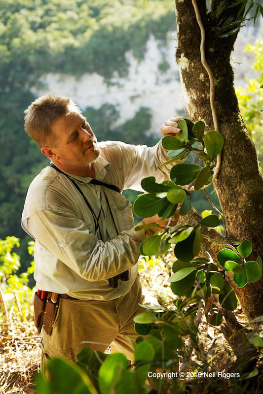
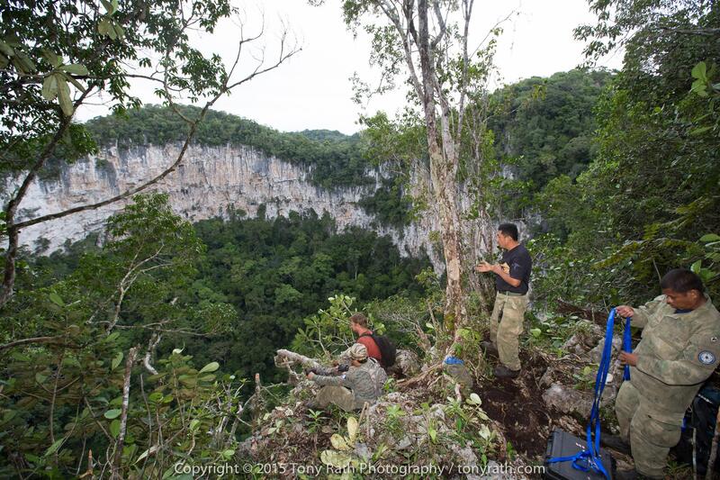
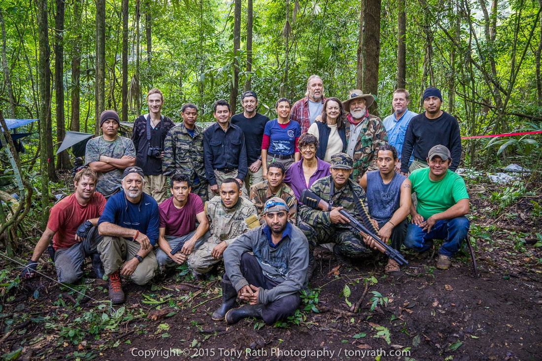
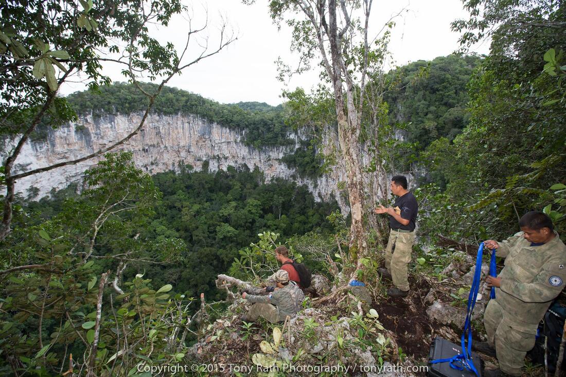
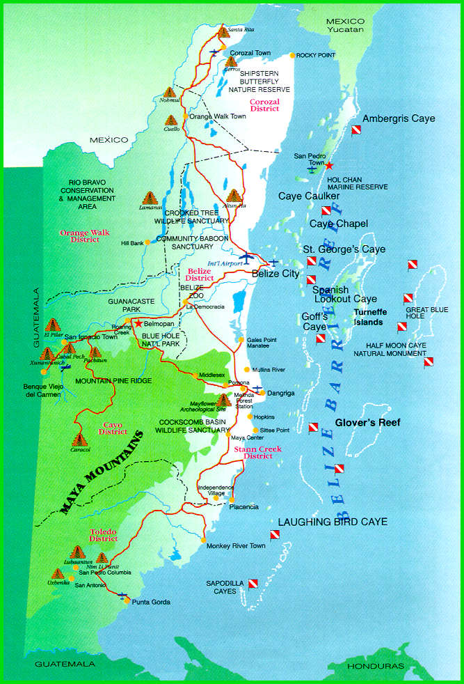
Nohoch Ch'en Sinkhole Nestled deep within the Chiquibul National Park lies a series of massive sinkholes. The Nohoch Ch'en Sinkhole, largest of which is nearly 1,000 feet wide and 600 feet deep, is about the same size as the famous Blue Hole (located at Lighthouse Reef Atoll). This sinkhole lies in a massive karst environment (which consists of about 40 other sinkholes). A karst environment exists when there is a series of underground caves which begin to collapse, losing their roof and creating a sinkholes. This karst environment is home to many unique features. Nohoch Ch'en the largest sinkhole in the area, is unique in the fact that there is only one small bridge of jungle connecting the jungle at the bottom of the sinkhole to the surrounding jungle, meaning it is a relatively isolated habitat. Within the sinkhole, team members found many species of reptiles and amphibians, rare ferns and orchids, and a possibly nesting pair of the incredibly rare Orange Breasted Falcon. Perhaps one of the most breathtaking discoveries was the remaining evidence of the significance of this sinkhole to the Ancient Maya. Within and surrounding the sinkhole, many structures, plazas, pottery, and other evidence was commonplace. Inside the sinkhole itself, many artifacts were found including 4 unbroken pots high up the cliff face in a small cave. Nohoch Ch'en is but one of many amazing features of the Chiquibul, but it is not without it's threats. Deforestation and incursions from over the border threaten this beautiful land, and it is up to the govering rangers of FCD (Friends of Conservation & Development), and all of us to protect it. The Red Line shows the Chiquibul Cave System (Going from Kabal Cave (in Belize) & extending to the XIbalba Cave (in Guatemala) The yellow dots, represent all the sinkholes in the area. You can see the location of the Nohoch Ch'en Sinkhole. CHIQUIBUL CAVE SYSTEM CHIQUIBUL CAVE SYSTEM Each year, rain falls on the non-carbonate rocks of Belize’s Maya Mountains and flows west toward the karstic Vaca Plateau. The Chiquibul River goes underground connecting the Chiquibul System’s Kabal Cave Group, which connects (4) caves, by one waterway passage (the Chiquibul River). The cave system consists of four big caves and numerous sinkholes, which have been extensively explored during the last 30 years. Actun Kabal (Kabal Group) - This upper section of the Chiquibul Cave System has over 12 km of mapped passages, with a depth of -95 m. Included is Chiquibul Chamber, at 250 m by 150 m one of the world's largest caverns. 1. Actun Kabal Cave - The upper end of Kabal Cave System Group there is ponded waters with large, washed-in rotting trees and organic debris. Downstream the system holds less water and organic material because fewer collapses intersect the cave. Passages in the cave are generally 10-60 m wide and 10-30 m high. The downstream end of the Kabal Cave System Group is a valley collapsed passage that ends at the entrance of the Actun Tunkul. 2. Actun Tunkul Cave (Stone Drum) - Includes Belize chamber with dimensions of 300m by 150m by 65m, it is one of the largest natural caverns in the world. TunKul was connected with Cebada cave in 1999, resulting in a 39m long cave. Most of the floor is a thick deposit of sand and silt laden with organic debris. The cave ends in a deep sump about 500 m from the upstream end of Cebada cave. 3. Cebada Cave - Cebada Cave and Tun Kul were linked in 1999; at 39 km it is the longest cave in Belize. The entrance to Cebada Cave is 1.5 km east of the Guatemalan border at the base of a deep collapsed sinkhole, like the other caves of the Chiquibul System. The passage is similar to Actun Tunkul but has more side passages and the side passages tend to be longer. Downstream from the Cebada entrance, the Chiquibul River flows about 2.2 km and sumps just before reaching Guatemala. 4. Xibalba Cave (Guatemala) - This downstream section of the Chiquibul Cave System is entirely within Guatemala, and is the country's deepest cave. Over seven kilometres of passages have been mapped, including some that are over 100 m wide. The cave entrance is 200 m across. The river discharges below Xibalba’s main entrance, with (2) other significant passages also occur in this cave. (Passage #1) Is a dry (upper level, 30-m-wide by 20-m-high) passage that extends north from the main entrance. (Passage #2) Begins at the Zactun sinkhole and extends as a series of lakes for nearly 3 km to the upstream end of the main passage. Exploring the Chiquibul Kabal Cave System Cavers Mike Boon and Tom Miller visited the area in 1971 and 1982 respectively, with Miller initiating the first cave explorations. Miller followed up with major international expeditions in 1984, 1986 and 1988, partially funded by National Geographic and the National Speleological Society. First expedition - surveyed the dry cave passages in Kabal and Tun Kul at the upstream part of the system, ending at a sump at the end of Tun Kul. Second expedition - surveyed dry cave passages and river passages in Cebada and Xibalba. Third expedition - attempted but failed to connect Cebada with Tun Kul. In 1990 a comprehensive cave survey was prepared by Steve Grundy and Olivia Whitwell. Thousands of years ago, most of the landmass of Belize was covered by a broad, shallow tropical sea. One of the major rock types deposited in this sea was limestone, a rock formed of calcium carbonate. This limestone can have its origin either from biological materials like corals and mollusks, or in some cases the limestone can be precipitated directly from the seawater. Geology of the Belize Caves System Like the modern Gulf of Mexico, this shallow Cretaceous sea was occasionally subject to violent storms that disturbed the floor of the sea. These storms created a distinctive type of limestone rock called a breccia. Breccia is a rock that is made up of angular pieces of other rocks. The angular pieces of rock are called “rip up clasts.” These are pieces of rock several inches on a side that were torn up and jumbled about before the clasts or pieces had a chance to harden. The distinctive rock is very easy to dissolve. Almost all limestone is soluble in a dilute solution of carbonic acid. Thousands of years later, these Cretaceous limestone formations were uplifted on the northern flanks of the Maya Mountains. After these mountains were uplifted, water would run off the crystalline rocks, and come into the outcrop of the Cretaceous limestone. As the rainwater fell through the atmosphere, it would react with carbon dioxide in the atmosphere. After the rain fell into the soil on the crest of the Maya Mountains, the water would absorb additional carbon dioxide from decaying plant material. The rainwater turns into a weak acid, which then reacts with the limestone rock. The acidic rainwater enters the limestone rock, and travels along zones of weakness called joints. Joints are microscopic cracks in the rock that are produced by mountain building processes (tectonics) and by earth tides (similar to oceanic tides). Water finds it easier to dissolve into the limestone than to flow across the limestone outcrop, creating a karst landscape. Nohoch Ch'em Sinkhole, as it sits in a karst landscape. Karst Landscape - This process of solution produces a distinctive type of landscape characterized by caves, sinkholes, and a lack of surface drainage. This landscape is called a Karst landscape, named for a region in former Yugoslavia. These processes of solution are accelerated in a tropical climate, so Belize is an example of a tropical Karst environment. The karst landscapes evolve though various stages which can be called (1) Youth Stage, (2) Middle Age Stage, and (3) Old Age Stage. The Cave Branch area, is part of the Old Age Karst landscape. One of the distinctive features of an old age landscape is a feature called a Karst window. Karst Wndows - As caves come to intersect with the land surface, they begin to collapse. This means that caves gradually lose their roofs. An underground river like the Sibun or Caves Branch River will run intermittently through the caves and above ground. Eventually, the caves will completely collapse, and the caves will be replaced by a valley without a roof. Karst Window - In A Old Age Stage - Kartst Landscaping This is similar to what you find in the Chiquibuil As the caves collapse and are destroyed by erosion, a single cave that was once very large (or long), becomes divided into a series of shorter caves. Many side passages become separate caves, like the Crystal Cave for example. Underground Cave Rivers & Streams - Cave rivers or streams, are active waterways. This means during rainy season (in summer), and hurricane season (in the fall), the cave can be completely fill with water. This is evidenced by large logs which are jammed into the roof of the cave ceiling. The cave stream also carries a great deal of sand and cobble-sized gravel. Some of this river gravel has its origin in the crystalline rocks of the central Maya Mountains. The main component of these river gravels is from chert or silica nodules that are part of the original limestone rock. These underground rivers behave much like surface ground rivers. Which means these river channels have a meander system similar to a surface river. Meandering rivers can change their course, and create what are known as high water levels, or abandoned meanders. As the limestone dissolves, it is redeposited in the caves as flowstone and dripstone. These caves then become full of stalagmites, stalactites, and other types of cave formations. The formations that are near to the water level are often redissolved during the higher water levels. This is a reminder that caves have a life of their own. Caves can be youthful, they grow old, and finally they die, as they are eroded away. The Chiquibul Cave System is an excellent example of a mature Karst landscape, and the site reminds us that nothing, in geology or life, is forever. Help us to protect this awesome natural wonder. Examples of Karst Topography NOHOCH CHEN SINKHOLE EXPEDITION Nohoch Ch'en Sinkhole Expedition In early 2015, a team of 22 people set out to reach the Chiquibul National Forest in Belize, to discover and explore the Nohoch Chen Sinkhole. A massive bowl with sheer limestone walls, dropping 500 feet below the jungle, and brethtaking views. Nohech Ch'en Sinkhole Expedition (as told by Marguerite Bevis (Jim's Wife) The seeds for the Nohoch Ch’en Expedition were planted years ago when Neil Rogers flew over the Chiquibul Forest and took the first images we had ever seen of the giant sinkhole. Jim Bevis (owner and operator of Mountain Equestrian Trails), in Cayo kept this photo over his desk for some twenty odd years. This was one expedition he was determined to make happen. In time, Jim approached Mr. Rafael Manzanero, Executive Director of Friends for Conservation & Development (FCD), for endorsement and to ensure that an expedition into this massive sinkhole would be beneficial to the development of the FCD Karst Management Program in this remote area of the Chiquibul. The answer was, “Let’s do it.” The purpose of the expedition would be to document one of the most remote, rugged and unexplored locations in Belize and to hopefully further justify to Belize and the world, the uniqueness and value of this region as a potential World Heritage site. The Nohoch Ch’en sinkhole, the largest of 49 collapsed doline formations that are located mostly over the Chiquibul Cave System, is located in an area where surface water is very scarce, making it challenging to explore for long periods of time. Very little scientific information was available for this region of the Chiquibul National Park, let alone the forest environment at the bottom of the 650’ wide and 450’ deep sinkhole. In the year 2000, several members of the Millennium Expedition descended by rope into the sinkhole and made brief observations, but time did not permit exploration and little data was collected, as this was not the main focus of their expedition. Jim spent months studying maps, making lists, planning every detail. He assembled a seasoned exploration team for the project: Jim Bevis, expedition leader, Marguerite Bevis (myself), camp nurse and communications coordinator, and our son, Arran Bevis, area exploration leader, have all led and outfitted expeditions into the Chiquibul since the early 90’s. Jim Allan, a world-class alpine climber and explorer, instructed and supervised the difficult technical climbs required. Neil Rogers is an adventure travel specialist who took the photo that inspired us all. Tony Rath, photographer extraordinaire, who’s well known images have attracted worldwide attention to the beautiful Jewel that is Belize, offered major support during the planning and implementation phase. Therese Rath, Tony’s lovely, vivacious, and energetic wife, was invited along to assist Tony and to cook, which she did amazingly. Bruce Holst, of The Marie Selby Botanical Gardens is perhaps the world’s top specialist in epiphytes and other tropical forest plant species. He has been doing research in Belize for over 20 years and has collected and catalogued over 10,000 species of different flora here. Bruce’s assistant, Ella Baron, founder of the Caves Branch Botanical Gardens, also became a part of the team. They would spend all day finding and mapping new specimens, and then work for hours in the evenings sorting, identifying and pressing, plus saving live specimens for various botanical gardens, including the National Herbarium in Belize. Other team members included Giovanni Martinez, level 3 rope rigger and natural history expert, as the rescue technician and lead medic; Nickolas Lormand, a film student from New Mexico; Joey Martinez, camp cook and “chain-saw Ninja”, when it came to clear the old logging road for the expedition to navigate deep in the Chiquibul; Hugo Orellano, camp cook and maintenance man; and Jairo ViaFranco, the “bush”mechanic who was able to fix anything and saved the day on several occasions. The FCD Rangers were essential team members. Gliss Penados and Boris Arevalo contributed significantly to the scientific component of the expedition gathering data and mapping areas by GPS. There were other FCD Rangers whose vigilance and knowledge of the area, made for a safe working and living environment. These are the brave sentinels of the Chiquibul. They kept guard day and night and reported their observations of the presence of potential intruders. Their dedication and commitment to conserving the Chiquibul is inspiring. Having loaded two trailers, one with supplies, the other with passengers, twenty team members began the journey on January 26, 2015 into the deepest parts of the Chiquibul Forest Reserve. We drove the tractors/trailers to FCD’s Tapir Camp where we spent the first night. We travelled the good road almost to Millonario but at that point, we had to reopen an old logging road for about ten kilometers to the base camp location at the pass below Nohoch Ch’en. Reopening the road took three days. On the fourth day, after hours of backbreaking labor, just before dark, we set camp at our final destination. MET donated a Weatherhaven 20’x20’shelter to FCD. This was an opportunity to instruct the FCD Rangers to set it up for use as a base camp facility. The tent housed a charging station for everyone’s electronics and was powered by a small generator for a few hours a day to charge the 12 volt batteries for continued use after the generator was turned off. A large table was in the center for food preparation and serving. Along the edges of this tent was storage for food and equipment. A water station was constructed to filter the dark tea-colored water brought from a Maya aguada every other day by tractor. After filtration the water was still slightly colored but purification drops were added for additional protection and nobody became ill. On the first morning at the base camp, the scientists and photographers went to the top of the sinkhole for the first glimpse and images of this magnificent natural wonder. Others stayed in camp to set up the large shelter and a kitchen and build sanitary facilities. Thus began the daily routine of exploration and discovery. While some descended into the sinkhole by bosun’s chair, others continued to search for a source of water closer to camp and for an above ground entrance to the giant underground chambers of the Chiquibul Cave. The scientists were constantly at work searching for epiphytes, and they were excited by what they found. Dr. Holst found over 50 species of orchids alone. Specimens have been sent to Marie Selby Gardens. At the bottom they discovered large boulders covered with mosses, ferns, and orchids, and a profusion of epiphytes. Getting to the bottom of the sinkhole was not easy. A Harken winch helped to lower people down to a ledge about a third of the way down into the hole and then they could carefully make their way to the bottom. Each member was carefully harnessed and double checked for safety before descending or ascending. Team members discovered small shallow holes in the vertical walls all around the sinkhole. One small cavern could be seen from across the rim and at the entrance were large Mayan pots. Climbers spent a day and a half accessing this cave, to photograph the three large storage urns. What we know for sure is that the bottom of the sinkhole had not been explored or looted by modern man and it is extremely rich with various plants and epiphytes. Bruce Holst called the sinkhole and its rim, “exceptionally rich beyond words.”The only mammals seen in the sinkhole were Spider Monkeys that climbed effortlessly in and out of the sinkhole via cascading vines. A pair of Orange-Breasted Falcons were seen every day and are likely nesting in the sinkhole cliffs, but no nest was seen. Slate-colored Solitaires could be heard singing their incomparable flute-like song most days. There also appears to be Mayan ceremonial temples on the west and east rims of the sinkhole and temples with plazas were found for miles in every direction near the sinkhole hill. Ancient Mayan agricultural terraces were everywhere. It became evident that the Maya did climb down into the sinkhole to build ceremonial places to leave pottery or mementos, presumably to honor the dead. It is unlikely anyone lived there. There is no water in the bottom of the hole; however, possibly it was there in the day of the Maya. Nohoch Ch’en means great well and water was a precious resource then and now. There was an aguada at the base of a Maya site near our base camp, which still holds water today. There was very little water elsewhere – a few muddy puddles but no creeks, no rivers. Water is the major limiting factor in planning this and future expeditions. Also evident during the expedition, is that the area is heavily trafficked by intruders. There was a lot of Guatemalan branded trash around their campsites and trails. They are not taking just Xate; they are taking valuable hardwoods and wildlife and leaving behind garbage. The area is at risk of becoming one big Guatemalan milpa. The issues are complex and there is no simple answer. In order to protect the Chiquibul, FCD requires the finances to sustain the efforts on the ground. Concerned citizens at home and abroad can help by supporting FCD. To know more on how to help visit the www.fcdbelize.org website. The Chiquibul Forest is rich in biodiversity. The bottom of the sinkhole is a virtual time capsule of plant specimens and undisturbed Mayan relics. Mayan terraces and buildings abound. Consider that also within the Chiquibul Forest is the natural bridge, “Puente Natural” and the Chiquibul Cave System, the largest cave system in Central America, not to mention the Mayan city of Caracol. The Upper Macal and Raspaculo Rivers are nesting grounds for the endangered Scarlet Macaw and have an abundance of wildlife. Let’s not forget that these are the headwaters for the Belize River, possibly your drinking water. The Chiquibul Forest is important not only for Belizeans but for the world. It is our unique and irreplaceable natural and cultural heritage. Photo Credits: by Tony Rath and Neil Rogers
0 Comments
Rivers of Belize These are the main rivers of Belize. Belize has a total of 35 major and minor river catchments or watersheds which drain into the Caribbean Sea. Here's 21 rivers to take a look at................ONLY IN BELIZE!
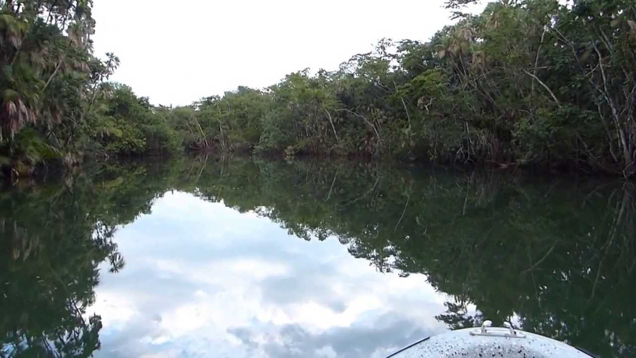
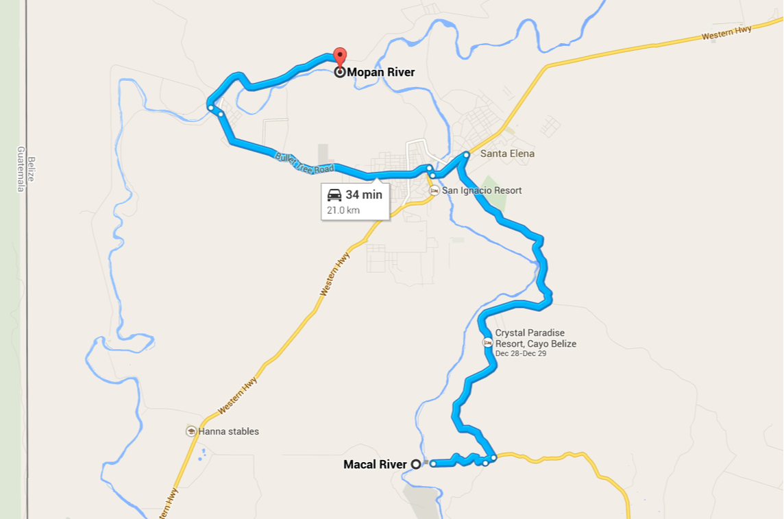
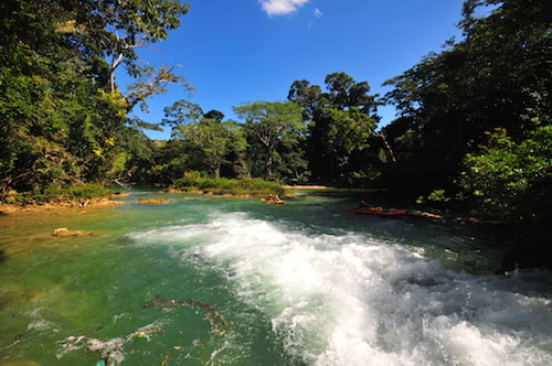
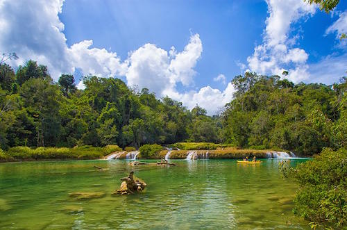
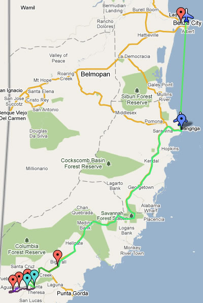
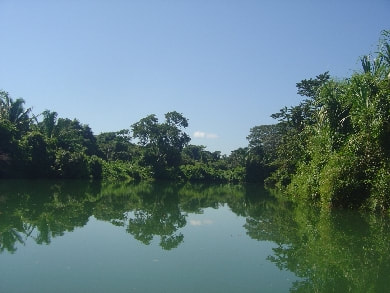
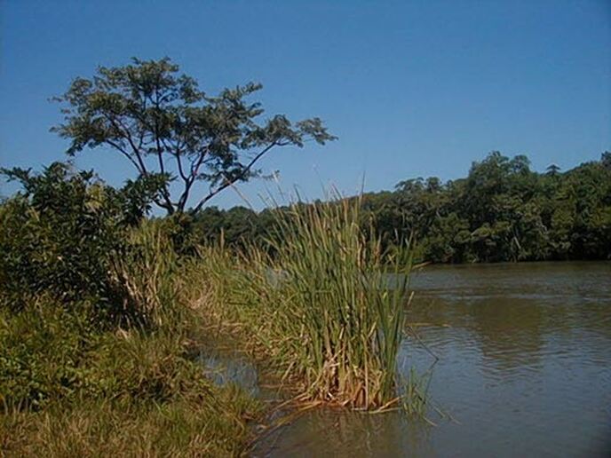
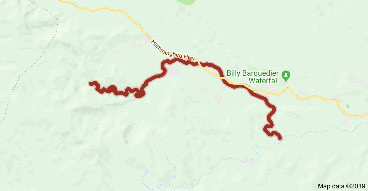
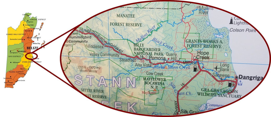
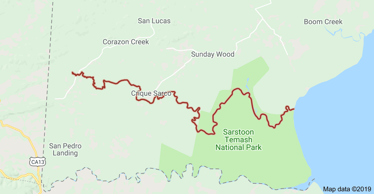
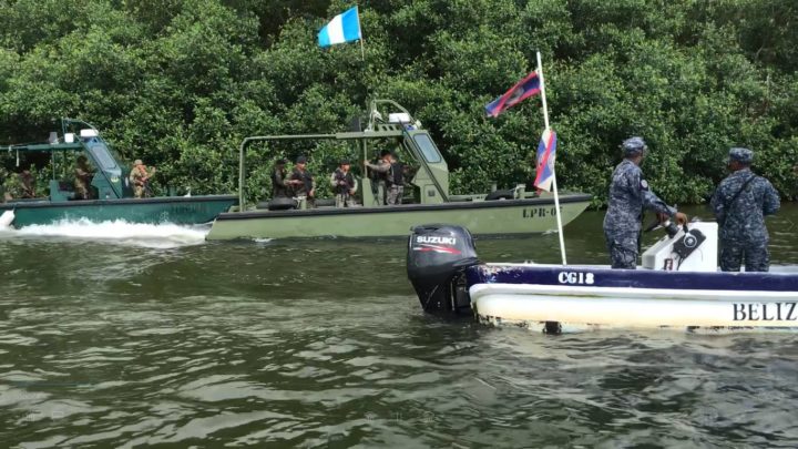
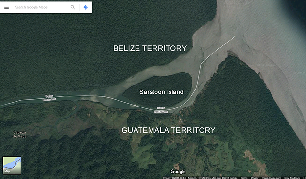
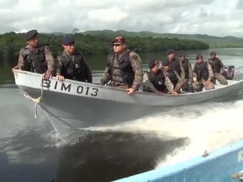
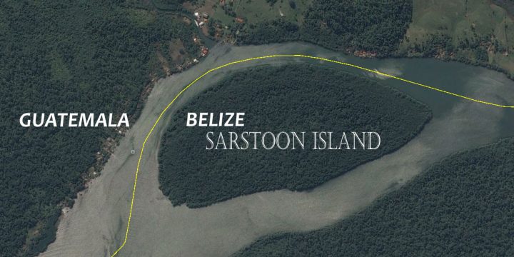
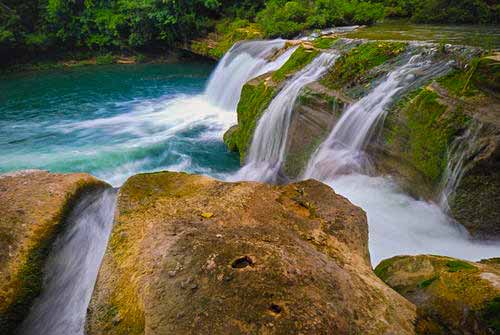
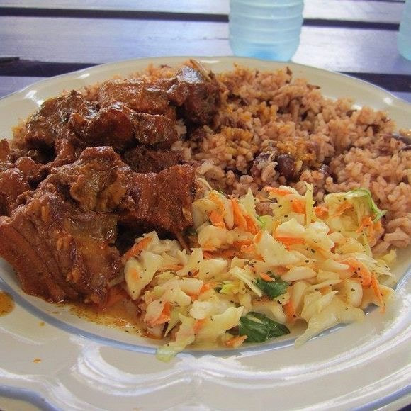
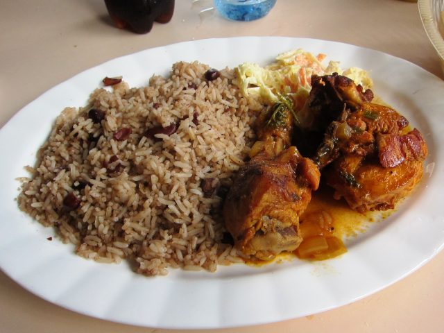
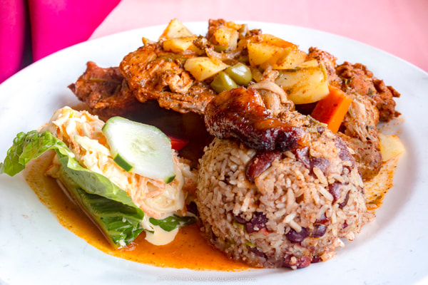
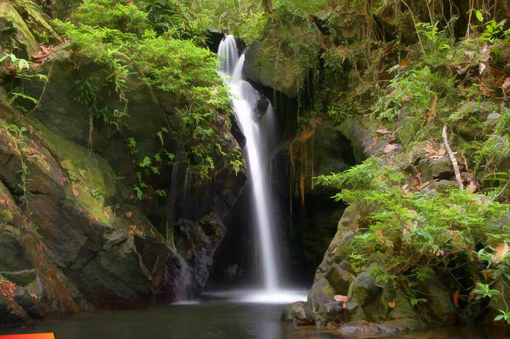
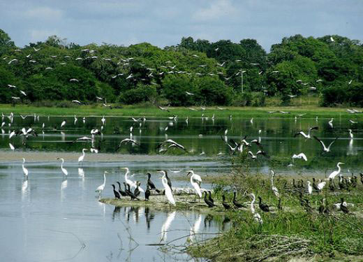
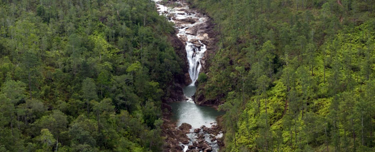
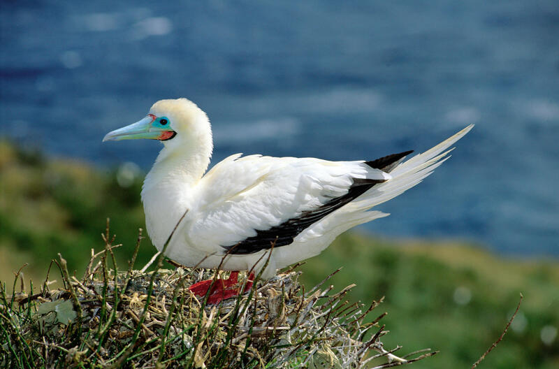
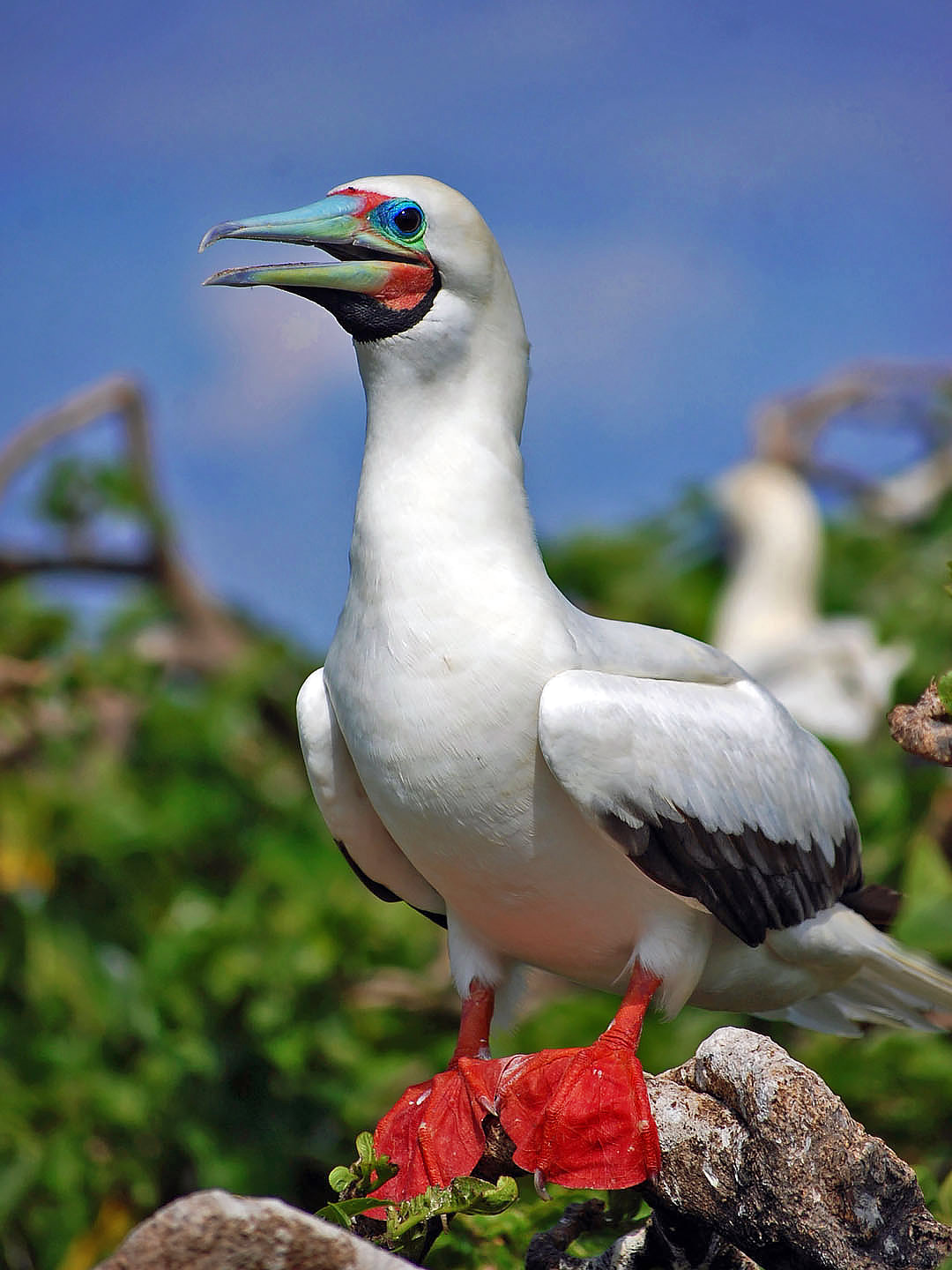
There are twenty-one (21) major rivers in Belize. The location and flow of these result from the geographical features of the land and the amount of precipitation in the area. NORTHERN BELIZE (3) In the north where the land is flat and the rainfall is lower, there are only three major river systems. These are the Rio Hondo, Boots River and the New River which flow sluggishly in a north-easterly direction. CENTRAL & SOUTHERN BELIZE (18) In the central and southern areas of the country, where there is more rainfall and more mountainous terrain, there are eighteen major rivers. The most northerly of these is the Belize Old River while the most southerly is the Sarstoon. These rivers flow in an easterly direction from headwaters in the Maya Mountains to estuaries in the Caribbean Sea. Because of rain, most communities in Belize have access to a supply of water from the natural environment but these waters may not be potable at source. Belize City, Dangriga and Belmopan have water works which access and treatwatersfrom major rivers. Other communities like Benque Viejo Town, San Ignacio, Corozal Town, Orange Walk Town and Punta Gordaget their supply from underground. Belize River, Belize 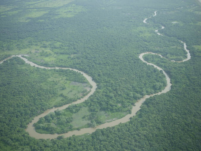 Belize Old River The Belize River runs 180 miles through the center of Belize. It drains more than one-quarter of the country as it winds along the northern edge of the Maya Mountains to the sea just north of Belize City. The Belize river valley is largely tropical rain forest. Also known as the Old River, the Belize River begins where the Mopan River and Macal River join just east of San Ignacio, Belize. The Belize River – Mopan River Catchment contains over 45 percent of the population of Belize. The Belize River, in spite of 78 runs or rapids, is passable via the Mopan to the Guatemalan border. It served as the main artery of commerce and communication between the interior and the coast until well into the twentieth century, and has long been associated with forestry of logwood (for dye) and of mahogany which survives in small stands. Bladon River, Belize 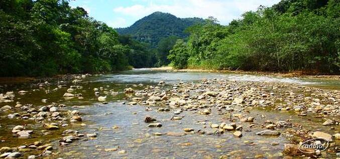 Bladen Branch Deep River, Belize 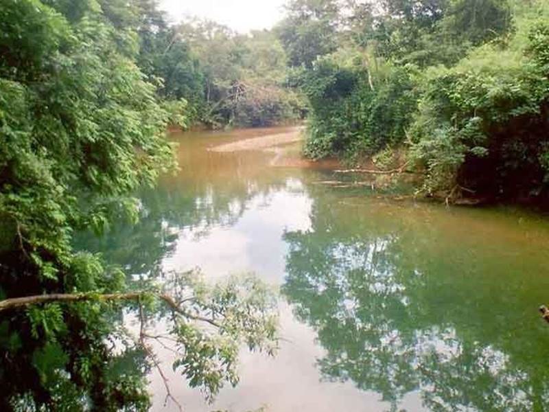 Deep River Deep River (Deep River) is a stream in Toledo District (Toledo). Deep River is also known as Deep River, Rio Deefs, Rio Hondo, Río Deefs, Río Hondo. Its coordinates are 16°16'60" N and 88°39'0" W in DMS (Degrees Minutes Seconds) or 16.2833 and -88.65 (in decimal degrees). Manatee River, Belize 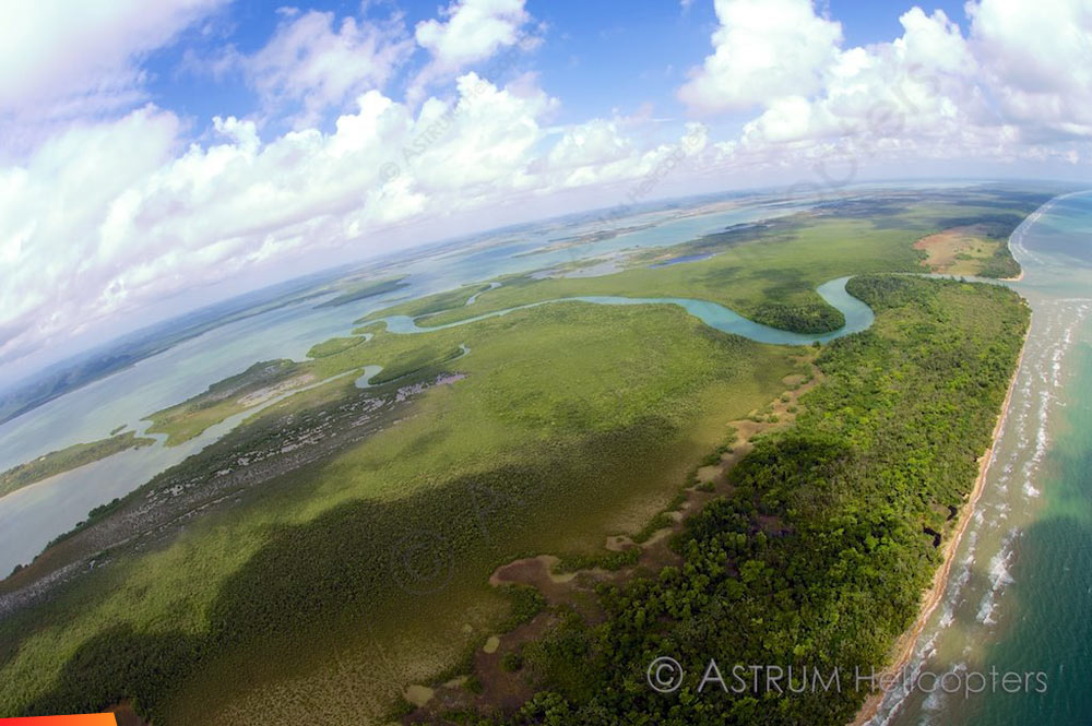 Manatee River Manatee River is a coastal watercourse in the Belize District of Belize. It consists of two parts, one on the western side of the Southern Lagoon, and the other connecting the eastern side of the Southern Lagoon with the Caribbean Sea (sometimes called the Manatee Bar River). The beach on either side of the mouth of the river is a nesting site for Loggerhead and Hawksbill sea turtles. The river was originally known by the Maya as the Texach. Macal River, Belize 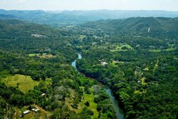 Macal River The Macal River is a river running through Cayo District in western Belize. Sites along the river include the ancient Mayan town of Cahal Pech and the Belize Botanic Gardens. The Macal River discharges to the Belize River. There are several tributaries to the Macal River including the following streams: Privassion, Rio On, Rio Frio, Mollejon and Cacao Camp. The size of the Macal River catchment basin is approximately 1,492 square kilometers. The Macal River rises in a rugged portion of the Maya Mountains and flows in a northerly direction where it joins with the Mopan River to form the Belize River. Lying to the east of the Macal River Basin is the Cockscomb Basin WIldlife Sanctuary, established specifically for conservation of the jaguar. Due to the steep terrain of the headwaters region and the high rainfall of the upper Macal Basin, the Macal River is subject to rapid stage height rise, contributing significantly to the downstream flooding of the Belize River. By legend, the river is named after a beautiful young girl Macall, an uncommon name. The lower river is navigated year-around with canoes. North of the Western Hwy is the Mopan River - South of the Western Hwy is the Macal River. Mopan River, Belize 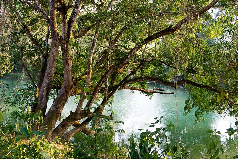 Mopan River The Mopan River is a river in Central America spanning the Peten Department of Guatemala and the Cayo District of Belize. It merges with the Macal River at Branch Mouth, Belize, forming the Belize River, which ultimately discharges to the Caribbean Sea. The drainage area of the combined watershed is 3,642.6 sq miles. Tributaries of the Mopan include Chiquibul Branch, Ceiba Grande, Salisipuedes, and Delores. Moho River, Belize 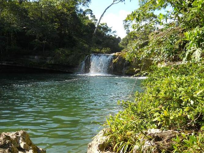 Moho River The Moho River is a river in Guatemala and Belize. The river is navigable year round between Santa Teresa and the mouth. The Moho River descends from the Maya Mountains to the Caribbean Sea. Journeying along you will experience both the calm meandering water that reflects the intense green of the jungle to stretches of rapids, pour-overs and spectacular waterfalls. Venturing into this remote region of Belize is a unique way to experience the traditional village life of the Maya people and learn about the habits of the wildlife. Kayaking the Moho River Kayaking the Moho River Located deep in the lush rainforests of Southern Belize, is the Moho River. Kayaking the emerald waters of this beautiful river offers an opportunity to explore one of the last remaining untouched regions of the country. What type of wildlife can you expect to see on the Moho River? We often see howler monkey, kinkajou, iguana and we also see so many varieties of tropical birds. The raptors are a highlight with sightings such as laughing falcon, black hawk eagle and ornate hawk eagle. Do guests need previous kayak experience to experience the Moho River? No previous experience is needed to experience this river. The guides provide excellent instruction in how to handle the boats and how to read the water. The first day on the water is pretty mellow, current and easy rapids so it is the perfect warm up. Most of the whitewater is what we call pool-drop so it is very forgiving and even if someone does wipe out on a run, typically they just end up floating in a calm pool below laughing. People who join this trip should know how to swim and be comfortable around water. Monkey River, Belize 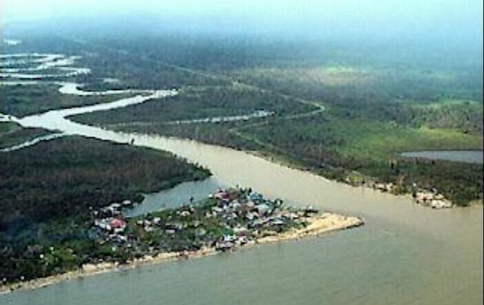 Monkey River Monkey River has been rated one of the top rivers in Southern Belize. Tropical birds, butterflies, crocodiles, iguanas, and of course howler monkeys are just a few of the wildlife that visitors see on this river. Ten interesting things to know about Monkey River 1.) Monkey River Village lies on the coast of Southern Belize, home to about 200 people. 2.) Monkey River is a perfect to experience amazing flora and fauna of southern Belize. 3.) Families of howler monkeys can be seen and heard along the rivers edge. 4.) Nature Trails, Manatee watching, and Bird watching are tours on Monkey River. 5.) Hiking along Monkey River, you can encounters tropical birds, gibnuts, deer, ocelots, tapirs, and agoutis. 6.) Monkey River was critical to the banana industry in the 1800’s. 7.) The river banks in Monkey River are perfect for birding. 8.) The Monkey River tour is a 15 miles boat ride from Placencia. Mullins River, Belize 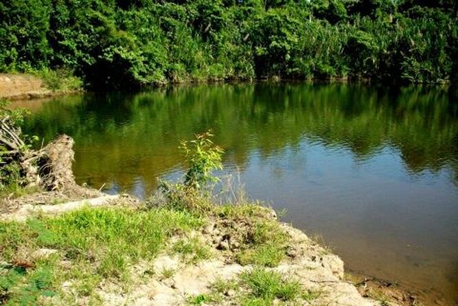 Mullins River Mullin River is the name of both a river and of a village on that river in the Stann Creek District of Belize. The village of Mullins River is located at the mouth of the river of the same name on the coast of the Caribbean Sea, north of Dangriga. At one time the Mullins River provided the only convenient route for bringing out produce from the Stann Creek Valley area and the town was prosperous and well populated. New River, Belize 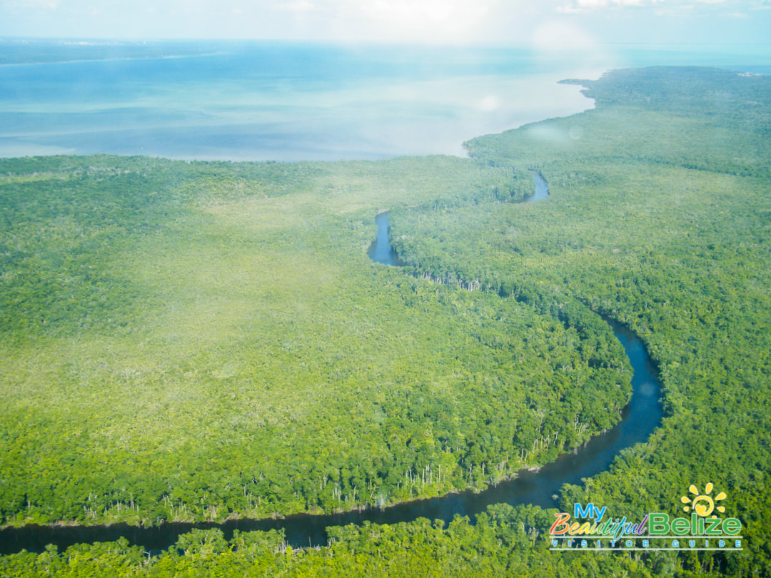 New River The New River, also Rio Nuevo, is a river in northern Belize. As the longest river that is entirely confined to Belize, it drains primarily the eastern part of the Orange Walk District during its north-northeasterly course and empties into the Chetumal Bay. The river also forms the New River Lagoon, the largest body of fresh water in Belize, just east of the Maya temples of Lamanai. The New River is a habitat for numerous types of fish, birds, as well as crocodiles. Rio Grande River, Belize Rio Grande River The Rio Grande River begins in the southern hills of the Maya Mountains in the Toledo District of Belize. From that tropical beginning the clear waters stream down, through the Machaca Forest towards the most southern reaches of the Port Honduras Marine Reserve before blending in perfectly with the greater Caribbean Sea. Amongst the tributaries which feed below Big Falls into the Rio Grande River is the Jacinto Creek. Be prepared for rapid change in river width, for the river widens considerably as it heads for the sea. Rio Hondo River, Belize 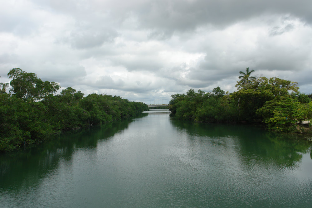 Rio Hondo River The Hondo River or Río Hondo river is a river of Central America, approximately 93 miles long, which flows in a northeasterly direction to discharge into Chetumal Bay on the Caribbean Sea. Most of the international border between the nations of Mexico and Belize runs along its length. The river is formed from the confluences of several upper tributaries, such as Blue Creek and Chan Chich (Rio Bravo) which have their sources in Guatemala's Peten Basin region, and Booth's River which originates in the western Belizean district of Orange Walk. These tributaries join to form the Hondo River near the settlements of Blue Creek Village, on the Belizean side, and La Unión on the Mexican side. The river continues its northeastern course with few other settlements along its length until reaching its outlet in Chetumal Bay. The city of Chetumal, capital of the Mexican state of Quintana Roo and the region's main port, lies close to this outlet. Sibun River, Belize 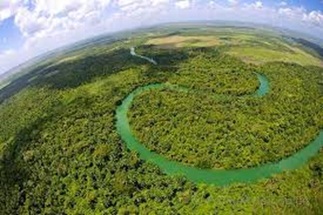 Sibun River The Sibun River (Xibun River) is a river in Belize which drains a large central portion of the country. The Sibun (Xibun) where ancient Maya people who inhabited the region. Sibun River, view from Hummingbird Highway. The headwaters of the Sibun River are located within the Maya Mountains, at approximately 800 meters above sea level, where it is known as the Caves Branch River. The river then flows through a gorge until it reaches an alluvial floodplain, where citrus and cacao plantations exist. Here the river valley is flanked by karst topography featuring Maya cave sites. Before the river reaches the village of Freetown Sibun, river figs and spiny bamboo (Guadua Longifolia) are common along its banks; along the stretch of river between the coast and the village, mangroves are predominant. It empties into the Caribbean Sea, south of Belize City. The Sibun River Watershed features several vegetation types, including tropical evergreen seasonal mixed needle forest, broadleaf forest, mangroves, and agriculture. The Sibun Watershed Association is a local organization focused on environmental issues within the watershed. Sittee River, Belize 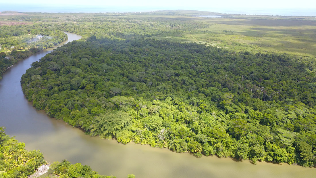 Sittee River Located in central Belize, the mangroves located at the mouth of this river are the tallest ever reported for the Caribbean region and among the tallest anywhere in the entire Neotropics. The mouth of the Sittee River represents the optimal conditions for mangrove development and the forest found there has a high level of structural development. Freshwater flows and sediments carried by the river itself, draining from the Maya Mountains, and tidal flushing from the Caribbean Sea all support this tree growth. The forest at the mouth of the river is composed of three mangrove species: red mangrove (rhizophora mangle), white mangrove (laguncularia racemosa) black mangrove (avicennia germinans). Stann Creek, Belize 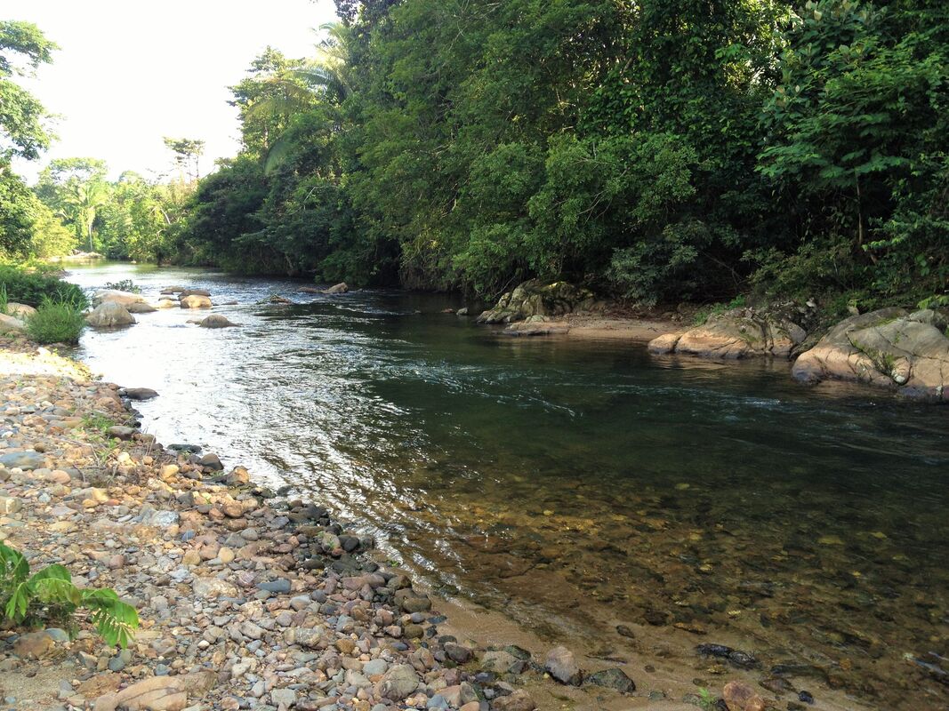 North Stann Creek River - The North Stann Creek River is 40 miles long, it winds through the North Stann Creek Valley rapidly at first and then more lazily and then empties into the Caribbean Sea at the bar mouth of Dangriga. The river is made up of two main branches, a north branch and a south branch, that joins behind Steadfast. The south branch originates in the Sittee Forest Reserve and is famous for the Davis falls. The north branch orginates near the Cayo-Stann Creek border. The Kent River is a smaller tributary, that joins the north branch at Middlesex. South Stann Creek River - is a watercourse in southeastern Belize. The administrative division, Stann Creek District, is named after the river. South Stann Creek rises in the foothills of the eastern slopes of the Maya Mountains within the Cockscomb Basin Wildlife Sanctuary. It drains the Cockscomb West Basin. Temash River, Belize 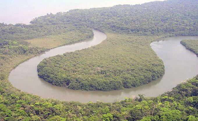 Temash River Between the Sarstoon and Temash rivers, sits the Sarstoon-Temash National Park. The park protects the entire watersheds of these two wild and remote rivers, including a vast wetland complex and the most highly developed riverine mangrove in the country. Both rivers then empty into the rich fishing grounds of the Caribbean Sea. The survival of STNP‘s unique wetlands and mangrove complex owe much to the careful management practices of the local indigenous peoples who have historically used its resources. Remoteness and difficult access has helped greatly in its preservation. Between the Temash & Sarstoon Rivers is the Sarstoon Temash National Park Sarastoon River, Belize 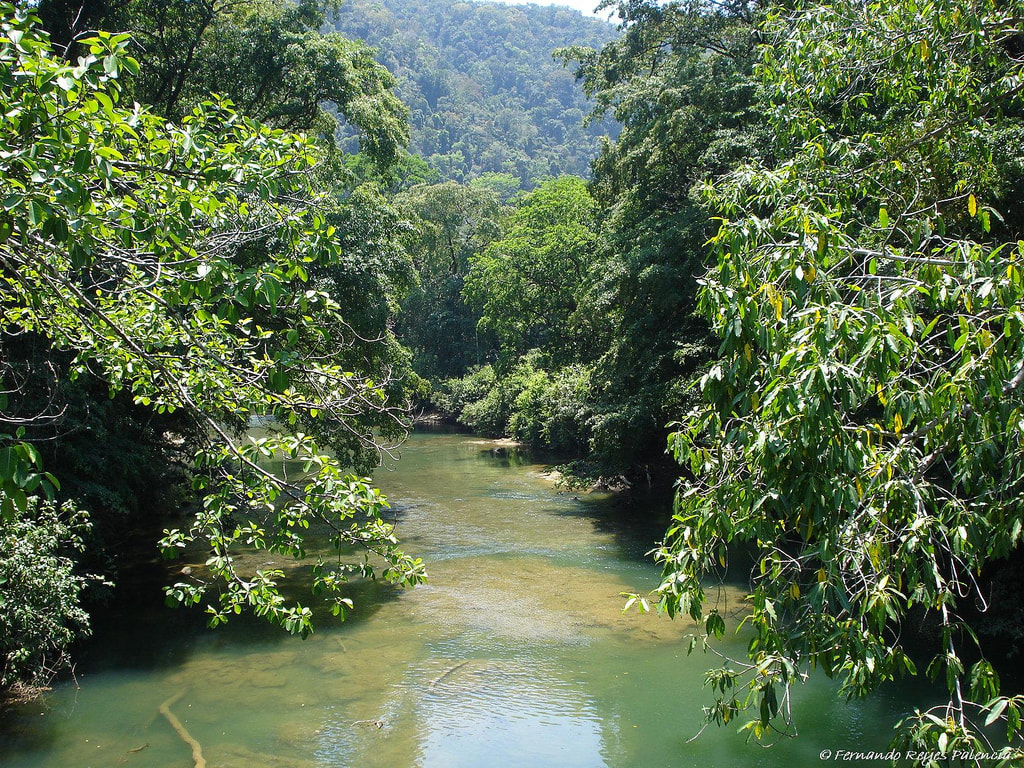 Sarastoon River The Sarstoon River, acts as a dividing line between Belize and Guatemala. Guatemala insisted that Belize had no control over the river or Sarstoon Island and Belize claims half the river and Sarstoon Island as being within it's territory. The territorial boundary, remains unsettled and the river is highly patrolled by both countries Belize and Guatemala. Waterfalls in Belize are some of the most gorgeous places on earth, to spend some time. The pristine beauty and the tranquil atmosphere (that surrounds a waterfall), is a real treat to the eyes. There is something about the sound of trickling, flowing, dripping water, that relaxes and refreshes us. Below are 15 unbelievable waterfalls, found only in Belize. 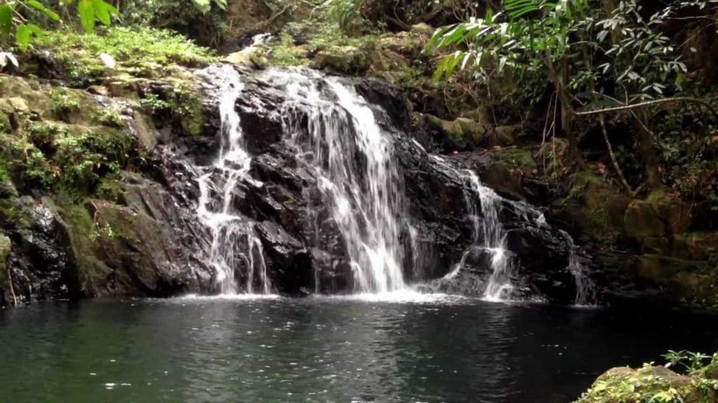 1. ANTELOPE FALLS Most of Belize’s waterfalls are located in state parks, and Antelope Falls in Mayflower Bocawina State Park is no exception. At nearly 1,000 feet tall, this is one of the country's tallest waterfalls. The hike to Antelope Falls is more difficult than many others, but the panoramic views (from the top), of the surrounding rainforest and the Caribbean Sea is well worth the effort. There is an upper and lower portion to the falls, the latter being the easiest to reach. The park offers guided bird-watching, zip-lining, and hiking tours to ancient Mayan ruins. 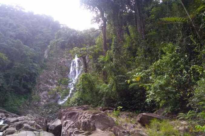 2. DAVIS FALLS At nearly 500 feet tall, Davis Falls are said to be the second-largest in the country. Davis Falls is located in the Stann Creek area, which puts them in close proximity to amazing beaches, ancient ruins, and a host of other tourist sites. The falls are located just off the Hummingbird Highway near the town of Dangrea, and there’s a fee to enter. Due to their remote location, one of the favorite methods of seeing them is by guided ATV tour. 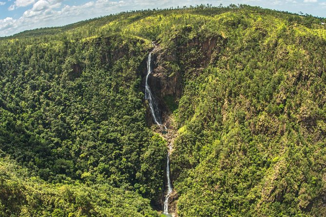 3. THOUSAND FOOT FALLS At nearly 1,600 feet, The Thousand Foot Falls are a bit misnamed, it's actually much more than a thousand feet in height. Occastionaaly referred to as "Hidden Valley Falls" by some. This is the tallest falls in the country of Belize, and for that fact for the entire Central America area. Due to the sheer size of the falls, they can be seen from far away, especially when driving through the valley below. It's quite a drive to get all the way there, and though the view is magical, you don't get to jump in the pool of water at the bottom. Once you turn off the main road, you continue on for about 4 miles. This will bring you to the falls and a picnic area. You can view the falls from across the gorge and through breaks in the mist. A small store and picnic tables can be found at the viewpoint (open 7:00 a.m. to 5:00 p.m. daily). Thousand Foot Falls is located in the Mountain Pine Ridge Forest Reserve. 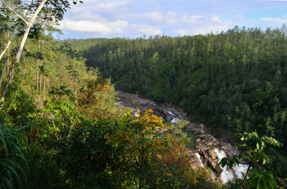 4. BIG ROCK FALLS Big Rock Fals is a gorgeous 150 foot waterfall on the Privassion River in the Mountain Pine Ridge Forest Reserve in the Cayo District, and is among the largest falls in Belize. Due to the rock over which the falls flow, the water is tapered into a V-shape, giving the falls a truly unique look. Though the surrounding rocks may look climbable, be careful; they can be slippery. Although the water doesn’t look too forceful, it packs a lot of punch. The pool below is easily accessible and a great place for a family swim and picnic. It can be accessed through a trail about 300 yards long down a 130′ deep gorge and is an ideal location for swimming or sun tanning.The tremendous view of water rushing over the huge 150-ft rock formations and plummeting into the deep perfectly round pool at its base provides a rush of excitement. A visit to this magnificent spot is one of the highlights of any trip to the mountain Pine Ridge area. 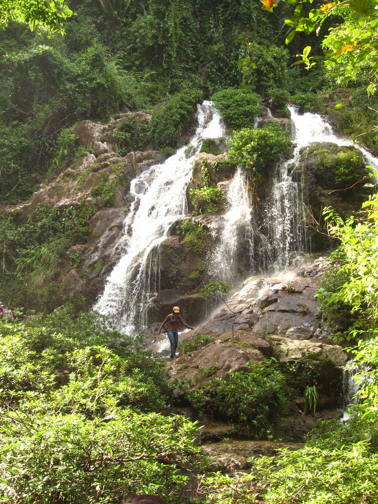 5. BOCAWINA FALLS The Bocawina Falls are found inside the Mayflower Bocawina National Park. There is actually three waterfalls in this national park (Bocawina Falls, Three Sisters Falls, and Antelope Falls). In addtion to this stunning waterfall, Bocawina is home to an amazing number of bird species, Mayan ruins, and a zip-line that’s purported to be the longest in the entire country. At nearly 100 feet tall, the falls are impressive and picturesque. Due to their hidden location in the surrounding forest, they are best reached with a guide. The pools below the falls are a great place for a swim or picnic and repelling and climbing are available if you’d like to get your heart rate up. If bird watching is your thing, don’t forget your binoculars. Access to the park is easiest from Hopkins, about 20 minutes by car. However, tours are offered from Placencia and Dangriga, as well as from Hopkins. The entrance to the park is about 4-1/2 miles off the Southern Highway. From the visitor center, to get to Bocawina and Three Sisters Falls, which are close together, it’s an easy hike of about 1-1/4 miles on the marked Bocawina Falls trail. The trail to Antelope Falls, about 1-3/4 miles, is somewhat more difficult due to some steep sections that can be slick after rains. Maps of the trails are available at the small visitor center. So far, little excavation has been conducted at the Mayan sites, but the parklike setting at the base of the Maya Mountains is beautiful. 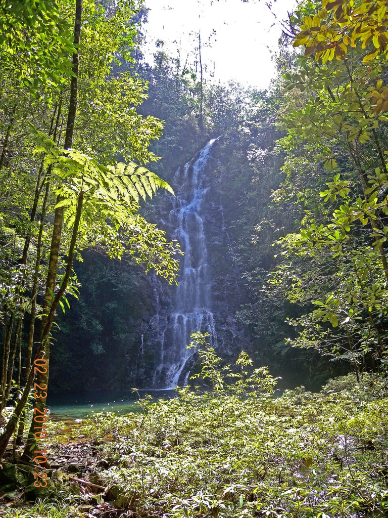 6. BUTTERFLY FALLS Located in the southern portion of Belize, Butterfly Falls is located on the border of the Mountain Pine Ridge Forest Reserve (in the Cayo District), which is nearly 100,000 acres of protected pine forest. Though near the forest reserve, the falls are actually on private property and can only be accessed through special permission. The water above the emerald green pool falls nearly 80 feet from the fall’s crest, contrasting with the rock face and lush jungle surrounding it. 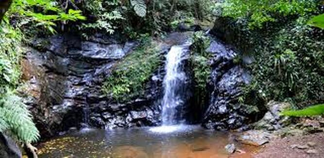 7. MAYA KING FALLS Near the quaint fishing town of Placencia on Belize’s southeast Caribbean coast, the Maya King Waterfalls are perfectly located for those who want to experience the country’s eco-related activities like hiking, climbing, and snorkeling. At about 70 feet high, the fall’s water drops from the forest above and splashes to the scenic pool filled with refreshing water at its base. The falls are on private property and there is a small fee to enjoy them. It’s best to go with a tour guide; the cost will include transportation, entrance fees, and the guide’s fee too. 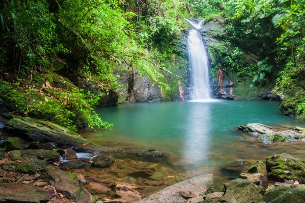 8. TIGER FERN FALLS Located in Cockscomb Basin Wildlife Sanctuary is Tiger Fern Waterfall. The hike from the park headquarters to the falls is about (4) kilometers. Depending on your physical ability, it should take no more than a few hours round trip. The park employees will give you an overview of the various trails in the area; if you’re comfortable with the layout, you’re more than welcome to head out on your own. Keep an eye out for the exotic plants and animals that call the park home. Many of them aren’t found anywhere else. 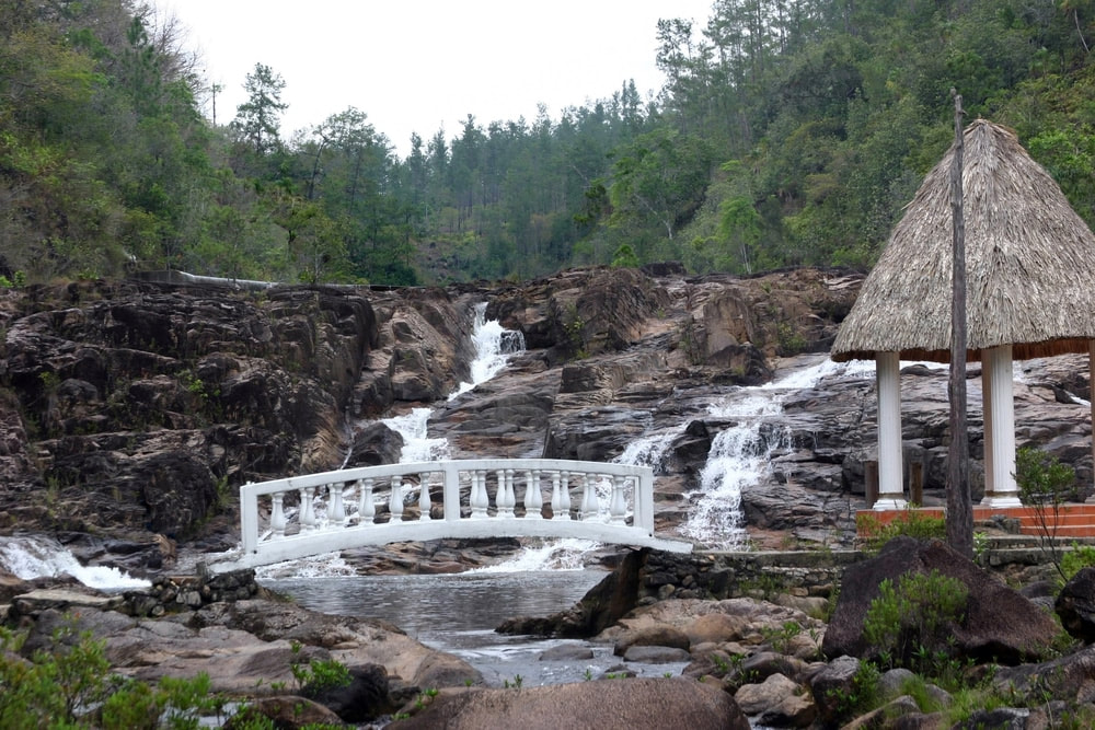 9. FIVE SISTERS FALLS The waterfall got its name because the water forms 5 separate streams as it rolls over the rocks and boulders, hence the name Five Sisters and is excellent for a cool and refreshing swim. Located near the central Belize town of Sarawina, Five Sisters Falls is a popular attraction to visitors heading to the Mountain Pine Ridge Forest Reserve. Five Sisters is noted for its enticingly clear pools and gleaming falls set against the dense green forest nearby. The falls are near to lodging and restaurants if you’d like to spend the evening in luxury after a tough day of slashing your way through the jungle. The falls and viewing areas are easily reachable from the park office and resort. 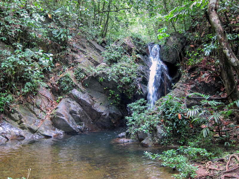 10. BEN BLUFF FALLS Located in the Cockscomb Basin Wildlife Sanctuary, Ben’s Bluff Waterfall is another must-see waterfall in Belize’s Stann Creek area. The park’s land has been set aside to protect the area’s plants and animals. The moderately difficult trail winds its way about 4-1/2 kilometers through the park to the falls. Though it can be tricky in spots, it’s suitable for most visitors. Though not tall by waterfall standards, the falls are beautiful and well worth the effort to get to them. Be especially careful in the early morning or late afternoon, as this is feeding time for many jaguars. 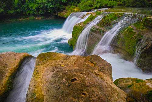 11. RIO BLANCO FALLS Located inside a 500-acre protected area, the Rio Blanco Waterfall in San Antonio is part of an area set aside for the local indigenous people. In part, they support themselves from revenue from the falls, so there’s a fee to enter. The mile-long trail is accessible by car or on foot, but it’s best not to drive because (depending on the season), the trail can be narrow and slick. At just about 20 feet, the falls make up for in beauty what they lack in size. Don’t forget a bathing suit and bug spray, and don’t be surprised if you see some of the natives enjoying the falls and swimming hole too. 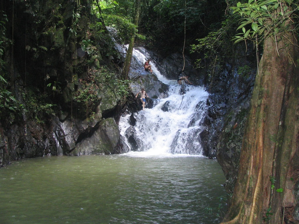 12. BILL BARQUEDIER FALLS Located in a national park with the same name, Billy Barquedier falls are conveniently located in the country’s popular Stann Creek area, which makes them a great place to see in an easy day trip. There’s a fee to enter the park, and the falls are about half an hour from the parking area. The trail can be difficult in areas, including portions over slippery stone and up muddy embankments, so be careful. The falls aren’t large, but they seem to emerge from a dark hole in the surrounding jungle, and the pool below is a great place for a refreshing swim. 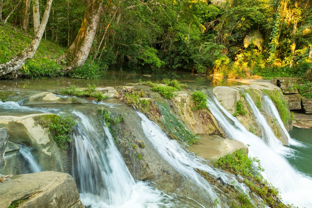 13. SAN ANTONIO FALLS If, like me, you thought that a waterfall that barely reached 10 feet wasn’t exactly a must-see in a country with so many noteworthy sites, guess again. Near the small town of San Antonio, the small but scenic falls sport easily accessible pools above and below; each are perfect places to take a dip and wash away that sweat and grime. The pool’s water is shallow, and if it hasn’t rained recently, clear too, which makes them easy to wade across and check out some of the things that live inside. The falls are a stone’s throw from the road leading out of town and are a great stop, even if just for an hour or two.  14. GOLDEN STREAM WATERFALL Another small but tranquil and beautiful waterfall is the Golden Stream Waterfall, located near a town of the same name in southern Belize. Even today, villagers still use the waterfall to get water, wash clothes, and bathe in. These small waterfalls are more well known for the large pools they flow into. The pools are large and deep, making them perfect for swimming. You'll probably have the pleasure of sharing them with some of the village children. It's not far from the village of Golden Stream, so its a perfect place to see the life of local people, as you enjoy this spot. 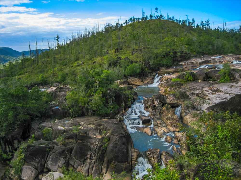 15. RIO ON WATERFALLS & POOLS Located near Cayo, in Belize’s western interior, just off the main road in the Mountain Pine Ridge Reserve (before reaching Augustine Village). Rio on Pools and the surrounding falls are often referred to as Belize’s most alluring swimming pool. Although they are waterfalls, they’re really a series of natural pools set along a slow-moving river strewn with large, round boulders. The scene revealed from the riverbank high above is absolutely breathtaking. A short hike down to the river transports visitors to a swimming pool wonderland. Whether your desire it to sit under a waterfall, slide over the smooth granite boulders, swim in your very own selection of pools or simply bask in the awesome natural beauty around you, Rio On Pools is sure to provide a relaxing and enjoyable experience.  1-1/2 pounds of Belizean conch 1 sweet pepper (medium size) 1 onion (medium size) 1-1/4 c. of flour 1-1/2 c. of water 1 sprig of cilantro 1 celery stalk 1/4 tsp. salt 1/4 tsp. pepper 1/4 of Habanero chili pepper (optional) Prepare Ingredients: Clean your conch and cut it into pieces. Clean, de-seed and chop a sweet pepper into small pieces. Clean, peel, and chop onion into 8 pieces. Clean, and chop celery into 4 pieces. Clean and chop up your herbs (cilantro, basil, etc.) Place in Blender: Place all of the above in a mixing bowl, spoon 1/3 of the ingredients into a blender followed by 1/3 cup of water and blend for 6-10 seconds. Pour into a new mixing bowl and continue process until all the ingredients has been blended. In Mixing Bowl: Stir in flour. Add salt & pepper (mixture consistency should be like a cake batter; if you need more water just add a small amount. In Skillet: Pour oil in frying pan and heat the oil in frying pan (medium heat): make sure oil is sizzling to get the desired results (if you like, you can begin to heat oil around step 6). Spoon 1 pot spoon size of mixture into frying pan (cook 4 -5 at a time); turn over only when ends are golden brown and the fritter is somewhat cooked; continue cooking on the other side until entire fritter is golden-dark brown. Drain on a paper towel placed on a large serving plate. Repeat cooking process until entire batter is finished CONCH FRITTER DIPPING SAUCE  1/2 c. prepared salsa 1 c. real mayonnaise 1 tsp. garlic powder 1/4 tsp. cayenne pepper 1/2 tsp. dried basil, crushed 1/2 tsp. salt (more or less to taste) 1/4 tsp. pepper Mix everything together and place in small ramikins and serve with hot conch fritters. 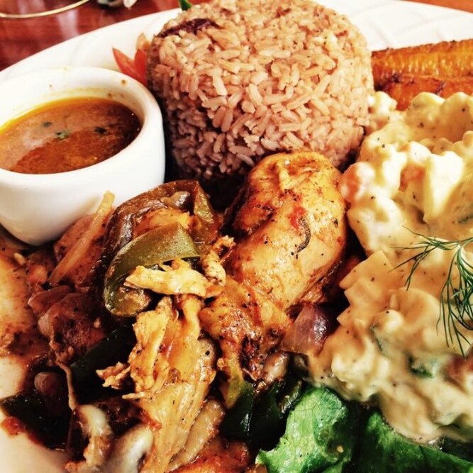 1 (4 lb.) chicken cut into small pieces 1 clove garlic, minced 1 tsp. thyme, salt, pepper Small bunch of cilantro 1 tiny silver of ginger 2 Tbsp. onions, chopped 1 Tbsp. green or red sweet pepper, chopped 1/4 tsp. cumin 1 tsp. brown sugar 1 small ripe tomato Dime size red recado Vinegar or lime juice DIRECTIONS 1. Wash chicken pieces, season with vinegar, lime juice, red recado, cuming, thyme, cilantro, salt and pepper. 2. Heat 2 Tbsp. cooking oil, add brown sugar and watch carefully to avoid burning. LEt sugar cook until completely melted and turns dark. 3. Add clove of garlic that has been smashed and minced. 4. Add giner and fry, stirring, remove ginger when it gets brown. 5. Add chicken and brown properly on all sides. 6. Add remaining seasoning from chicken, chopped onions, sweet pepepr and tomato and add about a half cup of water. 7. Reduce heat to medium and cover pot. Let simmer, adding water so the pot is never completely dry. 8. Cook for about 1 hour until chicken is very tender. How to Cook Belizean Rice & Beans 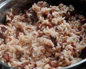 1 lb. red kidney beans (fresh) 1 medium onion sliced 2 lbs. rice Black Pepper 1/2 tsp. thyme 1 tsp. salt 2 plugs garlic (crushed) 1 can coconut milk (15 oz.) 6-8 c. water DIRECTIONS 1. Collect all ingredients. 2. Soak beans for 4-6 hours. 3. Boil beans with garlic, onion, until tender. 4. Season soften beans with black pepper, thyme and salt. 5. Add coconut milk. Stir & taste. Let boil. 6. Clean and wash rice. 7. Add rice to seasoned beans. Stir, then cover. Cook until water is absorbed or rice is tender. If necessary add more water gradually and continue cooking until rice is tender. 1. Cockscomb Basin Wildlife Sanctuary While visitors rarely see a jaguar, the many ecosystems of Cockscomb support a rich and varied bird fauna - forest species, pine woodland and savanna species, species restricted to riverine areas, and birds associated with higher elevations. 2. Crooked Tree Wildlife Sanctuary In 1998, this protected area was declared Belize's first Ramsar site based on the wetland's international significance for many migratory and non-migratory wetland bird species. Large numbers of wading birds flock into the lagoons during Belize's dry season (February through May) when food is hard to find in other places. 3. Aguacaliente Wildlife Sanctuary These wetlands in the Toledo District attract a number of very visible birds forming the principal attraction for visitors. Aguacaliente protects important breeding colonies for the Wood Stork and Boat-Billed Heron. There are a few birds in Toledo District that can't be found elsewhere in Belize. 4. Mountain Pine Ridge Forest Reserve Raptors cruise the valleys of the Pine Ridge and it is the most likely place in Belize to see the rare Orange-breasted Falcon. 5. Ambergris Caye & Caye Caulker Of all the habitats in Belize, the littoral forest on the Cayes is the most endangered due to development. Caye littoral forests benefit the Black Catbird and White-crowned Pigeon, both are listed as near-threatened species. The mangrove habitat also attracts many other birds. 6. Caracol Archaeological Reserve Caracol is one of the last outposts where the Keel-Billed Motmot, a globally vulnerable species is relatively common. Other notable birds seen at Caracol include Ocellated Turkey, Crested Guan, and Great Curassow. While admiring the largest Maya site in Belize, you may also see colorful toucans and trogons. 7. Half Moon Caye Natural Monument Declared a crown reserve bird sanctuary in 1928, the Red-Footed Booby colony of Half Moon Caye is the oldest site for wildlife protection in Belize. Half Moon Caye's population, an estimated 4,000 birds, is made up almost entirely of White Booby Birds with black on the trailing edge of the wings. 8. Red Bank Village
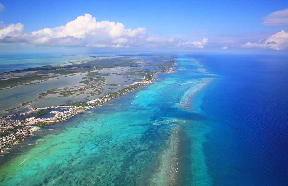
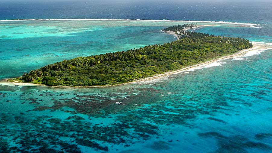
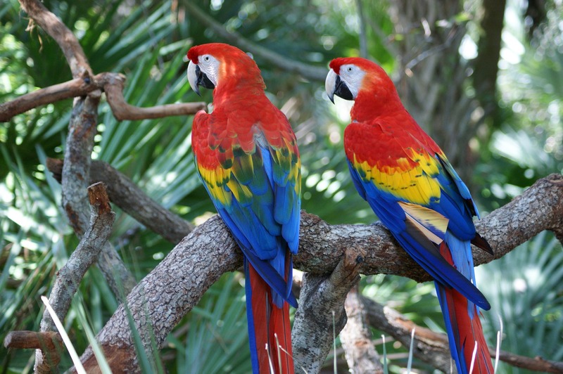
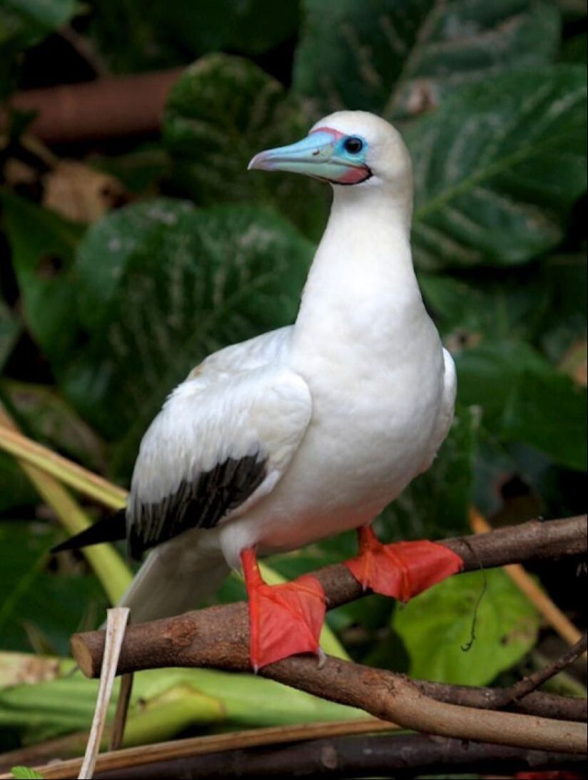
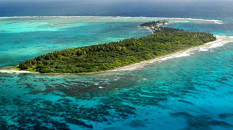
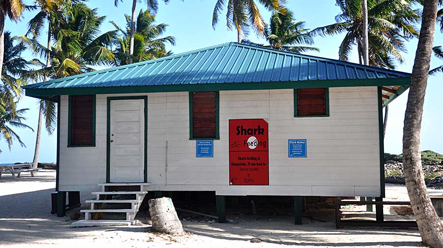
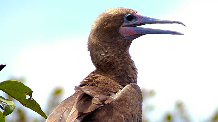
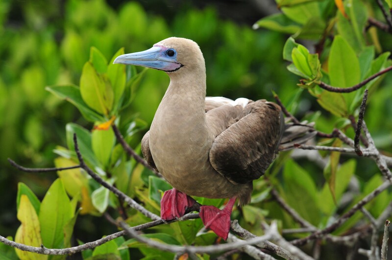
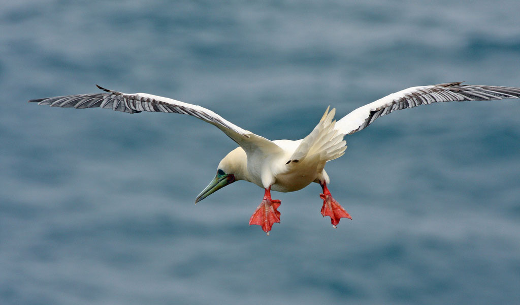
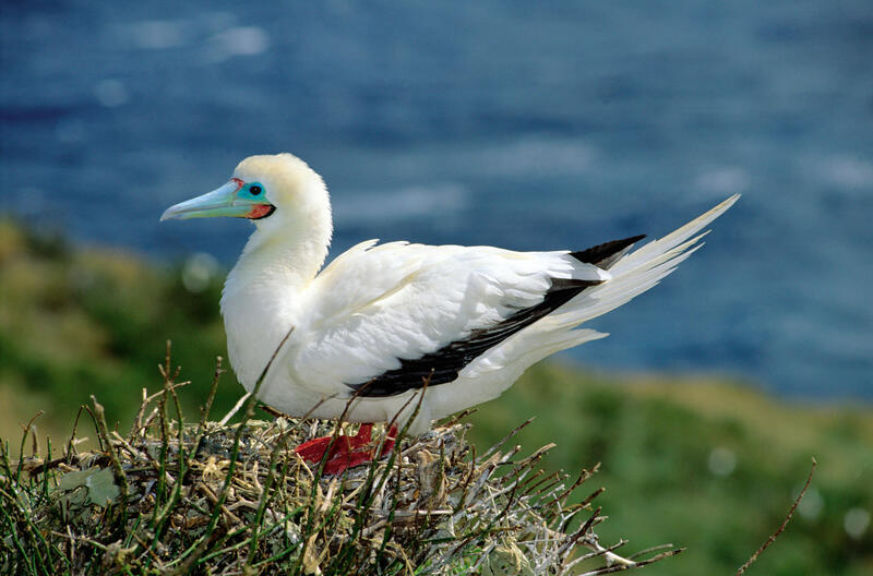
The unmistakable Scarlet Macaw flocks to the small Maya Village of Red Bank in South Stann Creek seasonally. As many as 100 birds gather near the village (primarily from January to March), to feed on the sweet ripe fruits of the annato trees. 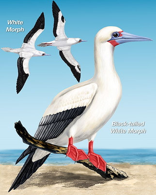 Found only on Half Moon Caye, they live there for about 10 months of the year. Nesting starts around mid-December and the young hatch around March. Chicks are full grown in a matter of months and then its off to the open sea. Flying fish are their favorite food, caught at night when the fish are nearer the surface. Most of Half Moon's Boobies are white, instead of the more normal brown color found in and around the Caribbean. In 1928, part of Half Moon Caye was reserved by the crown, as a bird sanctuary under the Crown Land Ordinance to protect the habitat of the Red-footed Booby. It is Belize’s oldest site designated for protection of wildlife. Over 120 different species of birds can be seen on Half Moon Caye. The Half Moon Caye colony is made up of about 4,000+ birds nests, amidst Orange-flowered Ziricote trees. Red-footed Boobies prefer Orange-flowered Ziricote trees for nest building and raising chicks. In return, the booby colony supports the forest’s stability by providing guano as fertilizer. This beautiful relationship will endure for many years to come if left relatively undisturbed. On Half Moon Caye, the bird population is almost entirely made up of white-colored birds with black on the railing edge of their wings. The Red-footed Booby, unlike other seabirds, displays a variety of color morphs. Elsewhere they are dull brown. Look carefully, somewhere in the crowd you may see a white-tailed brown morph or a Red-footed Booby that is entirely brown. Despite plumage differences, all adults have the characteristic red feet. The Red-footed Booby and Magnificent Frigatebird share a unique relationship, they have both reside together peacefully in nesting colonies on land. Conflicts occur over the open sea, when the Magnificent Frigatedbird chases and attacks the Red Footed Booby Bird to give up its food. The Red-footed Booby has learned to dive, catch its food and swallow it almost immediately before the Magnificent Frigatebird has a chance to steal it from them. This behavior of stealing food is called kleptoparasitism. Half Moon Caye - Lighthouse Reef Atoll The Half Moon Caye Natural Monument (HMCNM) is located at the southeast corner of Lighthouse Reef Atoll. Lighthouse Reef Atoll is the furthest of Belize’s three atolls from the mainland, and one of only four such atolls in the Western Hemisphere. The atoll is an asymmetric rimmed platform, entirely surrounded by a fringing reef rising to the surface. Inside this fringing reef is a lagoon speckled with hundreds of coral patches which is known for its high density and diversity of corals and fishes.
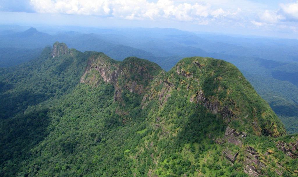
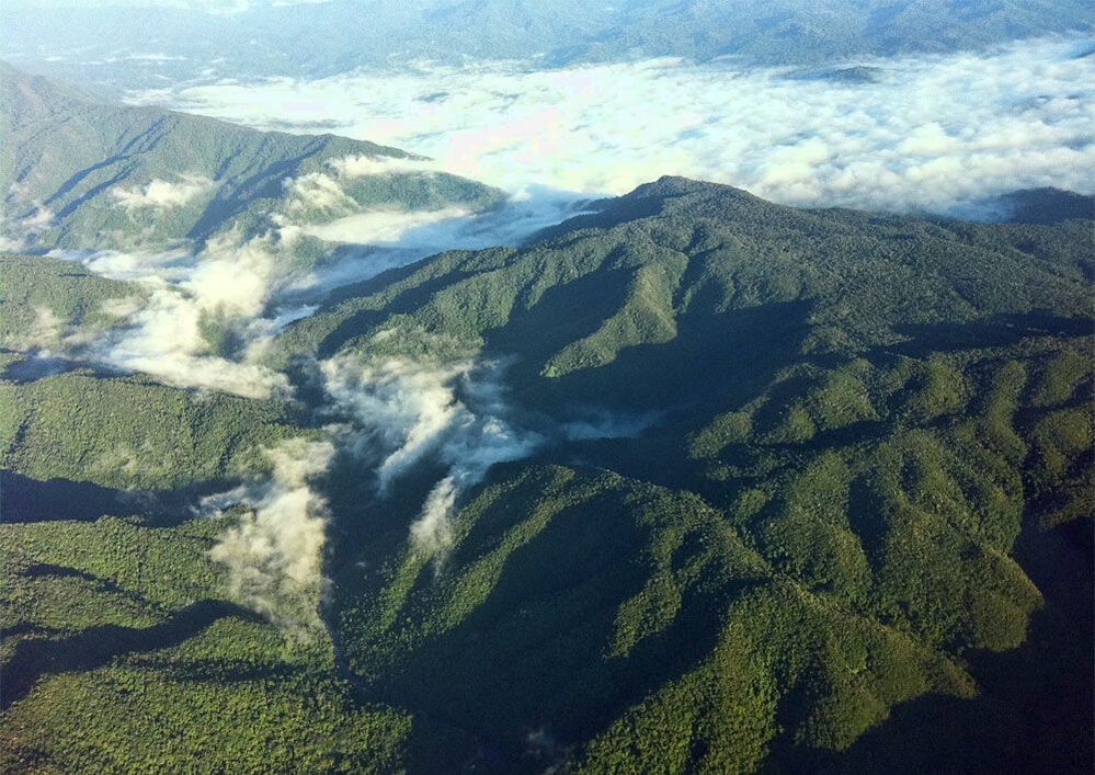
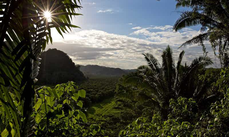
MAYA MOUNTAINS Maya Mountains is a range of hills mostly in southern Belize, extending about 70 miles northeastward from across the Guatemalan border into Central Belize. The range falls abruptly to the coastal plain to the east and north but more gradually to the west, becoming the Vaca Plateau, which extends into eastern Guatemala. The highest points being Doyle's Delight (3,688 feet - Cayo District) and Victoria Peak (3,680 feet - Stann Creek District), in the transverse Cockscomb Range, which extends seaward perpendicularly from the main divide. Doyle's Delight is named after Sir Arthur Conan Doyle, the author of the Sherlock Holmes mysteries. In 1912, Doyle wrote a book called "The Lost World", which refers to this mountain range as both beautiful and wild. While both of the tallest peaks are difficult to reach, the Maya Mountains remain a top attraction in Belize due to their amazing views, unspoiled landscapes, the abundance of wildlife, and the number of waterfalls found in the area. Many of Belize’s national forests and protected conservation areas are found partially or wholly inside the Maya Mountain range. The mountains take their name from the Maya people, who retreated into the mountains before the Spaniards, leaving behind lost cities such as Lubaantun on the mountains southeastern side. DOYLE'S DELIGHT (3,688 feet - Cayo District) Doyle's Delight, the country's tallest peak. The mountain remains hidden in the very heart of the Maya Mountains, which sits right on the border of Toledo & Cayo Districts. Doyle's Delight summit is an immense area nearly 300m long and a good 100m wide. The vegetation and the soil changes dramatically on a daily basis, compare with the ridge top. Green, dripping, dark vegetation tapestries, where rivers disappear underground, howler monkeys roar from the treetops, thousand-year-old Mayan temples await discover, and ticks, chiggers and flesh-boring flies buzz and bite. VICTORIA PEAK (3,680 feet - Stann Creek District) Victoria Peak is the second highest mountain in the range at a height of 3,680 feet and the second highest elevation in Belize (8 feet lower than Doyle's Delight), Victoria Peak is situated in the Cockscomb Basin Wildlife Sanctuary. On May 2, 1998, Victoria Peak was declared to be a natural monument. Prior to this declaration, Victoria Peak was part of the Cockscomb Basin Wildlife Sanctuary. At the launching of the 30th Anniversary Celebration on February 6, 1999, an agreement between the Belize Audubon Society and the Government of Belize was signed, adding Victoria Peak and Blue Hole Natural Monuments to the list of protected areas managed by the Belize Audubon Society. MOUNT MARGARETH Mount Margareth is almost unexplored mountain, in middle of the rain forest. Located in the North-East shores of the Maya Mountains, in Cayo District. Is completely covered with vegetation (quasist forests). This range is not terribly high, but it is comprised of extremely challenging terrain due in part to the constant weathering of its volcanic spine and limestone. NATURAL PARKS & RESERVES The Maya Mountains contains lot of interesting places such as: natural parks, natural reserves, sanctuaries with: Ancient city-building Mayans, lots of caves, creeks, rivers, rain forest, wild animals. All mentioned before are almost unexplored. * Blue Hole National Park (665 acres) * Chiquibul National Park (265,262 acres) * Caracol Mayan Ruins (Lost City) * Cockscomb Wildife Sanctuary & Jaguar Reserve (96,000 acres) * Five Blue Lake National Park (4,060 acres) * Mountain Pine Ridge Forest Reserve * Colombia Forest Reserve, over half of the total area of Maya Mountains The Maya Mountains continue to beckon outdoor adventure seekers who know that the nation's government supports a vibrant ecosystem that protects the nation's natural assets. The fact is appreciated by tourist eager to vacation in the shadow of this imposing mountain range, the mountains remain as stately as they did when the earth was formed. Easy to reach via Hummingbird and George Price Highways, the Maya Mountains will continue to intrigue and fascinate visitors for generations to come. Scientists refer to those areas as "Green Paradise". Cause de diversity of flora and fauna, is rich in wildlife, including jaguar, deer, tapir, monkey, and kinkajou. Numerous species of birds inhabit the forests. Reptiles and amphibians include iguanas, crocodiles, and green tree frogs. It's been the focus of several recent expeditions, each of which has revealed new species never before recorded in Belize, and some new to science. VICTORIA PEAK HIKING TRAILS Rising abruptly from the lowlands, the jagged Cockscomb Mountains are an impressive mass of rock that is visible from the coast in clear days. The Victoria Peak Trail is open during Belize's dry season, February 1st to May 31st. Recommended to do it in 3-4 days hiking, 5 days if you're not in good conditions. All hikers must be accompanied by a licensed tour guide (experienced guides can be hired from the local communities buffering Cockscomb). Maya Mountains - Geology
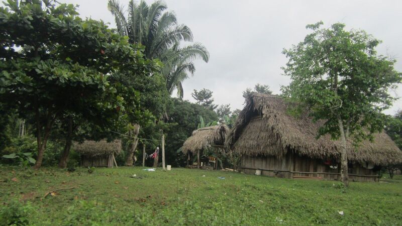
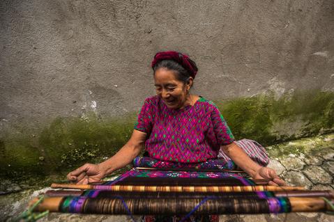
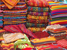
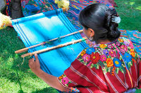
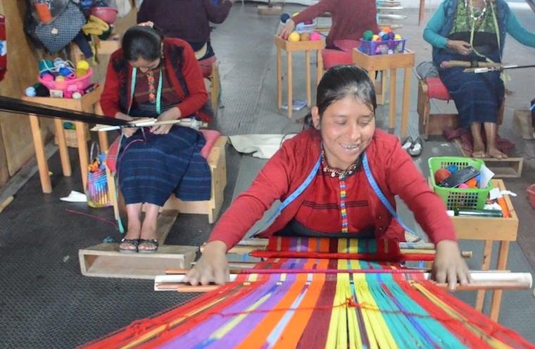
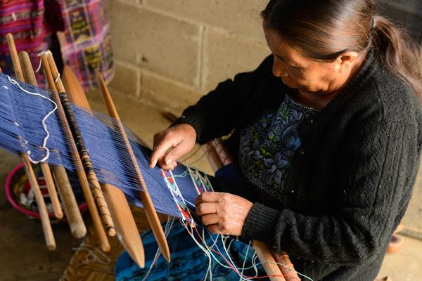
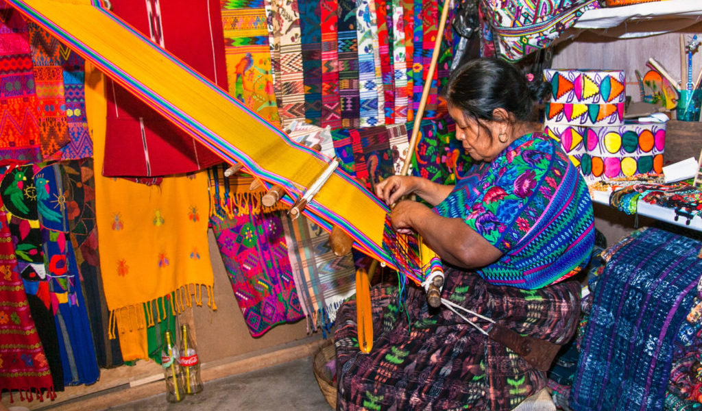
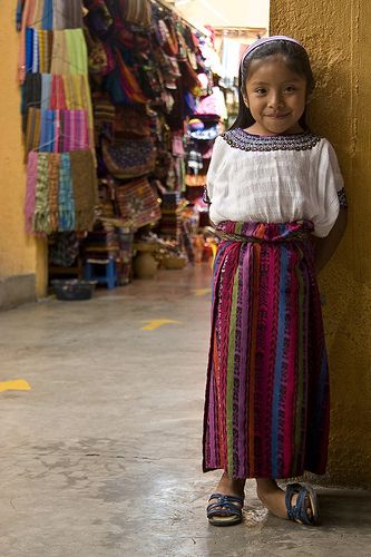
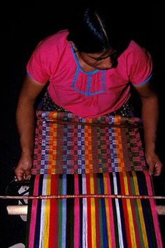
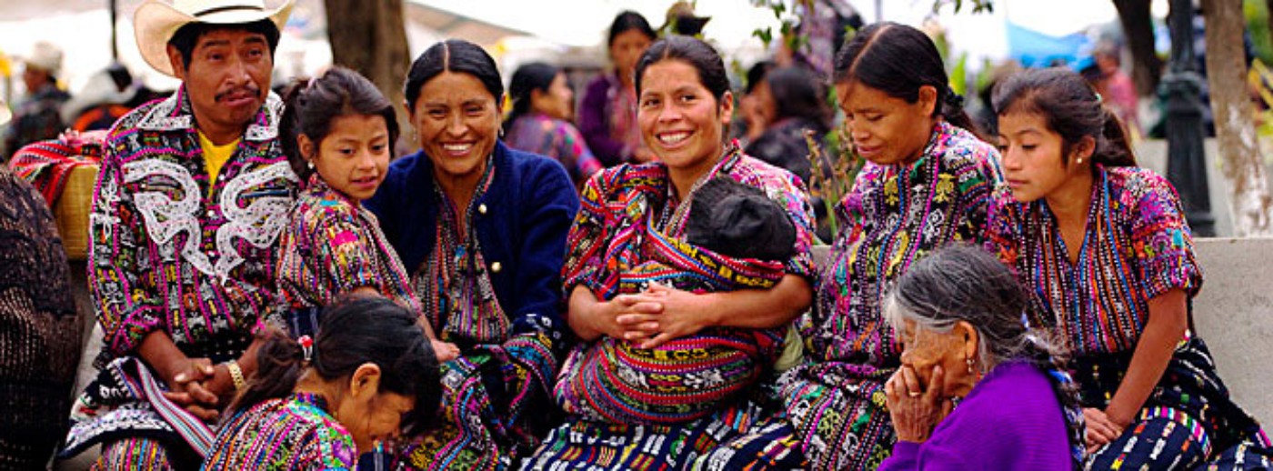
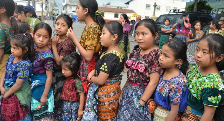
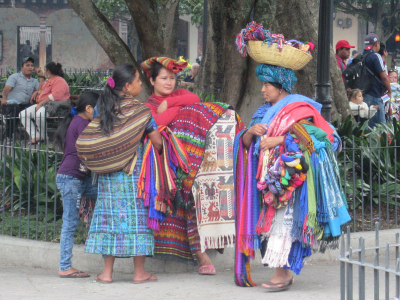
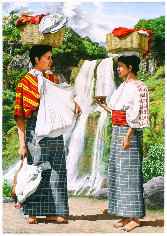
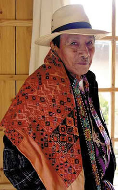
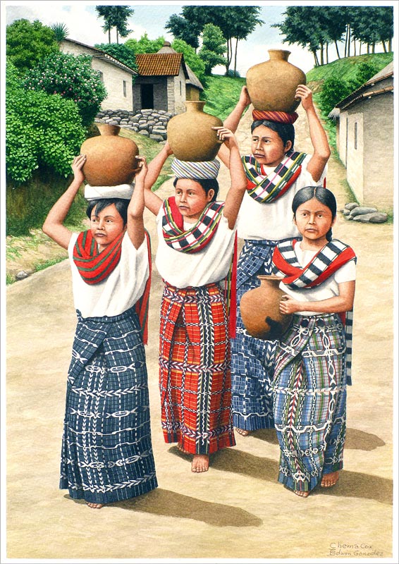
According to Researchgate.net, the range's geology is composed of Pre-Mesozoic crystaline, sedimentary and volcanic rock, but it's the sedimentary rock that tells the story of the mountains origin: a mix of "metamorphosed fluviomarine conglomerates, turbidites, graywackes, quartzites, sandstones, siltstones, shales and minor crinoidal limestones." Most materials were pushed up from the earth's core when the North American and Caribbean tectonic plates crashed together during the earth's formation. Maya Mountains - Biggest Secret "Gold" In addition to being a geological treasure, the Maya Mountains hold deeper secrets that have yet to be unearthed - Gold! Huge parts of the mountain range remain unexplored or under-explored due to hard-to-traverse terrain and thick vegetation. Because of this, it will take a major effort to extract gold from the area in the future, even with state-of-the-art prospecting tools. So the question remains to be asked, where did the Maya's get their gold? Who knows what secrets this land still holds and whether Belize's future will be shaped by plans to mine the mountain range. 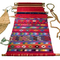 The Maya people of Mexico and Central America form one of the largest indigenous populations in the Americas. With over 4 million people who identify themselves as Maya, this is an extremely diverse group. Some Maya live in the steamy jungles of the Yucatan peninsula, others in the rugged highlands of Guatemala, still others in the country of Belize. The Maya people are well-known for the beauty, quality, and sophistication of their textiles. Women have traditionaaly created textiles in Maya society, and textiles were a significant form of ancient Maya art and religious beliefs. They were considered a prestige good, that would distinguish the commoners from the elite. Maya textiles are pretty easy to identify becuase, they stand out. Characterized by vivid colors of every shade imaginable and covered in geometic and animal patterns, these textiles "stand out" and demand your attention. Besides the basic appearance, one of the keys to understanding any textile is knowing how it is made. Maya textiles are woven, as poosed to being embroidered. The first step is making the threads that will be woven together. Today, Mayan weavers generally use cotton or wool threads, which can be purchased in Maya markets. Different patterns, represent social and religious significance. The following is a brief description of just some of the symbols used in Maya woven textile fabrics. Hope you enjoy my blog, this has really been fun putting this together. Woven Textile Maya Symbol & Their Meaning  BATS - To the Mayan people, were the guardians of the underworld (or caves). The bat is worshipped for its rule over the darkness, and its powerful sign to mark against enemies.  BUTTERFLY - The butterfly with its wings spread, represents freedom. This freedom is sometimes compared with that of the weaver, with her ability to weave wild stories into her textiles. The white butterfly indicates good news, the black butterfly indicates bad news. 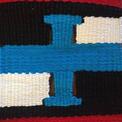 THE CROSS - The cross has ties to both Mayan and Christian religion. The four points represent the four directions of the winds, which give life to crops and mankind. The Mayan cross is made from four types of corn: white, yellow, red and black. The cross also signifies: dawn, darkness, water and air. 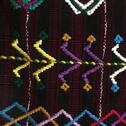 CORN - Is a particulary important symbol in the Guatemalan textiles. Mayan mythology tells the story of how corn created mankind. White corn was used for the bones, yellow corn was used for the muscles, black cork for the eyes and hair, and red corn for the blood. Corn for this reason is not just considered a source of food, but has ancestral, ceremenoial significance. 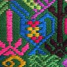 THE CUP - Cymbolizes the importance of sharing with others. In modern Guatemala this symbol has become a fusion of Mayan and Christian beliefs. It is sometimes understood as the cup Jesus shared with the disciples during the last supper. 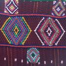 THE DIAMOND - Is one of the most important symbols, and can be found in most of Trama's products. It symbolizes the arms of the weaver, with her body at the bottom, and her textiles at the top.  THE DEER - Is considered a symbol of strong, stable, regal energy by the Maya. They respresent all of the animal kingdom. Deer also encompass the four levels of being, physical, mental, emotional and spiritual. The energies of the deer also signify the binding forces between an individual and their family. 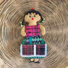 DOLLS - Represent the connection between women, Mother earth, and Ixchel, who is the gooddess of medicine, midwifery, the moon, and weaving. 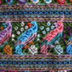 DOVES - Are the queens of the heavens. These femine birds provide nourishment for the Maya people and renew the fruits of life. 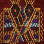 THE EAGLE - The ancient people understood the eagle's calls as a warning that an earthquake or stomr was on its way. In ancient Mayan mythology, one face of the double headed eagle represents good and the other represents evil. The creature itself represents contemplative thought when focused upon, this symbol assists in accessing inner wisdom and facilitiates focus. 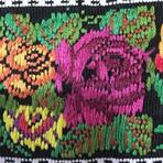 THE FLOWER - Motifs used in weaving are usually the native flowers of Guatemala like: roses, pansies, gladioli, and cactus flowers. All of these flowers bloom abundantly throughout the year. The Mayans view flowers as symbols of life and fertility. 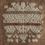 THE INUP - Is the Tree of Life, which represents the life of man, birth growth, reproduction and death. It also indicates love as shown in the union between the two people who make up the two parts of the tree. The fruits represent their offsprings. Many sacred rites are performed under the branches of these trees. 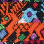 MAYAN GODS - Are frequently depicted with jaguar attributes. The jaguar is said to have the ability to cross between worlds, as represented by daytime and nightime. The world of the living and the earth are associated with the day, while the spirit world and the ancestors are associated with the night. 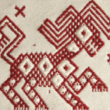 THE LION - Is often woven by young women to deomonstrate a desire to be courted. As the king of the jungle, the lion symbol is a keeper of goods, wealth, and good luck. Sometiems the lion is read as a representative of anger, and is therefore never used in huipils that are worn during happy events.  THE OWL - In Mayan mythology, the owl is a symbol of death and destruction. These nocturnal birds of prey are the mysterious messengers of dark powers. For the Kekchi people, the owl's hoot is an omen of death. 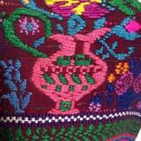 THE PITCHER - Symbolizes the head of a woman from which her wonderful ideas for patterns and color combinations in textiles are poured. 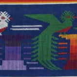 THE QUETZAL - Is the national bird of Guatemala, and one of the most important textile symbols, often present in traditional cltohing, in a number of modern Mayan dialects, the name means "treausred" or "sacred". Legend has it that long ago, the Quetzal would sing beautifully, but has been silent since the Spanish conquest. 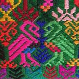 THE ROOSTER - Like the turkey is associated with marriage. In some Mayan communities, proposals are accompanied by the groom's family presenting the potential bride's family with between one and three roosters, depending on how they regard their prospective daughter-in-law. Those who received three roosters can feel proud that the mother-in-law is please with the union. 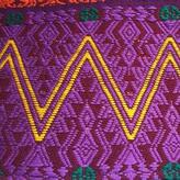 THE SERPENT - Appears frequently in Mayan textiles as a representative of the representing god Gucumatx, the creator of the world. This zigzag design can also signify mountains, which provide clean air and protection from sickness. 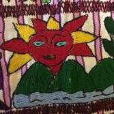 THE SUN - Represents the radiant energy that contributes to the motion of the universe. It's also symbolic of the god of corn, to whom the Maya pray to ensure a good harvest. 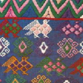 THE TURKEYS - Often tell the stories of weddings. The turkey represents a propsal. Once a Mayan couple are engaged, the groom's family will spend the next two years fattening up a turkey until the day of the wedding. The groom then presents the dead turkey tot he parents of the soon-to-be-bride. If the groom is rich enough, he will also give the bride's family bread and money. Kekchi Mayan's In Belize Not much is known about the lives and history of the Kekchi (pronounced Qʼeqchiʼ) people prior to being conquered by Spanish conquistadors, however, it is known that they were a Maya group located in the central highlands and northern lowlands of Guatemala. The Kekchi Maya are originally from the Verapaz region of Guatemala. Their land was formally known as Tezulutlan or “the land of war" and the Kekchi people were ruled by a king who had his own laws and government. When the Spanish began their conquest the Kekchiʼ were hard to control due to being a dispersed population. During the nineteenth century plantation agriculture was a big part of the Kekchi people's lives. This led to the seizure of the Kekchi communal land by plantations and the services of the Kekchi people by the government. By 1877, all communal landownership was abolished and this forced some of the Kekchi people to move to Belize. Many began migrating to Belize in the later years of the 1800's. The Kekchi settled in Belize around the lowland areas, along rivers and streams, forming small isolated villages (over 30 communities in all), throughout the Toledo District of Belize. The Kekchi people are the most populous Mayan group found in Belize. Because of their isolation, the Kekchi have become the most self reliant ethnic group found in Belize. They are a peaceful people, known for their cooperative practices in farming and cultural development. In time, the Kekchi Mayan mixed with the Mopan Mayan through marriages. Today we see very little difference between the Kechi and the Mopan Mayan groups. In Guatemala, they number just over half a million. In Toledo District of Belize alone, they make up (about 5 percent), of the Belize population according to the 2000 census. 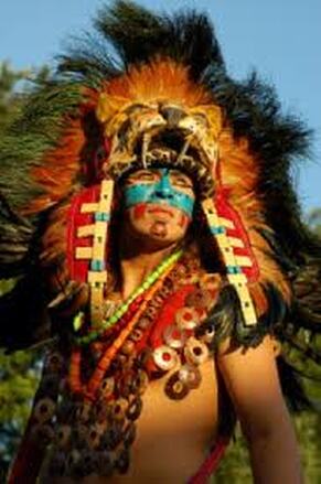 Kekchi Indians - Northern America, is not the only country that took land away from the native Indians. The history of the Kekchi Indian people (in Belize), dates between 1870's and 1880's. This was the time when large numbers of Kekchi Indians (and their families), escaped from Guatemala to Belize. Guatemalan dictator Justo Rufino Barrios made the export of coffee the backbone of his government in the 1870s. Barrios expropriated land belonging to the Catholic hierarchy, as well as communal lands held by Mayans (by 1877), Barrios had virtually eliminated communal ownership of land in Guatemala. By 1880, coffee accounted for 90% of Guatemala's exports. Many of the Kekchi Indian people fled Guatemala, as the government took away their land. They either stayed & were forced to become slave labor for coffee plantations, or they fled to Belize. The Kekchi you see living in Belize today, are descendants from the families who chose to flee Guatemala to Belize. These families chose not to become part of the forced slave work force for the coffee plantations. Today you find the majority of the Kekchi Mayan people, living in the Toledo District (the southern part) of Belize. |
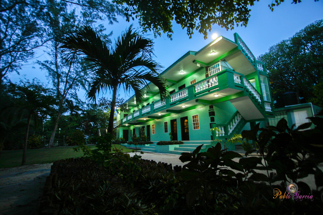
Is located on the island of Ambergris Caye, directly across from the Belize Barrier Reef, off the mainland coast of Belize. The property is nestled in a cluster of Australian Pine trees, backed to a littoral jungle, and surrounded by tropical gardens. It's about a one minute walk from the property to the beach, and a 10-15 minute drive from the island airstrip to the property.
We offer one bedroom suites (455 s.f.) of living area to include: livingroom, kitchenette, private bathroom and bedroom. We are also about a one minute walk from one of the best restaurants on the island serving (breakfast, lunch & dinner). Within walking distance you can find: (3) blocks is Robyn's BBQ (4) blocks is 2 fruit stands (5) blocks local grocery store IF YOU'RE COMING TO BELIZE TO............... If you're coming to Belize to dive the Blue Hole, descend the shelf walls at Turneffe, snorkel the Barrier Reef, explore Mayan ruins, rappel into a cave, kayak along the river through caves, zip line through jungle tree tops, hike through a cave to see an ancient human skeleton, swim with sharks, listen to Howler Monkey's, hold a boa constrictor, feed a jaguar, horseback ride through the jungle, canoe through a cave, rappel down a waterfall, sail around an island, enjoy cocktails & dinner to a sunset, climb 130' feet to the top of a Mayan ruin, rip up the jungle trails on an ATV, float through a series of caves on a tube, and sip on a rum punch..... then this is the place for you. Belize Budget Suites, offers you clean, affordable, attractive, accommodations, at prices that allow you to do all the things just mentioned. Archives
February 2021
Categories
All

For All Your Home Improvement Needs

For all Your Real Estate Needs
501-226-4400 10 Coconut Dr. San Pedro, Belize Your Ad Could Go Here
|







 RSS Feed

