Belize has some of the best ruins in all of Central America
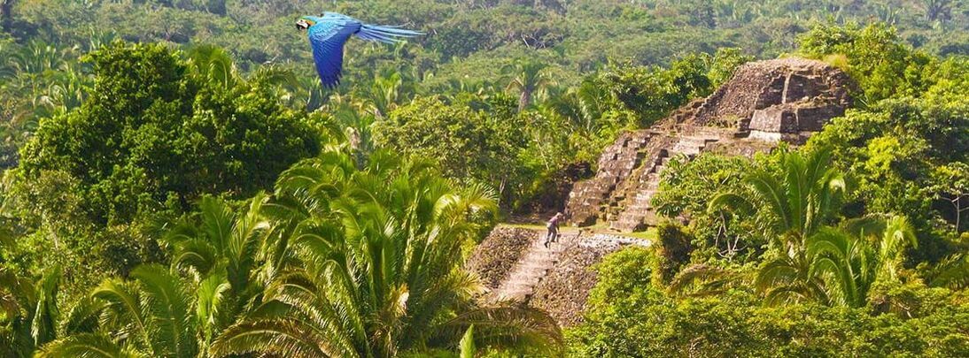
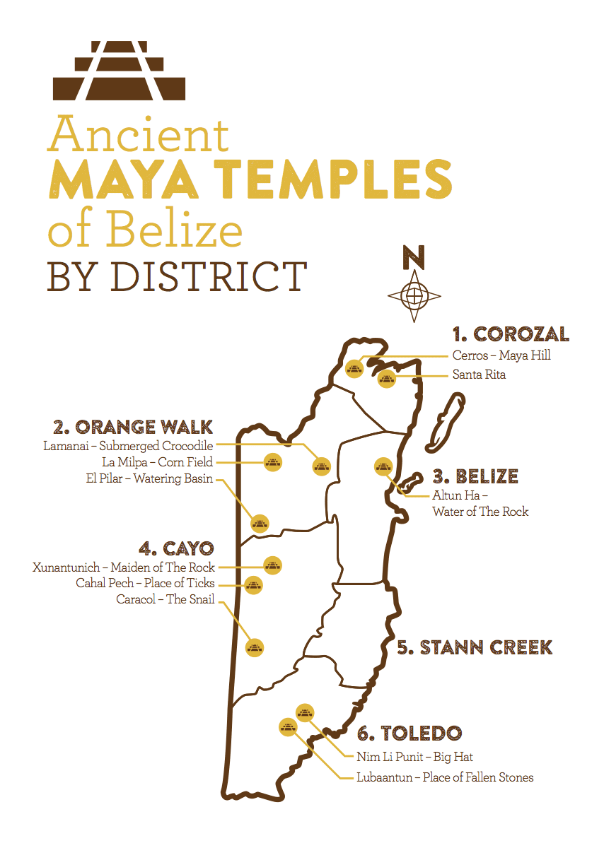
Best Mayan Temples to Visit
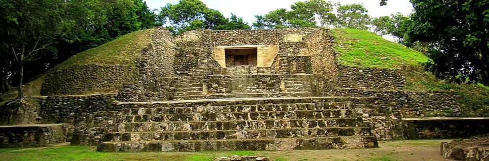
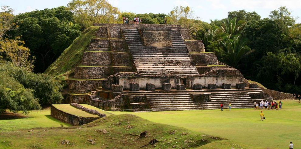
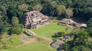
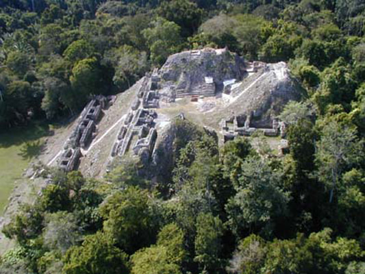
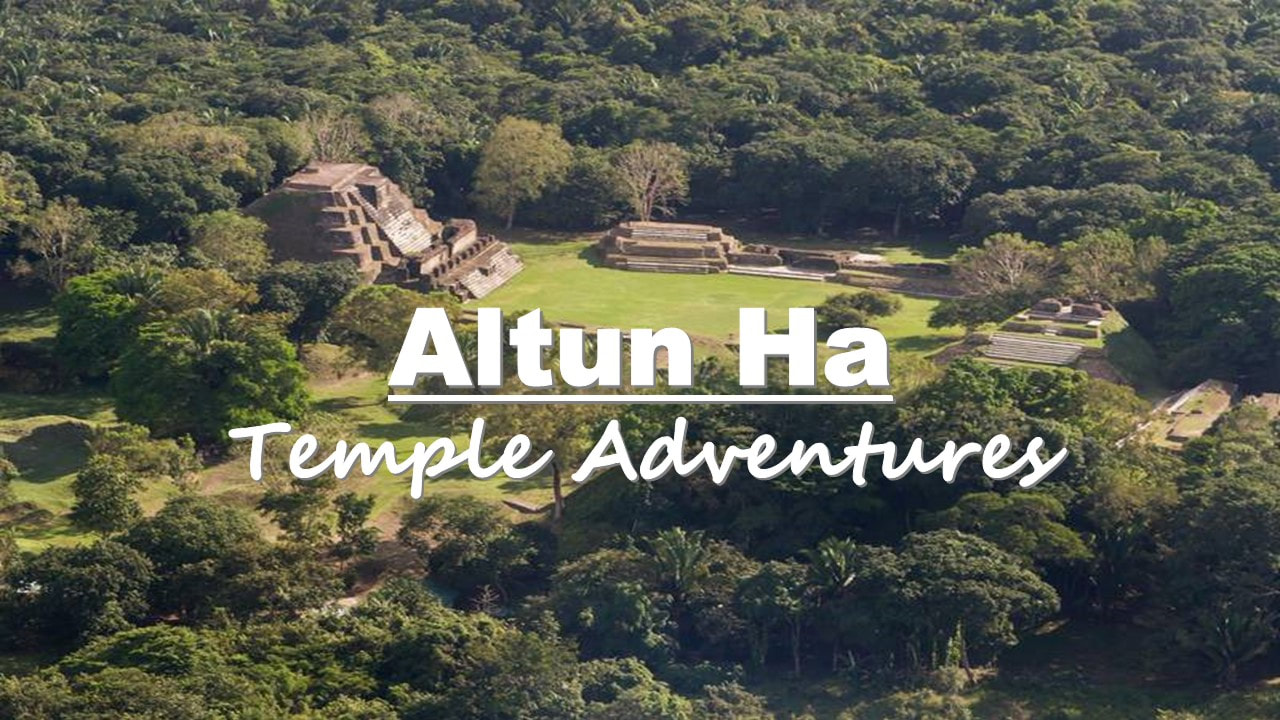
1. Altun Ha Mayan Ruins
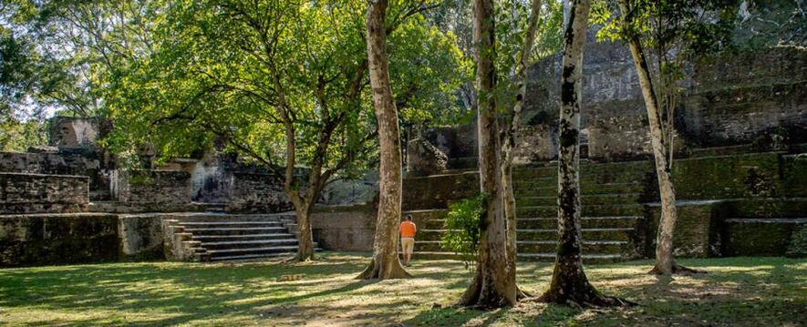
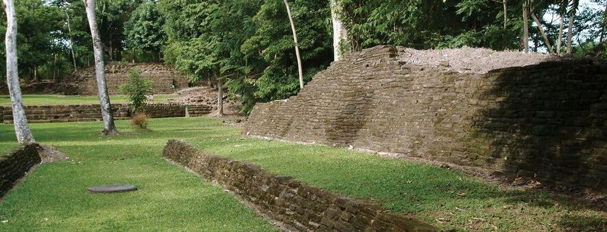
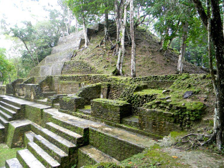
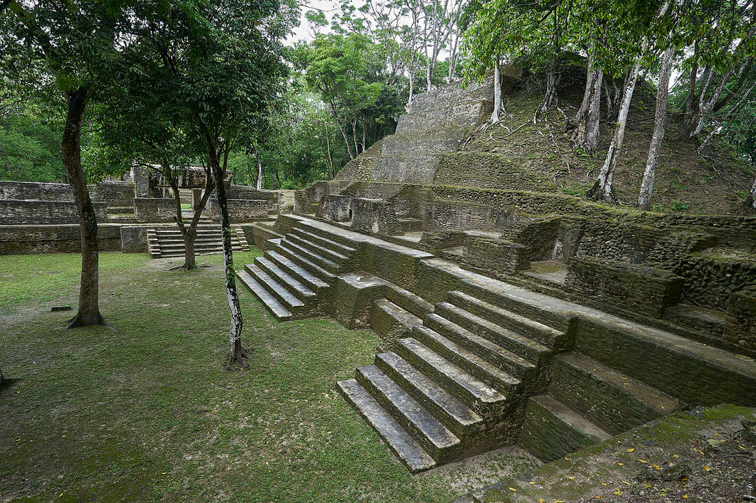
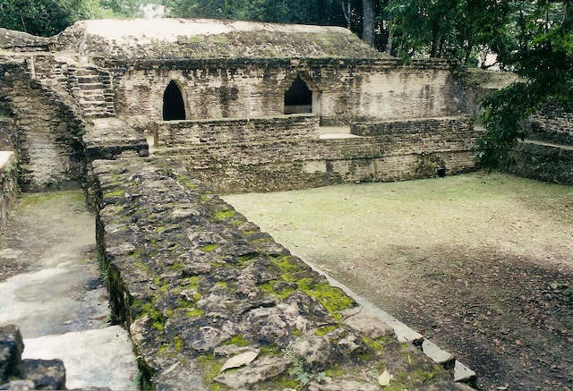
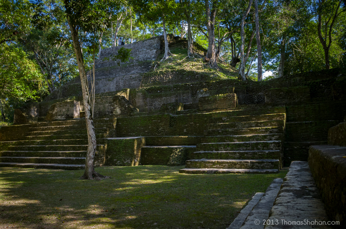
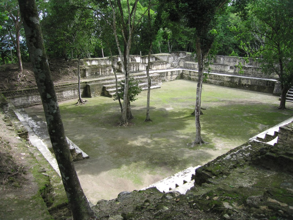
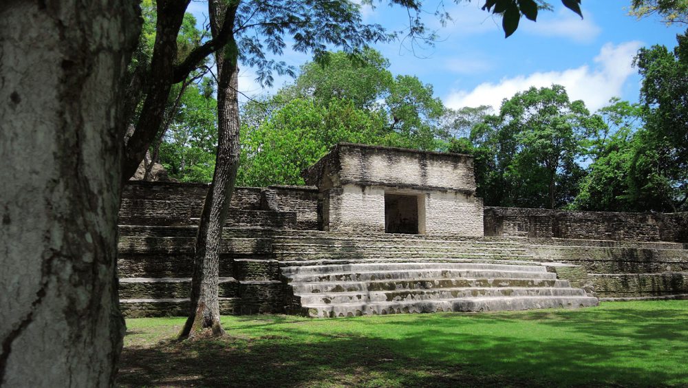
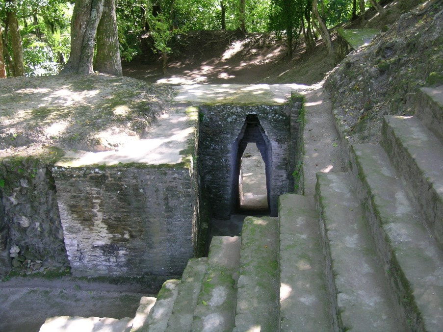
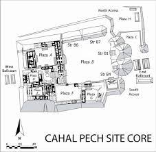
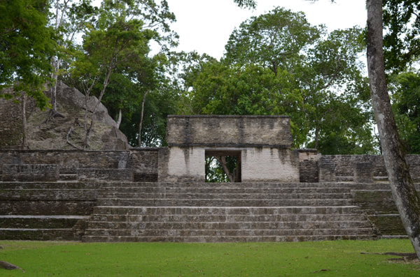
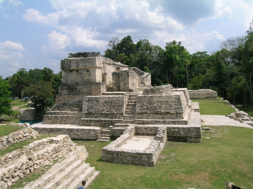
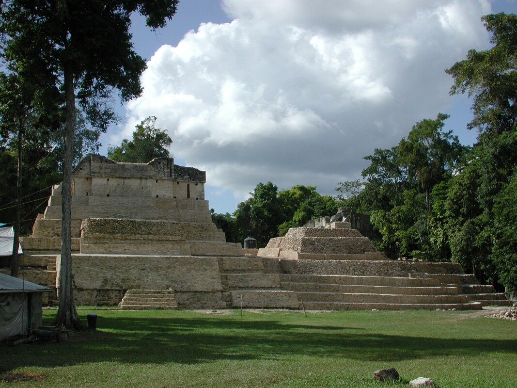
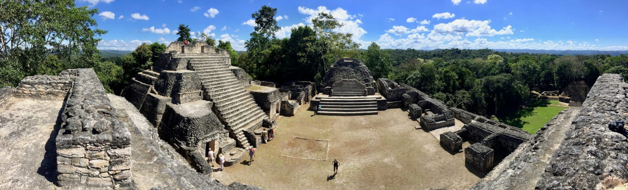
2. Cahal Pech Mayan Ruins
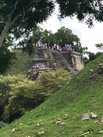
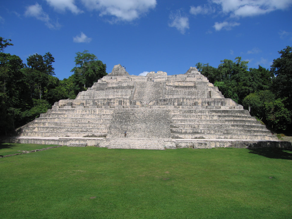
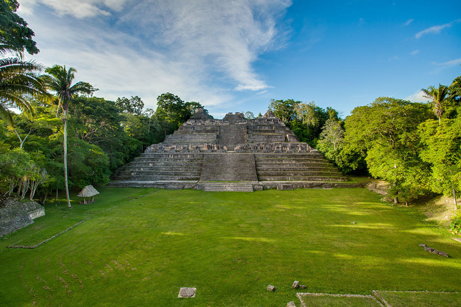
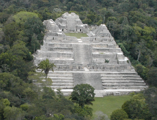
3. Caracol Mayan Ruins
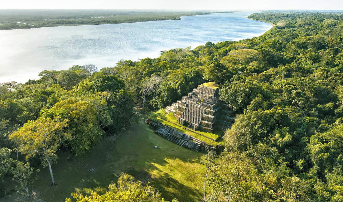
4. Lamanai Mayan Ruins (Don't Miss This Tour)
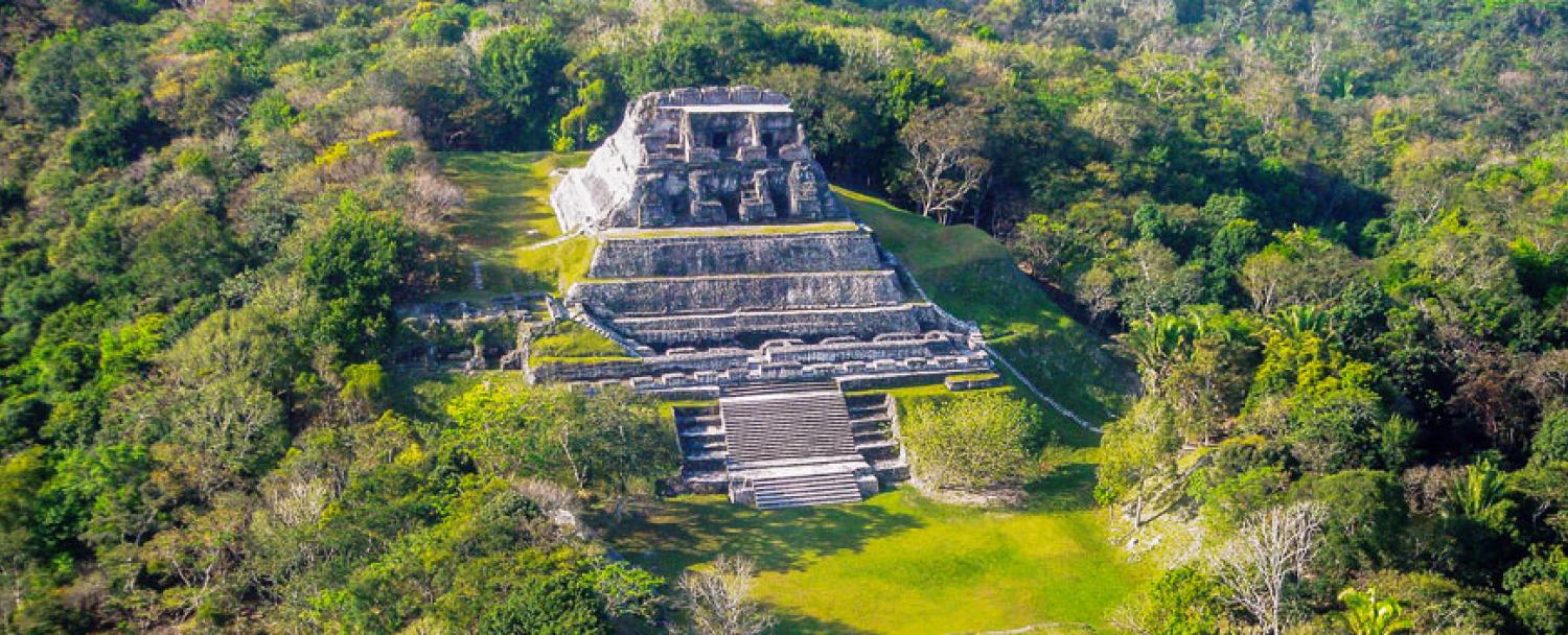
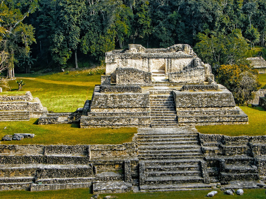
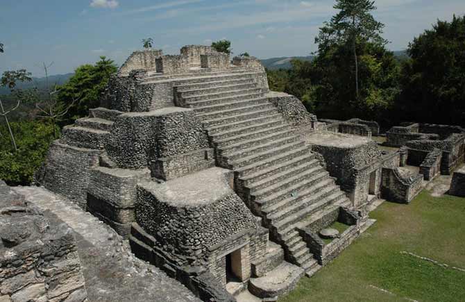
5. Xunantunich Mayan Ruins
2. Cahal Pech Mayan Ruins
3. Caracol Mayan Ruins
4. Lamanai Mayan Ruins (Don't Miss This Tour)
5. Xunantunich Mayan Ruins
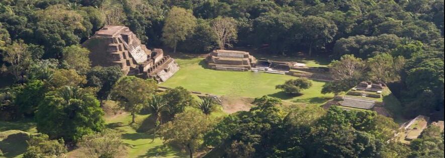
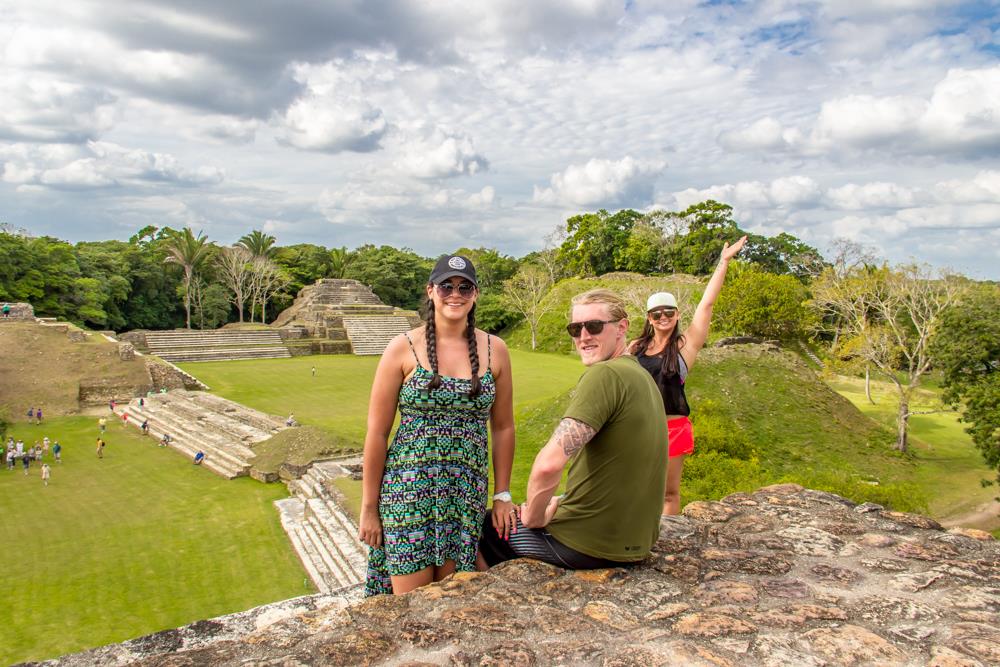
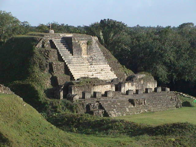
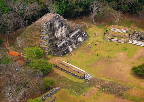
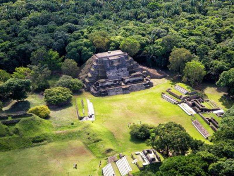
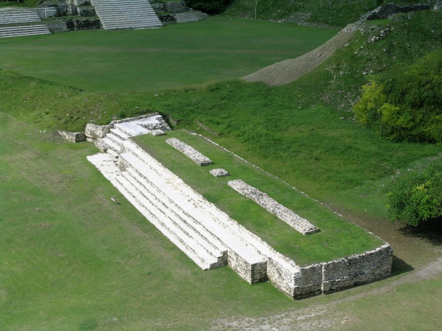
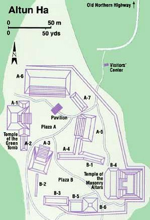
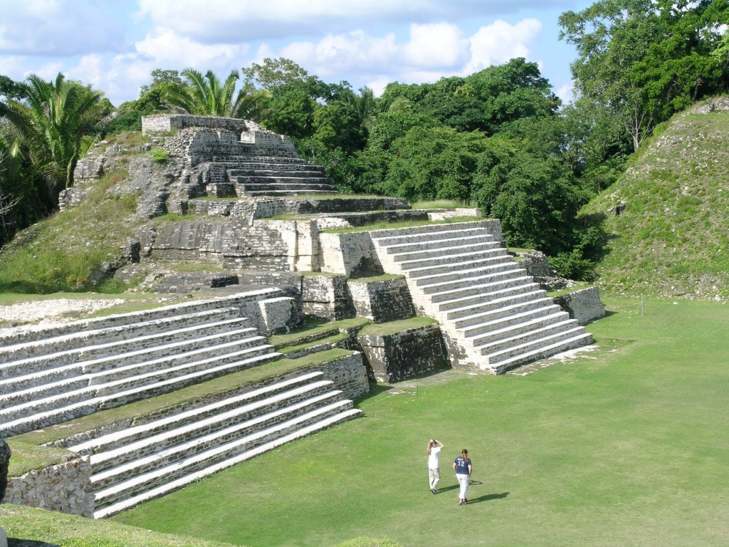
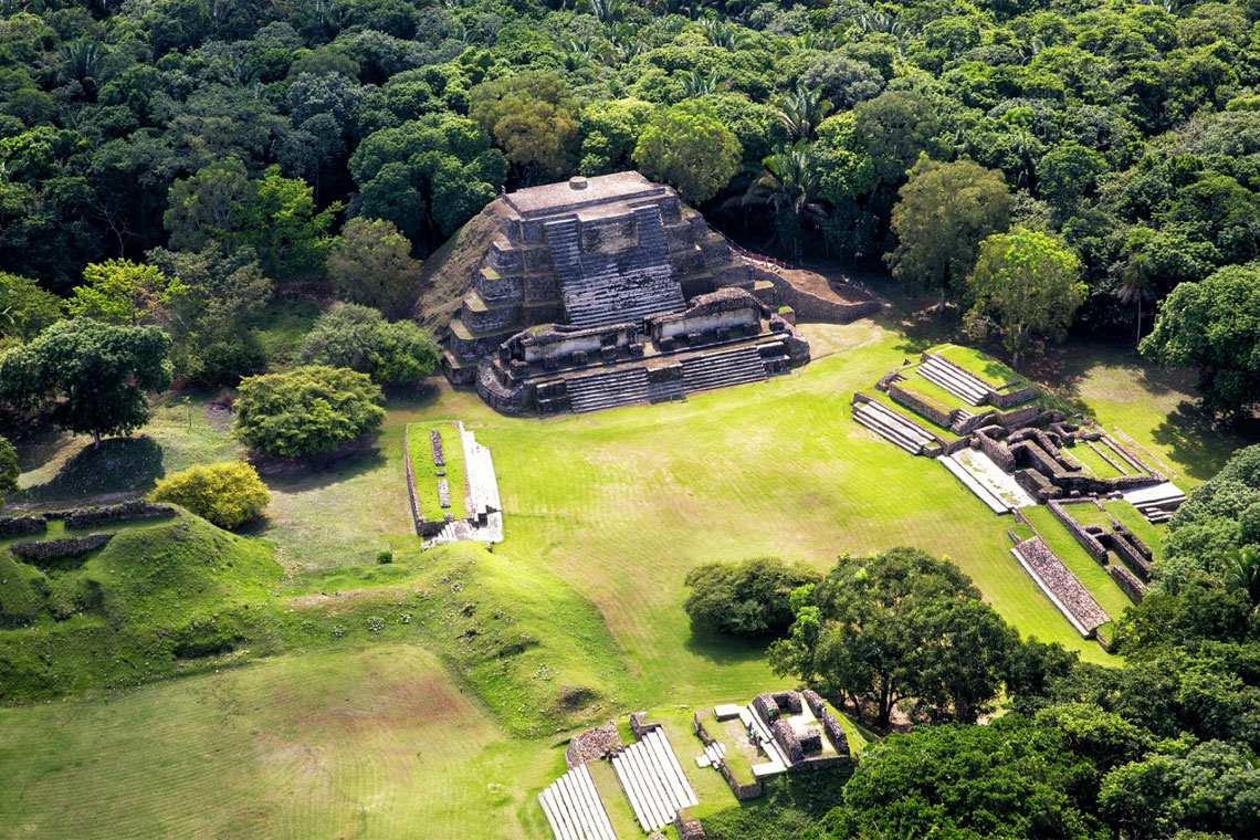
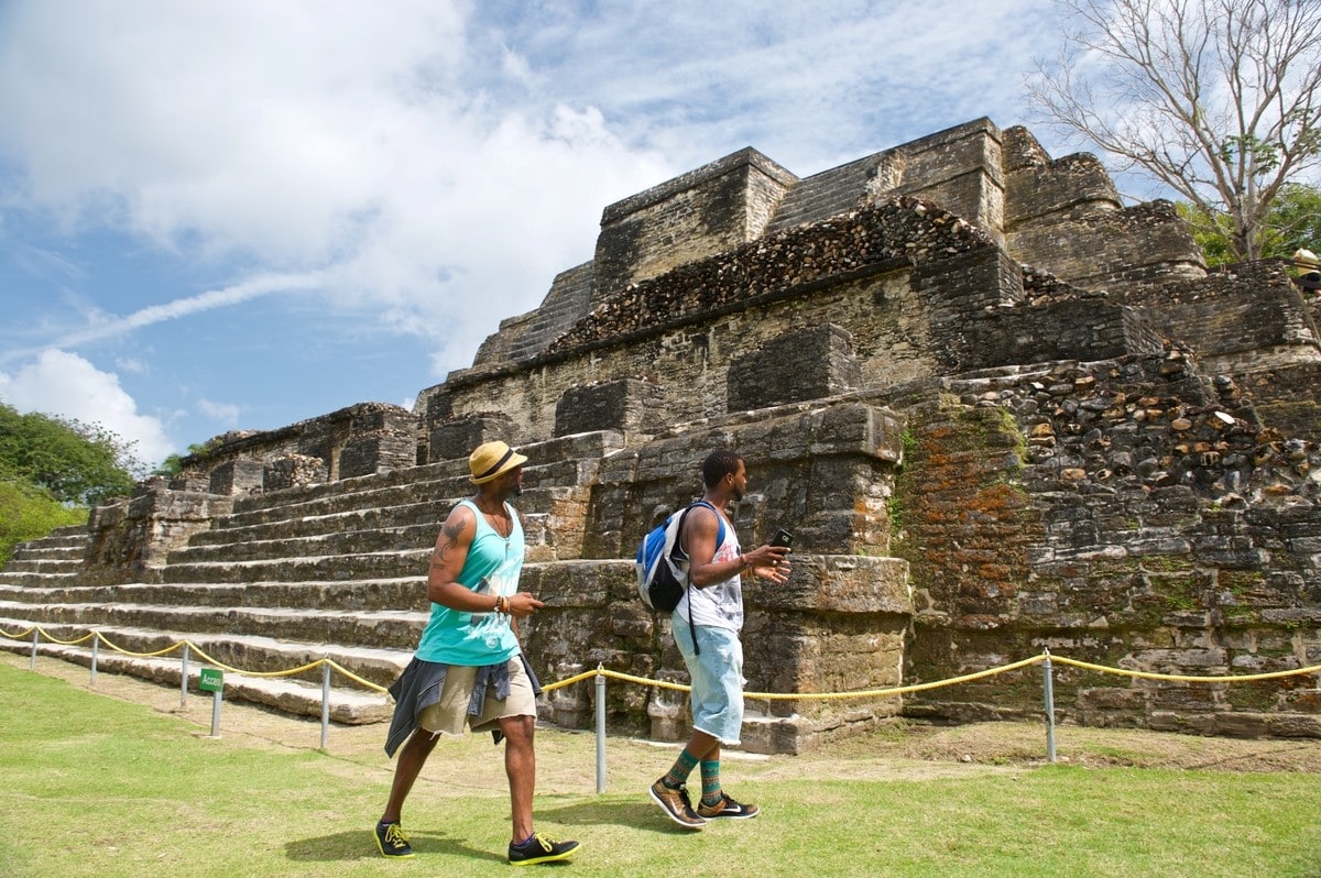
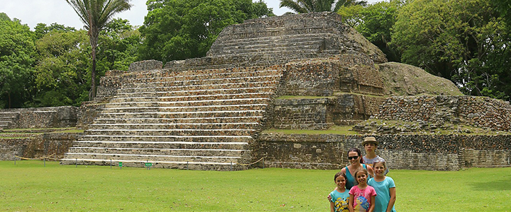
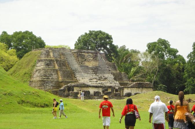
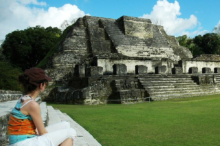
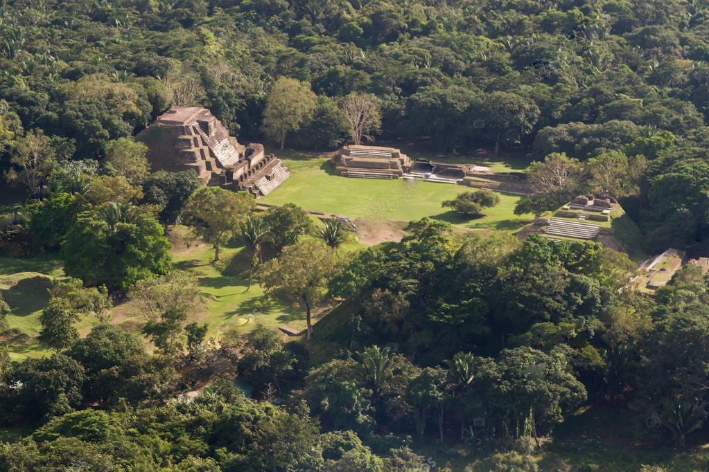
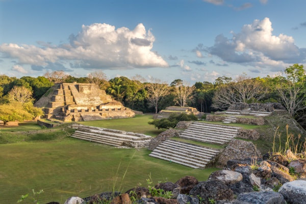
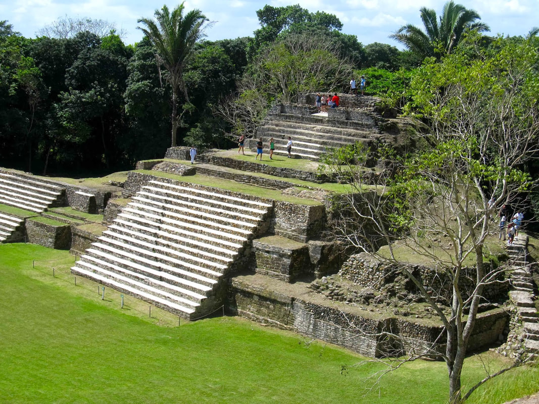
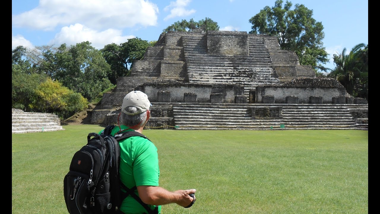
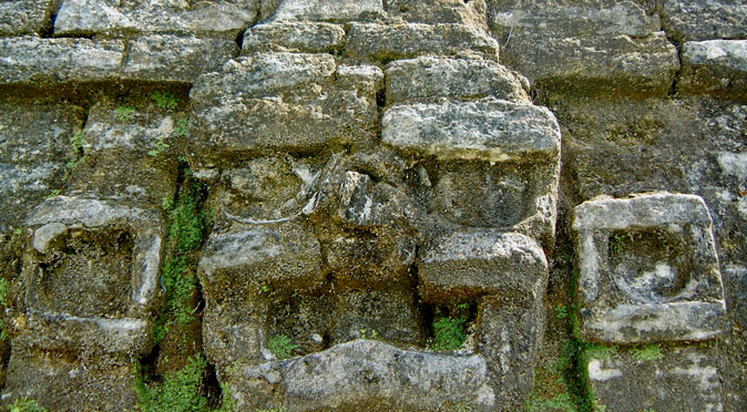
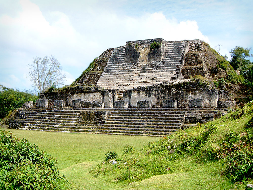
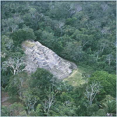
Altun Ha Mayan Temple
Altun Ha Mayan Temple
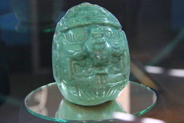
Altun Ha is located 31 miles north of Belize City on the Old Northern Highway. A two-mile dirt road connects the main road tot he site. Altun Ha, a major ceremonial and vital trade center during the Classic Period, has two principal plazas. The most significant find of Altun Ha is the Mayan Jade Head, which represents the Mayan Sun God, Kinich Ahua; it is the largest object carved of jade in the Maya civilization. And one of the crown jewels of Belize.
The area around the Altun Ha is rich in wildlife including armadillos, bats, squirrels, agouti, paca, foxes, raccoons, coati, tyra, tapir and the white-tailed deer. Two hundred species of birds have been recorded and there are large crocodiles that inhabit the Maya-made water reservoir.
For Directions: From Belize City, take the Northern Highway for about ½ hour just after passing Sandhill Village. Take the Old Northern Highway on your right for 14 miles. On your left, take the Rockstone Pond Road towards the reserve for 2 miles.
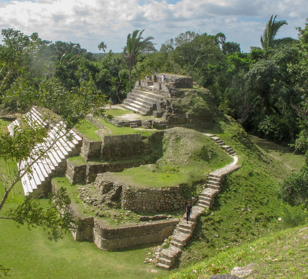
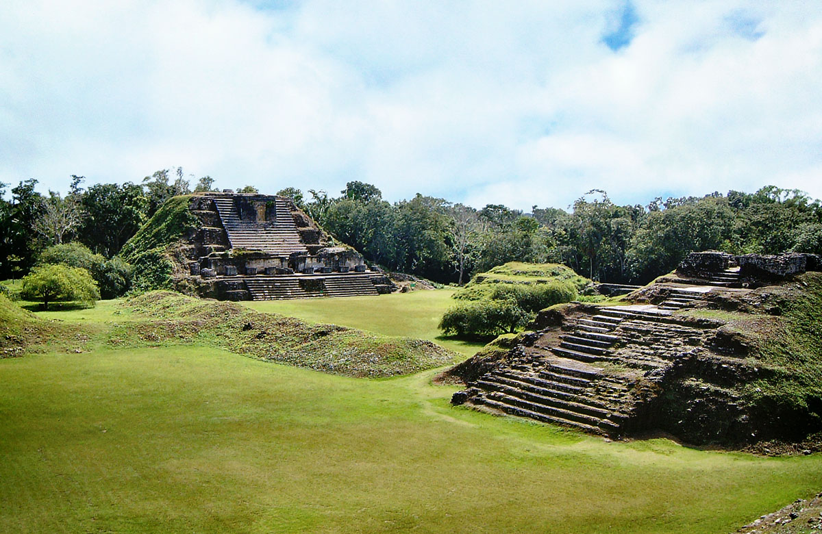
Cahal Pech Mayan Temple
Cahal Pech Mayan Temple
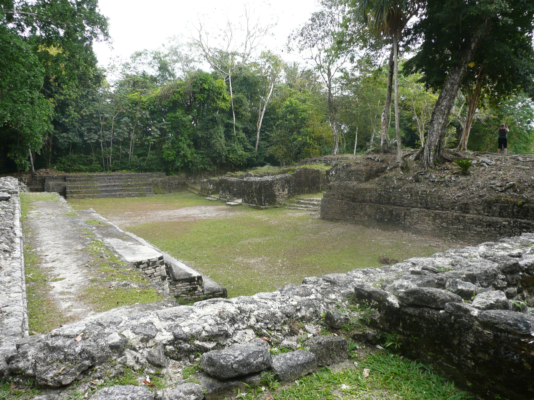
Cahal Pech is located on a imposing hill that overlooks the twin towns of San Ignacio and Santa Elena. The name of the site means "Place of Ticks", in the Yucatecan Maya language. But, don't let the name Place of Ticks scare you; the area was once pastureland!
In 1988 an archaeological team unearthed 10 mounds at this two acre site. The site comprises of 34 ancient structures, to include temple pyramids, two ball courts, an later, and five plain stelaes, so allow enough time to see it all. The center part of the ruins, provide a beautiful panoramic view of the surrounding area.
Excavations show that Cahal Pech was inhabited from 1000 B.C. to around 800 A.D.
For Directions: Take the Western highway for approximately 70 miles, until you reach Santa Elena town. Take the road that leads to the San Ignacio Hotel, until you reach a “Y” intersection with a stadium on the left. At this point you should see the sign for Cahal Pech Village Resort and Cahal Pech Maya ruins. Proceed up the road, Cahal Pech Archaeological Reserve is on your left.

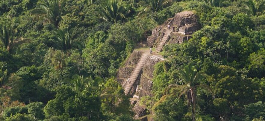
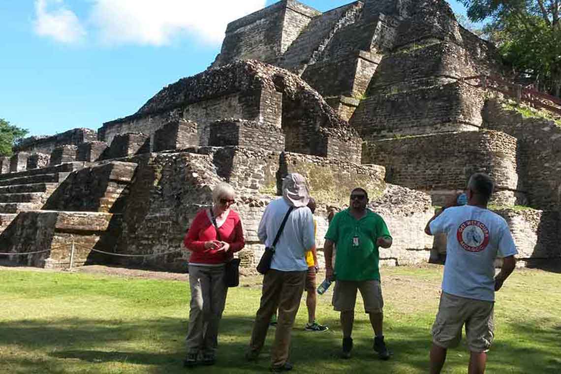
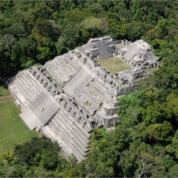
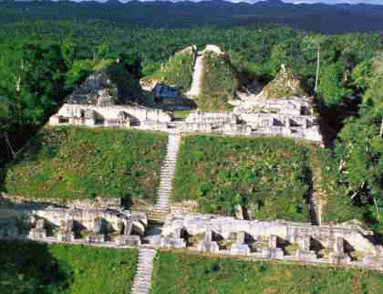
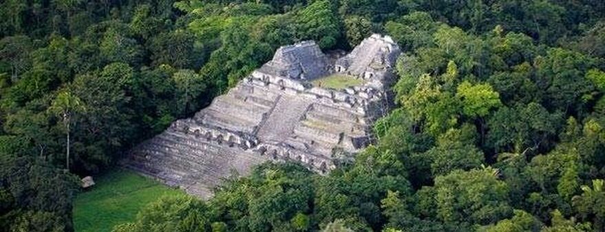
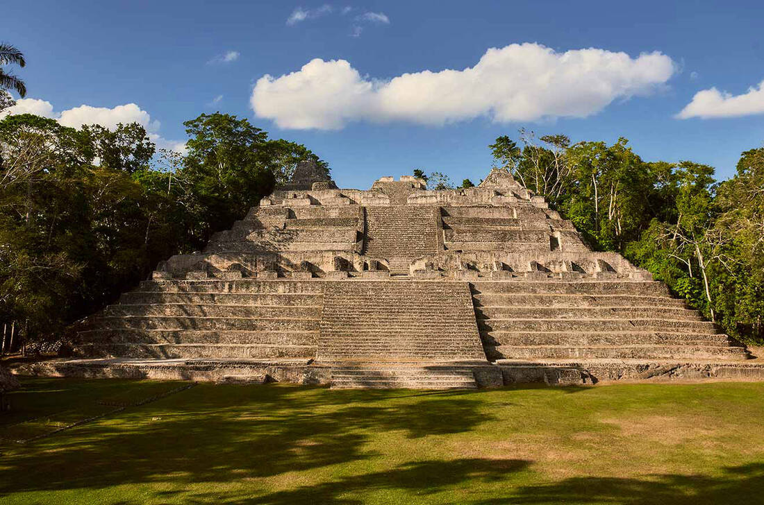
Caracol Mayan Temple
Caracol Mayan Temple
Caracol is located on the western edge of the Maya Mountains within the Chiquibul Forest Reserve, Caracol sits on a high plateau of some 500m above sea level, which then drops into a deep valley to the northwest and rises into hilly terrain to the southwest.
Situated on the edge of the Maya Mountains, it remains an active dig site, but it takes some effort to get there. It is one of the most challenging Belize ruins to reach, but it is also one of the most scenic drives you will ever experience. The highlight of this ruin is Canaa (Sky Palace), a 140-foot tall pyramid.
Caracol is the larges known Maya center within the country, containing the largest pyramid structure. The site was discovered in 1938 by Rosa Mai, a logger looking for mahogany.
A large part of Caracol is largely still being discovered, but numerous carved monuments populate the area, and the main reservoir (on-site), is an engineering masterpiece.
For Directions: Caracol is a 2-½ hour drive from San Ignacio town. Take the Cristo Rey Road and drive towards Mountain Pine Ridge until you reach Douglas D’Silva Forest Station. From there drive another 45 minutes until you reach the Caracol Archaeological Reserve.
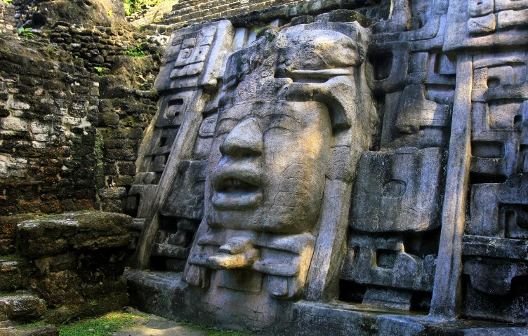
Cerros Mayan Temple
Cerros Mayan Temple
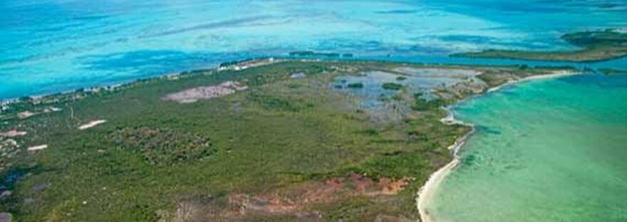
Cerros is a Spanish name translated "Maya Hill", and is located on a peninsula, across from the town of Corozal, in the Bay of Chetumal. Research suggests that it functioned as an important coastal trading center in the Late Pre-Classic Period (350 BC to AD 250).
Cerro sits on 52 acres and includes (3) large architectural complexes, (5) temples, plazas and a canal system that winds around (3) architectural complexes. Tombs and ball courts have been excavated and artifacts found within them attest to the importance of the site between 400 BC and AD 100.
The site's proximity to the sea has resulted in part of it being submerged under water, and this has eroded two of the larger structures. One of these mounds, contains large stucco masks that have now been replicated to the Institute of Archaeology.
Archaeologists believe Cerros must not have survived long because of a shift in trade routes. At the height of its day, the city distributed salt from mining communities and traded chert tools.
For Directions: Cerros (as it is locally referred to) can be reached by a short boat ride from Corozal Town. Boats can be hired in town from your hotel guest services. Additionally one can drive to Cerro Maya by road passing such picturesque, lagoon side, villages as Chunox, Progresso and Copper Bank.
El Pilar Mayan Temple
El Pilar Mayan Temple
The El Pilar means "water basin", because of the abundant supply of water in the area. Unusual for most Maya sites. The site covers about 120 acres and includes over 15 plazas, one ball court and hundreds of other buildings. The site encompasses 5,000 acres, and sits half in Guatemala and half in Belize (the Cayo District).
The Belize portion of the Reserve is managed by the Belize Institute of Archaeology and the Guatemalan portion is managed by the Instituto de Antroplogia a Historia. El Pilar Archeological Reseerve for Maya Flora and Fauna is a legally declared cultural monument in both Belize and Guatemala.
The focus of excavation and presentation at El Pilar is on Maya houses, Maya ways of life and traditional Maya agriculture. Therefore, the only fully exposed building at El Pilar is a house called Tzunu'un, and one of the most important features at El Pilar is a Maya forest garden
El Pilar is the largest Maya site in the Belize River Valley and had a population of over 20,000 people during the Maya Classic Period. Construction of monuments at El Pilar were started by the Maya around 800 BC (Middle Preclassic Period) and by 250 BC, El Pilar housed large public works.
Latitude: 17° 7'60.00"N/Longitude: 89° 4'0.00"W
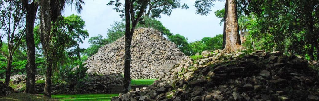
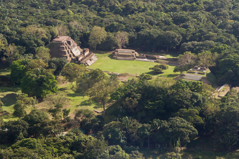
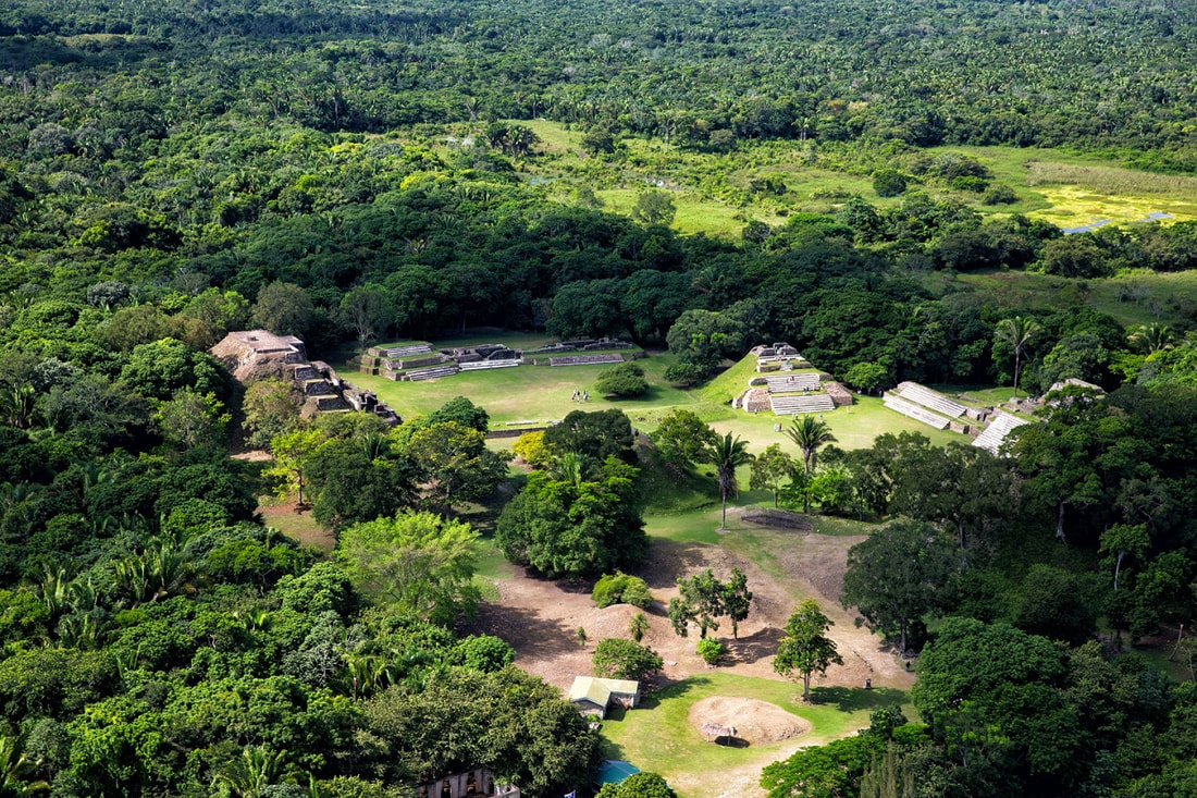
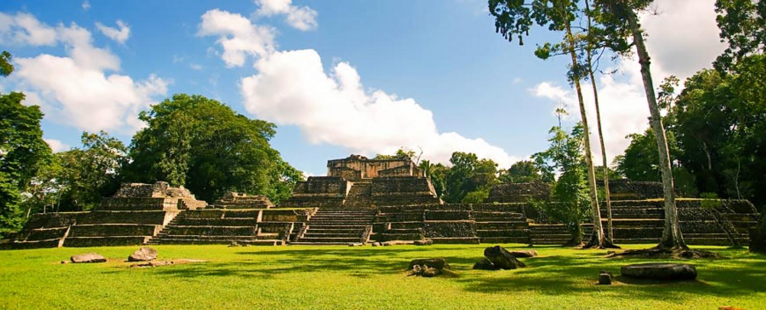
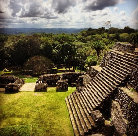
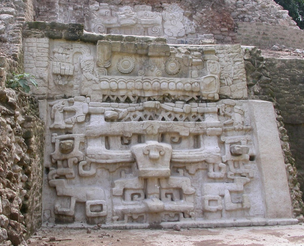
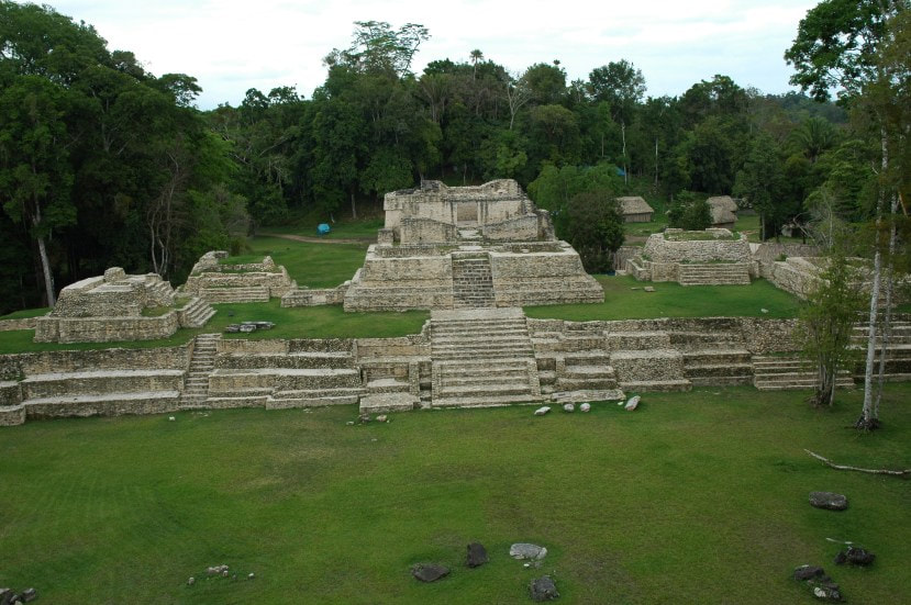
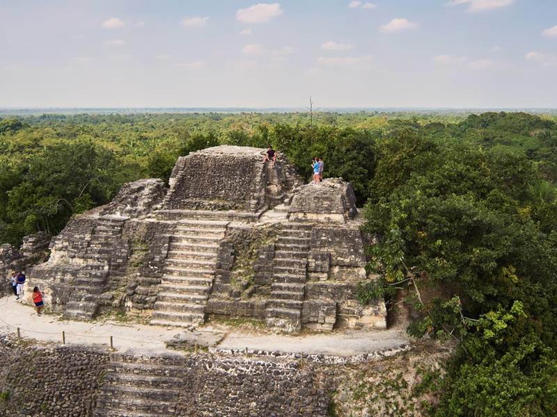
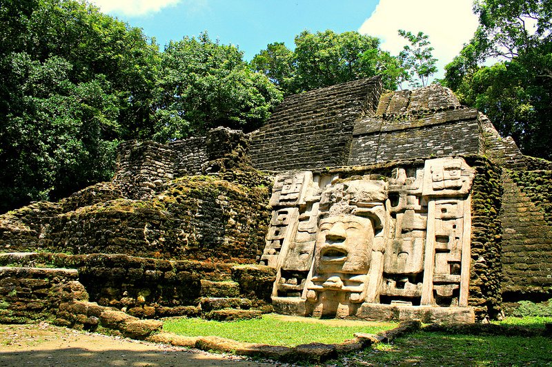
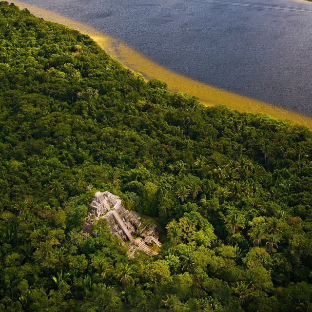
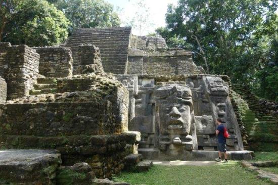
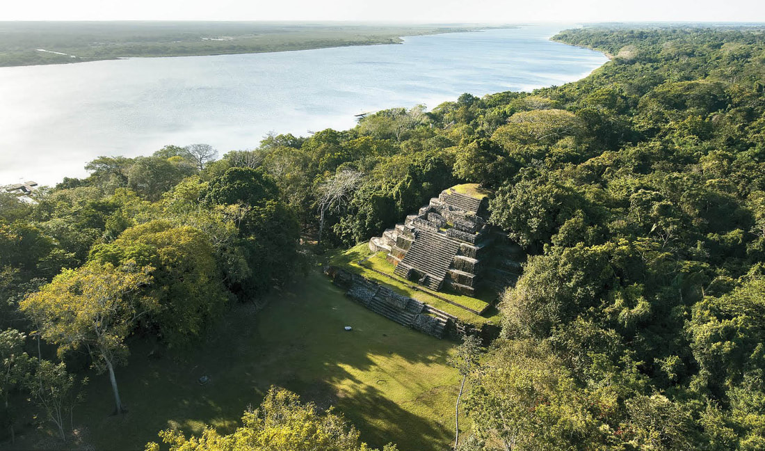
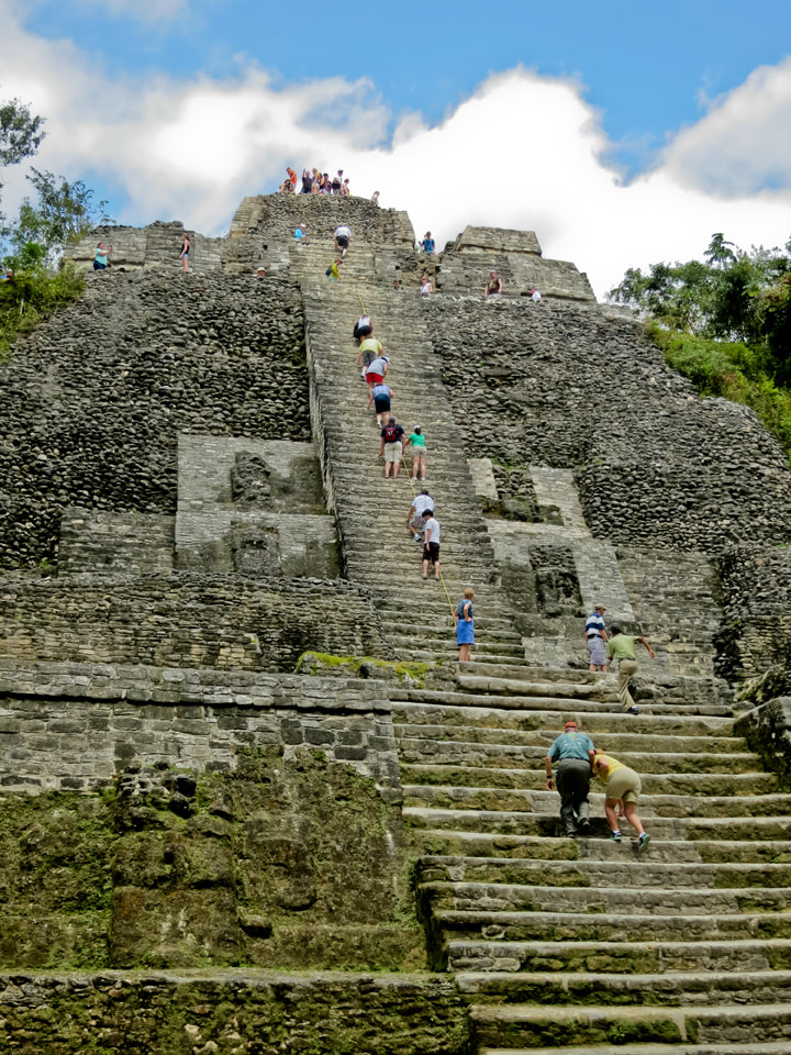
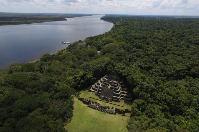
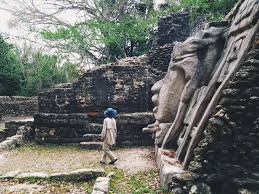
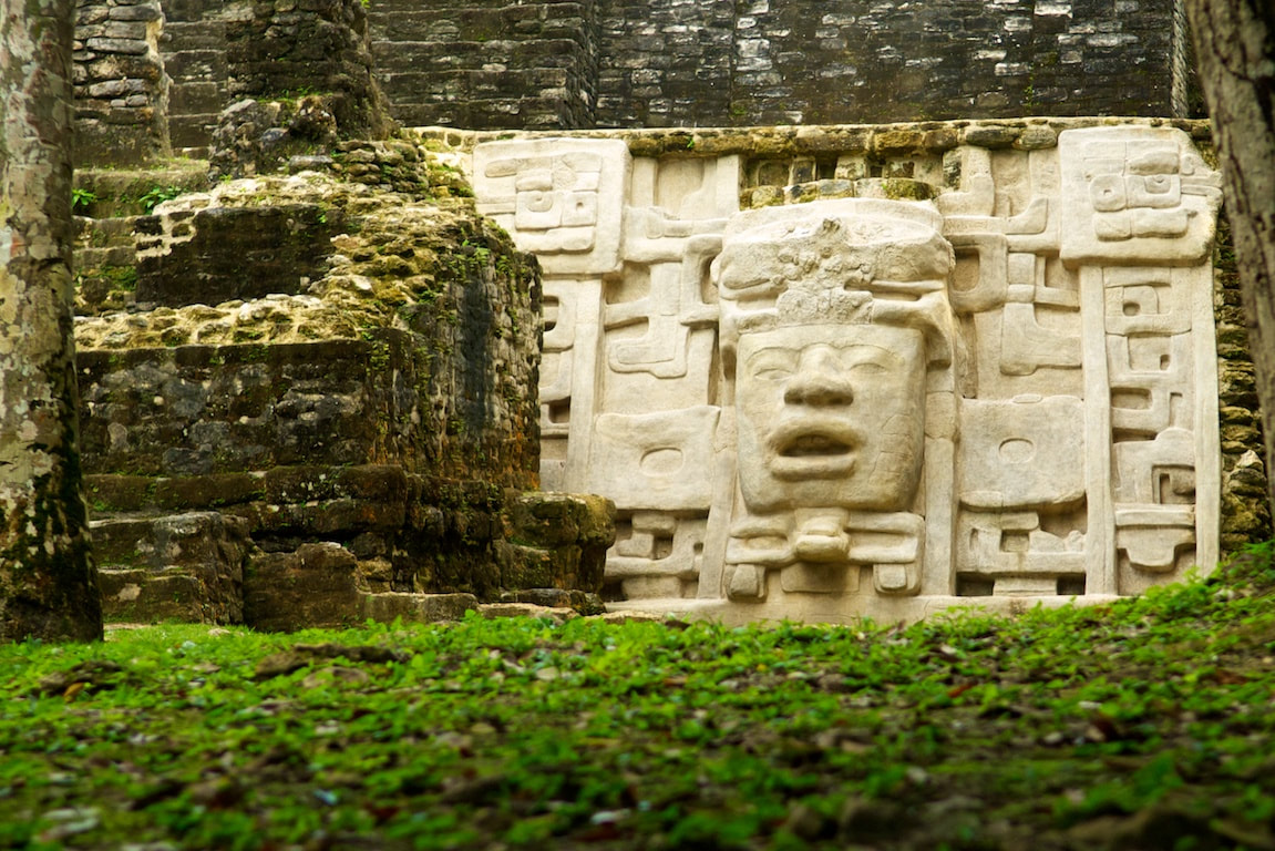
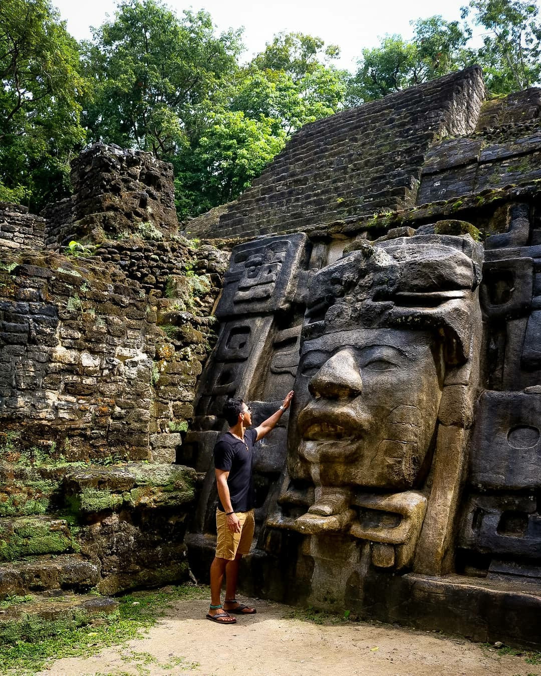
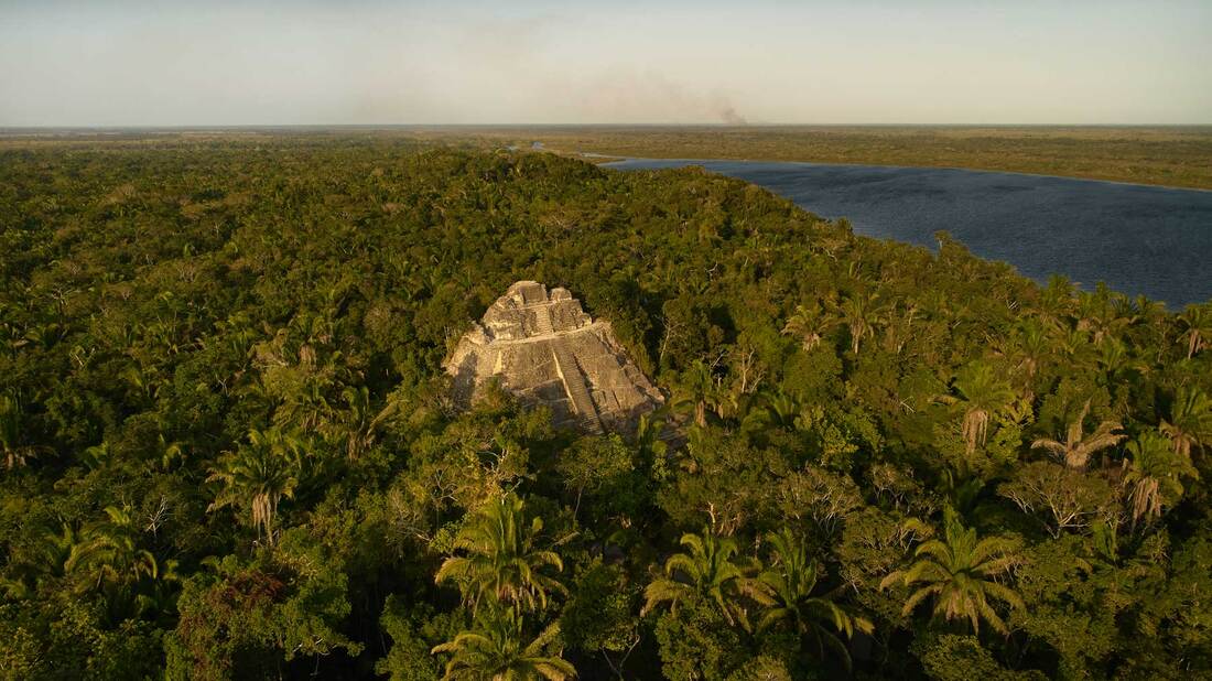
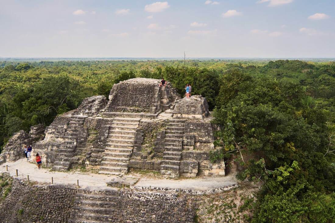
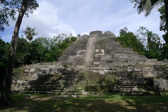
Lamanai Mayan Temple
Lamanai Mayan Temple
Lamanai is located in the northern district of Orange Walk. Lamanai is the Maya word for “submerged crocodile.” The site’s name “Lamanay” or “Lamayna” was recorded by Franciscan missionaries in the seventeenth century. It is one of the only sites retaining its original name and is among one of the largest Maya ceremonial centers in Belize.
Most folks visit Lamanai by road through San Felipe, Orange Walk, rather than by boat. A “jungle cruise”, the boat trip is an excellent chance to see birds, exotic plants and crocodiles. The site itself is even more spectacular. Situated on a major trade route, Lamanai is one of the longest occupied Mayan cities and was inhabited for over two millennia.
Lamanai has more than 719 mapped structures, including two 16th century Christian churches as well as an intact 19th century sugar mill. Due to the extraordinary length of time that Lamanai was occupied, one can explore several periods of Maya construction techniques, from the Classic Period to the Post Classic.
For Directions: Lamanai is on the banks of the New River Lagoon and the most interesting way to travel to the site is by means of water taxi up the river. The trip by river is also a nature-lover’s heaven for numerous species of water birds live along this rich and diverse waterway. You may even be lucky enough to view iguanas and crocodiles as they sun bathe on the river banks. There are also many species of flora and fauna to be seen at the Lamanai reserve.
Another route to Lamanai is via the all weather dirt road (approximately 28 miles) which runs from Orange Walk through several villages including San Felipe and Shipyard. The site is located in the village of Indian Church.
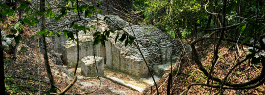
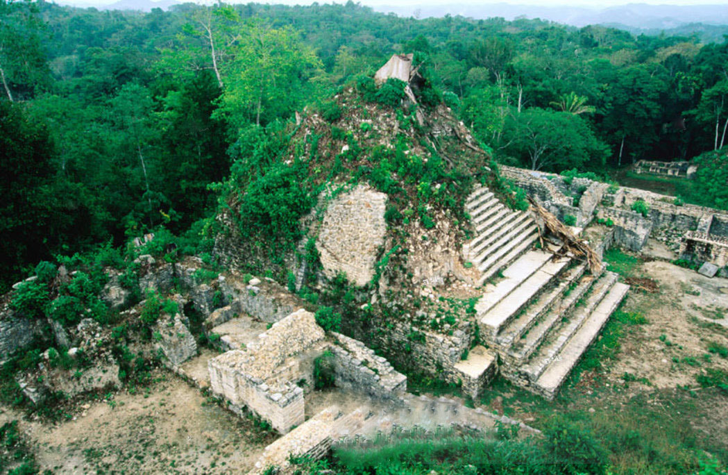
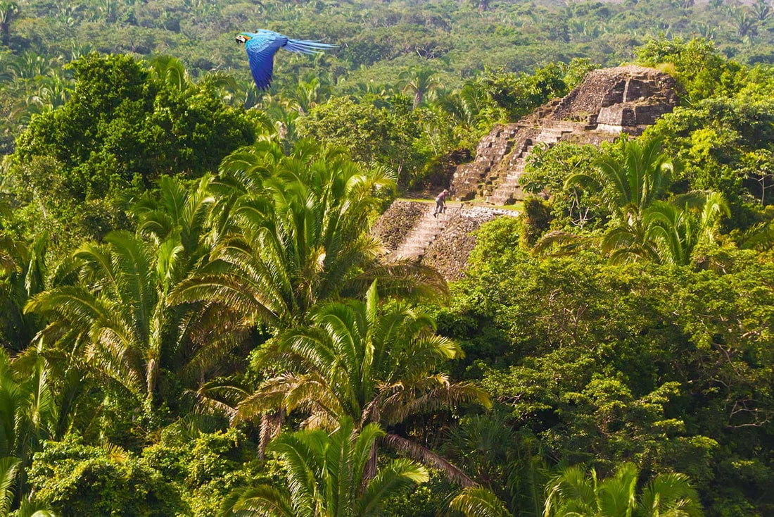
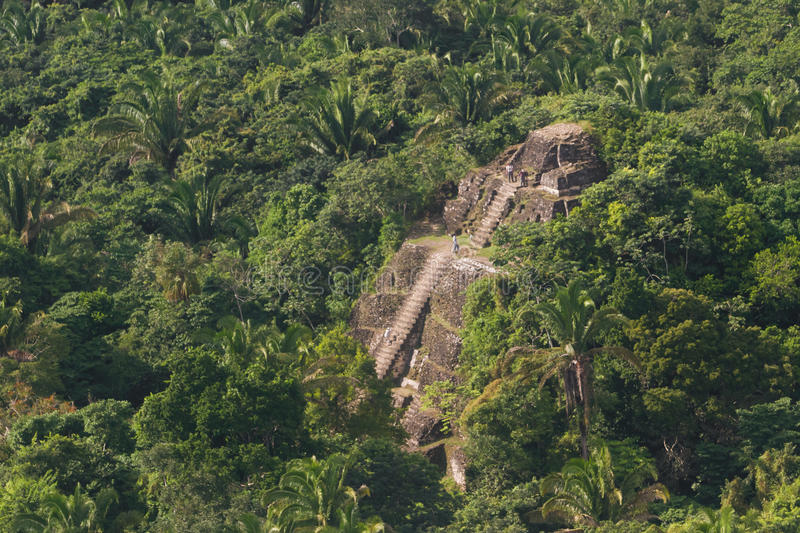
Lubaantun Mayan Site
Lubaantun Mayan Site
Lubaantun means: "Place of the Fallen Stones" It is located north of the Colombia River, one mile past the village of San Pedro Colombia, in the Toledo District.
This Late Classic ceremonial center is noted for its unusual style of construction distinctive of southern Belize, in the Toledo District.
Mayans at this location employed dressed stone blocks stones and organic materials, with no mortar holding them together. The buildings on top of the pyramids were made from perishable materials rather than masonry and hence do not remain. As a result, pyramids and buildings disintegrated, which is how this site got its unusual name.
For Directions: Lubaantun is north of the Colombia River, one mile past the village of San Pedro Colombia, Toledo District and is accessible by public transportation. From the City Of Belmopan, take the Hummingbird Highway for 45 miles to the junction of the Southern Highway Exit. Turn right unto the Southern Highway and travel an additional 70 miles (2 hours) until you reach the Silver Creek cut off. Travel through the villages of San Miguel and San Pedro Columbia. Exit right on the all weather gravel road and continue for about 1-1/2 miles until you reach the reserve.
Marco Gonzales Mayan Site
Marcos Gonzales Site
Marco Gonzalez is located at the southern tip of Ambergris Caye, about 5 miles south of San Pedro. It was first recorded in 1984 and excavated between 1984 and 1994. The site is littered with enormous amounts of broken pottery, conch shells, chert tools and human bones. However, the site had already been extensively looted before its excavation.
The ruins are about 600 to 1,100 feet in size, and are easily visible from the air flying into San Pedro town. The low-lying area around the site is predominated by red and black mangroves.
The site itself is covered by white mangrove, gumbo-limbo, white poisonwood, cabbage palms, silver palmettos, and a variety of shrubbery. It is roughly 12 feet above sea level, slightly higher than the surrounding swamps due to accumulated anthrosol, soil composed primarily of artifacts (e.g., pottery, tools), conch and other shells, building remains and other debris resulting from millennia of human habitation. The presence of artifacts beneath the mangrove swamps indicates that the site was once larger than what is now exposed.
Surrounded by thick jungle, access to the site is difficult, especially during and immediately after the rainy season. The trails leading there have become increasingly overgrown and visitors are rare.
There are at least 49 distinct structures and walls within the mapped area of the site. The structures at the northern end appear to be arranged around plazas, while elsewhere the building plan appears less formal. All of the structures are relatively low platforms, ranging in height from 12 inches to 14 feet.
Building foundations are composed mainly of blocks of Pleistocene limestone that was most likely quarried from local sources. Other building materials include the queen conch, strombus gigas, as well as other shells. Crude plaster floors were found in some structures, and evidence suggests that many of the habitations were of pole-and-thatch-roof design.
Marco Gonzalez was occupied from the late Preclassic Period to around 1500 AD when it was abandoned. Archaeologists believe it was abandoned because the melting of the last Pleistocene glaciers caused a change in ocean currents and a rapid rise in sea levels that together turned the site into an inhospitable low-lying mangrove swamp.
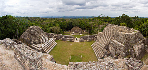
Nim Li Punit Mayan Site
Nim Li Punit Site
The Nim Li Punit archaeological site boasts both the longest stela in Belize (No. 14) and a postcard-perfect vista, overlooking the Toledo coastal plain and rain-forests. Wander through the main plaza, ball court and other on-site ruins, but it’s the stelae collection that will impress you most.
Nim Li Punit means "big hat" in the Kekchi Maya language and refers to the large headdress on a ruler depicted on one of the stela found at the site. The Nim Li Punit ruins are located off the Southern Highway about 25 miles north of Punta Gorda Town.
Nim Li Punit was occupied by about 5,000-7,000 people at its peak in the Late Classic Period and was occupied from around 721 to 890 AD. The people who lived in Nim Li Punit probably migrated to Nim Li Punit from the area that is now Guatemala and were probably aligned with Tikal in Guatemala and Copan in Honduras.
The site is organized around three plazas and includes an incredibly well-preserved ball court. Archaeologists also believe that Nim Li Punit includes a Mayan observatory in the Plaza of the Stelae because of the geometric positioning of the structures in this plaza.
Structures at Nim Li Punit were built of sandstone using mortar between stones unlike the mortarless slate construction at Lubaantun. Nim Li Punit was first investigated by archaeologists in 1976.
For Directions: From Belmopan, take the Hummingbird Highway for 45 miles until you reach the Southern Highway Exit. Turn right onto the Southern Highway and travel an additional 50 miles (1 ½ hours) until you reach Indian Creek Village. Exit to the right on the gravel road and continue for about 1/2 mile until you reach the reserve.
Latitude: 16°14'43.19"N/Longitude: 88°46'10.31"W
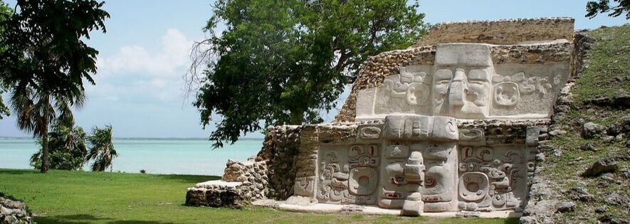
Santa Rita Mayan Temple
Santa Rita Mayan Temple
Santa Rita is located on the outskirts of Corozal Town (just off the main road leading to the Mexican border), and is bordered on the east by the Caribbean Sea. A Mayan ruin in northern Belize that dates from 2000 B.C., Santa Rita is what remains of Chactemal (modern-day Chetumal, Quintana Roo Mexico) an ancient Mayan city that is the genesis of the Mestizo people after the first European contact in the region.
Santa Rita was a European contact point and hub for traders traveling between Mexico and Guatemala, so the artifacts left behind are unusual and include jade, mica, gold earrings, pottery, ceramics, and agricultural tools.
Santa Rita controlled trade routes within the boundaries of today’s Mexico and Guatemala. Excavations have revealed fishing net sinkers and other objects, which point to Santa Rita’s coastal importance. Remains of rulers with jade and mica ornamentation, as well as others with gold ear decorations, show that the Mayan city had a commanding role for trade in the Yucatan Peninsula and surrounding areas.
This site of Santa Rita was first settled by Maya farmers around 1000 BC. Evidence for this early phase of occupation is provided by Swasey style pottery that represents some of the earliest ceramics discovered in the Maya lowlands. In the late Preclassic period, from 300 BC to A.D. 300 the settlement expanded but continued to be based primarily on agriculture.
The modern town of Corozal in Belize was founded in the mid 1800s and encircles the ancient city of Santa Rita. This site, bordered on the east by the sea, is situated on a limestone plateu typical of northern Belize which supports a low forest where game abounds. Just north of the center is the Rio Hondo. Along its banks there are large areas of swampland where the Maya created raised fields. These supported the cacao plantations for which the province was famous. The seacoast gave this site access to a wide variety of marine resources.
For Directions: From Corozal Town take the road that leads to the border with Mexico. At the northern exit to Corozal Town continue straight up the road intersection that leads to the town hospital. From there Santa Rita is a short distance further on your right just before reaching the Coca Cola distribution depot.
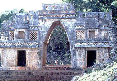
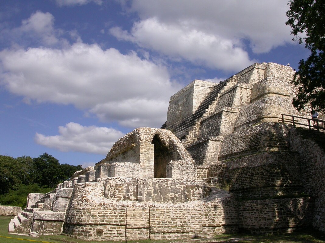
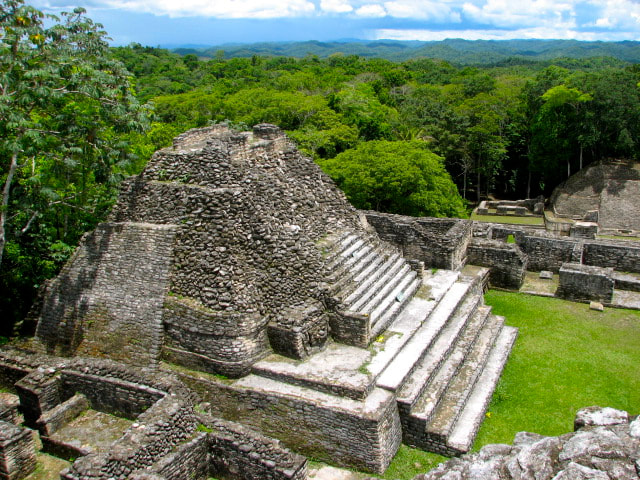
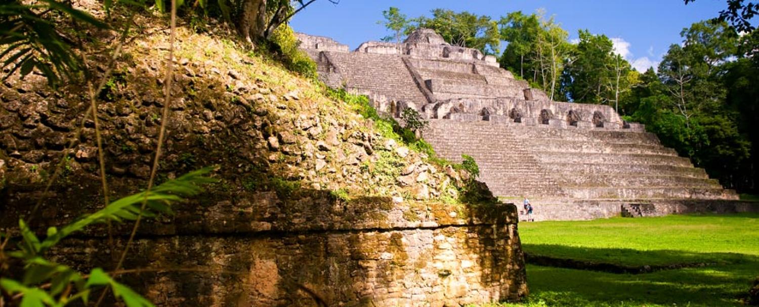
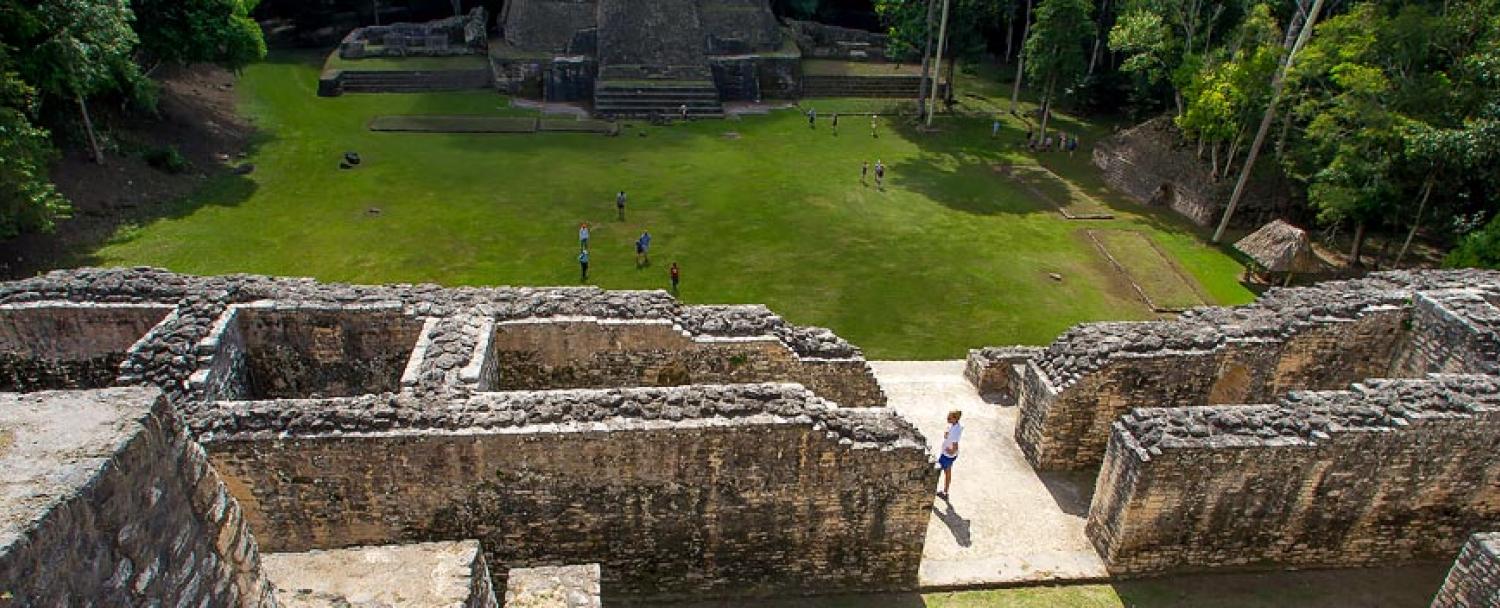
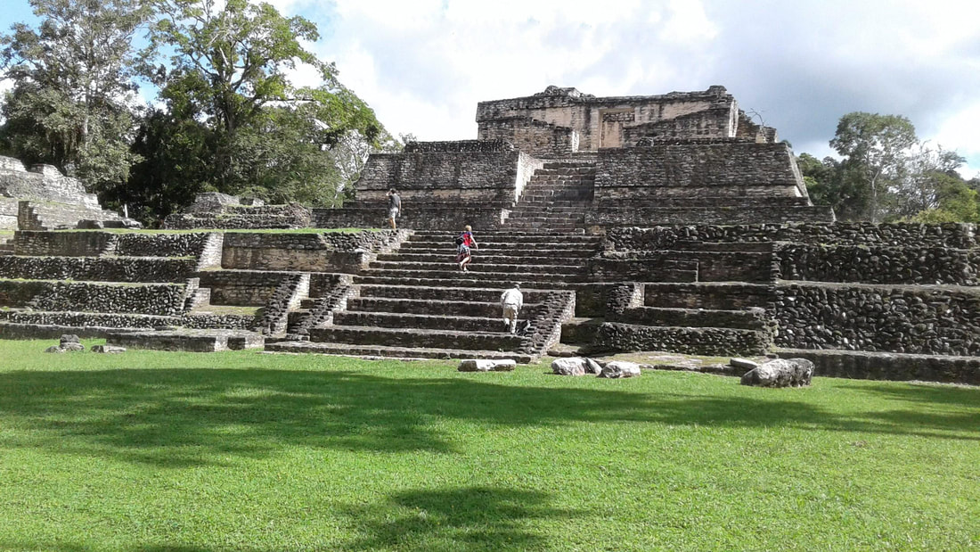
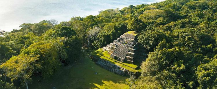
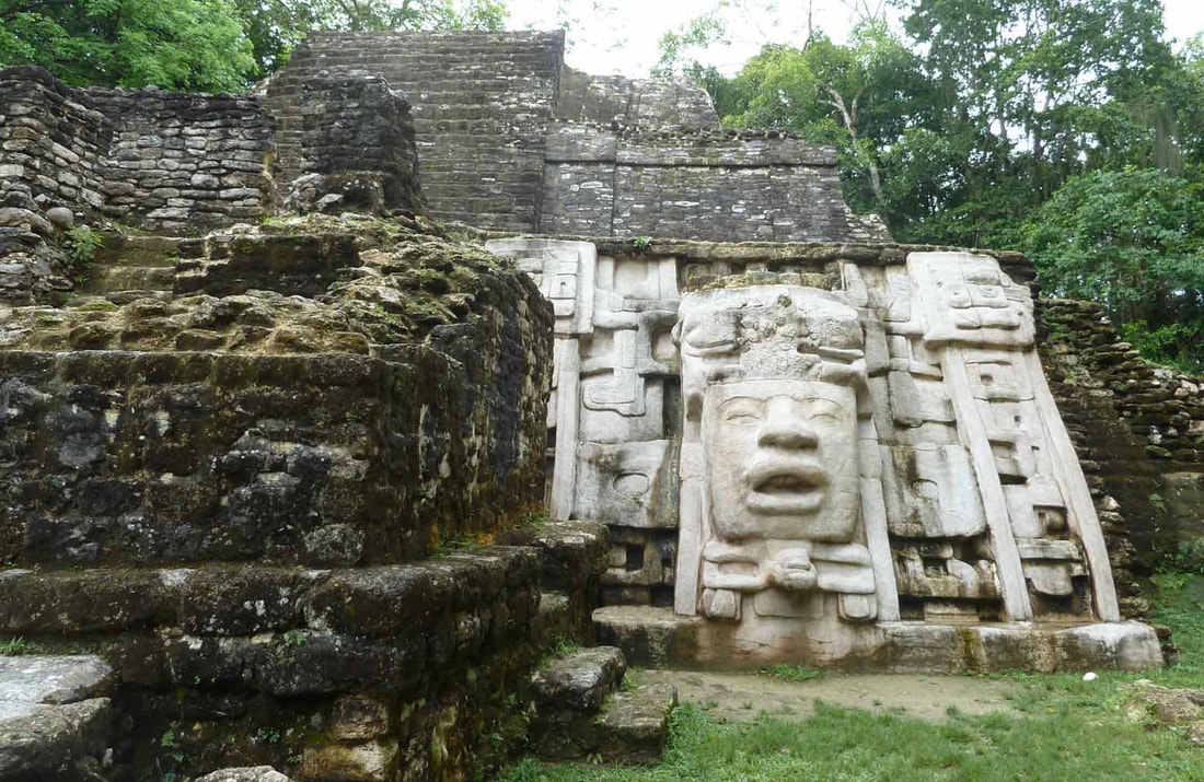
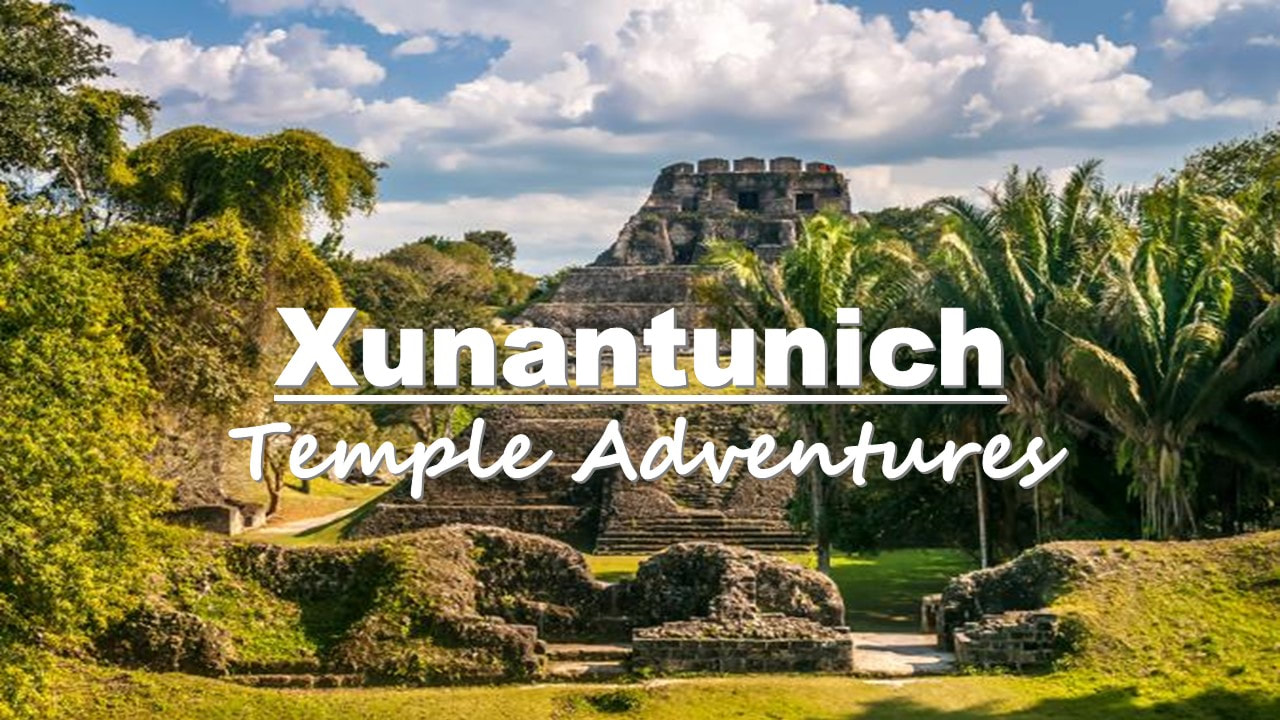
Xunantunich Mayan Temple
Xunantunich Temple
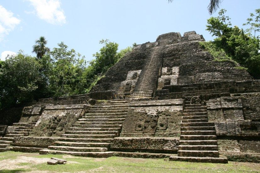
(Maiden of the Rock) isn’t far from the village of San Jose. Take a ferry there and find Belize’s second tallest ruin, six plazas and remnants of 25+ palaces and temples. Though the size of this site is only 300 square meters, Xunantunich is a tourist favorite because there’s so much to see.
Xunantunich means “maiden of the rock” or “stone woman” in Maya, and is situated on the Western Highway across the river from the village of San Jose Succotz.
It can be reached by ferry daily between 8 a.m. and 5 p.m. Xunantunich is a Classic Period ceremonial center. The site core occupies only 300 square meters but the periphery covers several square kilometers. On the main palace building is an astronomical carved frieze.
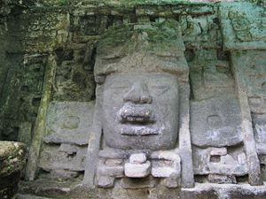
El Castillo tops off the peak at Xunantunich. The highest ruin is 133 feet tall, the second tallest temple in all of Belize. Well-preserved sun god masks decorate one side of the structure. Six major plazas, more than 25 temples and palaces and a new museum are just some of the reasons why Xunantunich is one of the most visited sites. For Directions: Take the Western highway for approximately 70 miles, until you reach Santa Elena town. Take the road that leads to Succotz village which is just before reaching Benque Viejo del Carmen. At this point you should see a ferry on the right hand side of the road and a sign for the Maya temple. You cross the ferry free of charge and Xunantunich is a three minute drive from there. Check out our full article devoted to Xunantunich Mayan Ruins.
Xunantunich means “maiden of the rock” or “stone woman” in Maya, and is situated on the Western Highway across the river from the village of San Jose Succotz.
It can be reached by ferry daily between 8 a.m. and 5 p.m. Xunantunich is a Classic Period ceremonial center. The site core occupies only 300 square meters but the periphery covers several square kilometers. On the main palace building is an astronomical carved frieze.
El Castillo tops off the peak at Xunantunich. The highest ruin is 133 feet tall, the second tallest temple in all of Belize. Well-preserved sun god masks decorate one side of the structure. Six major plazas, more than 25 temples and palaces and a new museum are just some of the reasons why Xunantunich is one of the most visited sites. For Directions: Take the Western highway for approximately 70 miles, until you reach Santa Elena town. Take the road that leads to Succotz village which is just before reaching Benque Viejo del Carmen. At this point you should see a ferry on the right hand side of the road and a sign for the Maya temple. You cross the ferry free of charge and Xunantunich is a three minute drive from there. Check out our full article devoted to Xunantunich Mayan Ruins.
Sites Partially Excavated
1. Actun Tunichil Muknal
2. Altun Ha 3. Barton Creek 4. Cahal Pech 5. Caracol 6. Cerros 7. El Pilar 8. Lamanai 9. Lubaantun 10. Marco Gonzalez 11. Nim Li Punit 12. Santa Rita 13. Xunantunich |
Excavation Future Sites
1. Baking Pot
2. Chaa Creek 3. Colha 4. Cuello 5. Ka'Kabish 6. La Milpa 7. Louisville 8. Minanha 9. Nohoch Che'en 10. Nohmu 11. Pusilha 12. San Estevan 13. Tipu 14. Uxbenka 15. Xnaheb |
Photo Gallery


Related Topics
|

|
|
Belize Budget Suites
First Class Accommodations for the Budget Traveler
First Class Accommodations for the Budget Traveler
WhatsApp (501) 632-3589 | Calling within Belize (501) 226-4402 or (501) 632-3589

Website Managed by Black Orchid Management, Ltd. (USA Corporation) | www.belizebudgetsuites.com | All Rights Reserved Copyright (2019-2024)